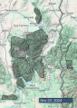
Advisory Archive
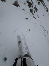
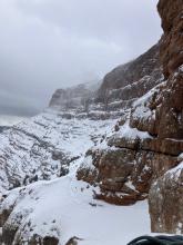
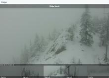
A couple inches of snow fell yesterday, along with strong west/southwest winds.
- Bridger Range 1” snow/0.1” SWE
- Hyalite Canyon 0” snow/0.0” SWE
- Big Sky 3” snow/0.3” SWE
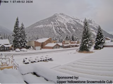
- West Yellowstone 3” snow/0.5” SWE
- Island Park 2” snow/0.2” SWE
- Cooke City 2” snow/0.3” SWE
More precipitation is on the way for the next couple days, with the biggest pulse coming Saturday into Saturday night. There may be a drizzle of rain today at lower elevations, but most of the moisture will fall as snow. By Sunday, expect 6”-12” of new snow near Island Park, 4-6” near West Yellowstone, and 2-4” near Bozeman, Big Sky, and Cooke City. Winds will remain breezy out of the west/southwest.


Mountain temperatures on Tuesday morning are in the single digits to teens F, some of the coldest we have seen this season. Winds are 5-15 mph from the west to the north, and the mountains received a fresh shot of snow.
- Bridger Range - 8” snow/0.6” SWE
- Hyalite Canyon - 7” snow/0.5” SWE
- Big Sky - 9” snow/0.5” SWE
- West Yellowstone - 5” snow/0.5” SWE
- Island Park - 7” snow/0.7” SWE
- Cooke City - 6” snow/0.6” SWE
Tuesday will feature the coldest temperatures of the week, with highs in the teens F and a lull in the incremental snowfall. Temperatures will warm, and chances for light snow accumulation will return in the second half of the week.


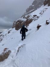
A few snowflakes are falling as I write this update on Friday afternoon. By Saturday morning, 3-4 inches should accumulate. Temperatures will be noticeably colder on Saturday when winds will be blowing from the north 10-15 mph with high temperatures in the teens F.
The sun should peak through the clouds briefly Saturday afternoon. Temperatures will warm into the 20s F for Sunday with strong winds from the west blowing 30-40 mph. A cold front will cross over the area early Monday bringing some of the coldest air yet, more snowfall (maybe 4-6 inches), and lighter winds.
Looking ahead in the weather models - there are no major storms lined up, but there is also no major ridge of high pressure forecasted. At the moment, it seems the pattern will be a series of disturbances and troughs that should bring a few inches of snow here and there which can add up surprisingly fast. Fingers crossed!

This morning (Wednesday) temperatures are teens to 20s F and wind is out of the southwest and northwest at 10-20 mph with gusts of 30-45 mph. Snow showers over the last couple days dropped 3-5” of snow in the mountains. For the second half of this week daytime temperatures will reach high 20s to mid-30s F with lows in the teens and low 20s F. Today and tomorrow winds will be out of the southwest at 15-20 mph with gusts of 30-40 mph. Skies will be mostly clear until the next measurable round of snowfall arrives late Friday or Saturday, with some light snowfall in the southern part of our area tonight and tomorrow.


Mountain temperatures on Wednesday morning are in the single digits to teens F, with 10-25 mph winds blowing from the west to the north. The mountains near Bozeman received 10-15” of new snow in the last 24 hours, with 4” in Big Sky, 1” in West Yellowstone and Cooke City, and none in Island Park. Lingering flurries will end this morning, and skies will be sunny for the remainder of the week as high temperatures work their way into the mid-30s to low-40s F.


Snowfall on Thursday night brought 2-3” inches of snow to the mountains near Bozeman, 5” near Big Sky, and 7-8” near West Yellowstone, Island Park and Cooke City. Winds have been out of the south and west at 10-20 mph with 30-45 mph gusts. Temperatures are in the 20s F this morning. Highs today and tomorrow will be in the 20s and 30s F. Winds will remain moderate out of the southwest today and shift more northerly tomorrow. More snow is on the way starting this afternoon or evening. It looks to favor the Island Park area where we could see 6-10” by tomorrow morning. 2-6” will fall across the rest of the advisory area. Another pulse of snow is forecasted for Monday night.

Snowfall on Monday night and Tuesday delivered up to 6” in the mountains, and cooler weather has settled in through at least next weekend. Temperatures are teens to 20s F this morning. Wind has been out of the west-northwest and shifted southerly this morning. Temperatures for the next few days will be high teens to low 20s overnight with daytime highs reaching high 20s to low 30s F. Wind will be out of the southwest at 5-15 mph with gusts to 25 mph. Another round of light snowfall is expected Thursday through Saturday morning with 3-5” in most of our forecast area, and up to 8” possible in the mountains south of Big Sky to West Yellowstone and Island Park.

Over the last week, the mountains have gotten a few light dustings of snow intermixed with warm and sunny weather. This trend looks to continue over the next week. Warm and sunny weather are expected this weekend before chances for snowfall return on Monday and continue through the following work week.

A winter storm blew into Southwest Montana Wednesday night (10/16) with mountain temperatures dropping into the teens to 20s F by Friday morning. Precipitation shifted to snow, blanketing the mountains with 4-6” in most areas and up to 10” in the Northern Gallatin and Southern Madison Ranges. This weekend and into early next week, mountain temperatures will peak in the 40s to 50s F under sunny skies, and winds will blow 5-15 mph from the northwest to the southwest. There is a chance for additional precipitation Monday night into Tuesday.


For current weather data check our weather stations in Cooke City, Hyalite, Lionhead, as well as Bridger Bowl’s weather stations, and SNOTEL sites throughout our advisory area. We will update the Weather and Avalanche Log and issue pre-season bulletins as needed.