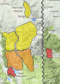
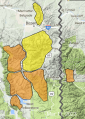
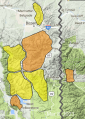
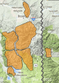
Advisory Archive

Since yesterday morning the mountains around Bozeman and Big Sky got hit with 11-14” of snow while in Taylor Fork, around West Yellowstone and Cooke City, 6” fell. Wind is currently W-NW at 10-15 mph with an occasional gust of 25 mph and temperatures are in the single digits F. Skies will clear today and temperatures will rise into the low 20’s F as west wind becomes light at 10-15 mph. A lingering mountain shower may drop a trace to 1” this morning before high pressure and sunny skies dominate through Sunday.


In the last 24 hours over a foot of new snow has fallen in Taylor Fork, around West Yellowstone and Cooke City. Around Big Sky, Hyalite and the Bridger Range, a trace to 2” fell. Southwest wind is averaging 25-30 mph with gusts of 64 mph. In the Bridger Range it is 10-30 mph from the west-southwest. Temperatures are in the mid 20s F. Snowfall will be strongest this morning and taper off this afternoon. A couple inches will fall in the Bridger Range and 4-6” is expected everywhere else. Wind will remain strong and switch to the northwest. Skies clear tonight.


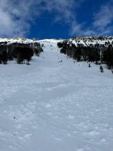
This morning, there is 4-6” of snow from the Taylor Fork south through West Yellowstone and Cooke City, 3” in the Big Sky area, and an inch in the Bridger Range. Temperatures are in the 20s F with 20-40 mph winds from the west to the south (15-20 mph - Bridger Range). Today, temperatures will be in the 30s F, and 25-35 mph winds from the south to southwest will slow later in the day. With West Yellowstone getting the most, the southern ranges will receive 8-14” of snow by morning, with 3-4” near Big Sky and 1-3” near Bozeman.

This morning, temperatures are in the teens to 20s F with 10-15 mph winds from the south to the west. The mountains south of Big Sky through West Yellowstone received 1” of new snow, and none elsewhere. Today, temperatures will be in the upper 20s to 30s F with 15-25 mph winds from the southwest. The mountains near West Yellowstone will receive 4-8” of new snow with 2-4” in Cooke City and 2” near Big Sky.

This morning there is no new snow. Temperatures are in the single digits to teens F. Wind is out of the southwest-west at 5-10 mph with gusts of 20-25 mph. Today will be mostly sunny with temperatures reaching high 20s F and southwest wind at 5-15 mph. The next chance for snow is late tomorrow through Wednesday.

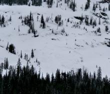
There are 3-4” of dense new snow in the mountains near Bozeman and 5-7” near Big Sky, West Yellowstone and Cooke City. Winds are 20-30 mph out of the west-northwest with gusts of 45-60 mph this morning. Yesterday afternoon gusts over 100 mph were recorded at Lionhead and on the summit of Lone Mountain. Temperatures are single digits and teens F. High temperatures will be in the teens and 20s F under partly sunny skies. Strong west winds will continue today, but gusts will not be as extreme as yesterday. An inch or two of snow are possible tonight in Cooke City. Other areas will only get a few flurries.

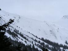
At 6 a.m., there are 7” of new snow in the Lionhead area and 2-3” across most of the rest of the advisory area (excepting the Bridger Range which stayed dry). Winds are 20-40 mph out of the south and southwest with gusts of 35-55 mph. Temperatures are in the teens F. South-southwest winds will ramp up even more during the day and we could see gusts into the 60s and 70s mph. High temperatures will generally be in the high 20s F (mid-30s F in the Bridgers). 5-10” of new snow will accumulate near West Yellowstone and Cooke City by tomorrow morning, with the bulk falling during daylight hours today. 3-5” will fall near Big Sky and 2-4” near Bozeman.


At 5 a.m. there is 1” of new snow in Cooke City and 2-3” in Big Sky to West Yellowstone. Wind is 5-15 mph from the S-SW, with the exception being the Bridger Range where an east wind is blowing 20-30 mph. Temperatures are 0-5F. Today will be partly cloudy and light wind with temperatures reaching the high teens. Snowfall late tonight will drop an inch up north and 3” in the southern ranges.

There’s no new snow to report this morning. Southwest wind is blowing 5-15 mph with gusts of 20 mph, except up Hyalite where it is averaging 25 mph and gusting to 35 mph. Temperatures are in the low single digits F and will rise to 20F under mostly sunny skies this morning. Snowfall will start by later afternoon and drop 1-2” by tomorrow morning with winds of 10-20 mph from the west.

The mountains received another 1-4” of fluffy snow yesterday, with the Bridger Range and mountains around West Yellowstone getting the most. This morning temperatures are in the single digits F with 5-15 mph winds from the south to the west. Today, temperatures will reach the teens to 20s F with 5-15 mph winds from the south to the southwest. A trace of snow is possible.