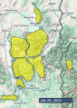
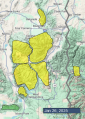
Advisory Archive
This morning, temperatures are in the 20s F, except for the low elevations in the Bridger Range, stubbornly sitting in the single digits above and below 0 F. Winds are 15-45 mph from the west through the south, with lighter winds in the Bridger Range.
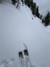
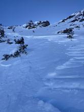
In the last 24 hours, Cooke City received an additional 6-8” of snow, with 2-3” falling everywhere else.
Mountain snow totals since Friday:
- Cooke City - 30” of snow (3.0” snow water equivalent - SWE)
- West Yellowstone and Island Park - 16-21” of snow (2.0-2.4” SWE)
- Bridger, Madison, and Gallatin Ranges - 12-20” of snow (1.0-1.6” SWE)
Today, mountain temperatures will hover above and below the freezing mark, with cooler temperatures persisting in the Bridger Range. Winds will be 15-25 mph from the southwest. Across the forecast area, 2-4” of snow will fall by tomorrow morning, with a trace to 1” in the Bridger Range.


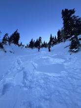
New snow totals this morning are 6-8” most places with 3” in the Taylor Fork. Wind has been moderate to strong, out of the southwest and west at 10-25 mph with gusts of 25-60 mph. Temperatures are single digits to teens F near Bozeman and Big Sky and high 20s F elsewhere. Temperatures will remain colder in the north half of our forecast area and reach high 20s and low 30s in the southern half of the area.
Snowfall will continue today. Wind will be moderate out of the west and southwest, with stronger speeds and gusts in the southern half of our area. By this evening the mountains could have up to 12” of new snow near Cooke City, 5-9” near Island Park and West Yellowstone, and 3-6” elsewhere.


New snow totals this morning are:
- 4-6” near Cooke City, Island Park, West Yellowstone
- 3-5” in Big Sky,
- 2” in Hyalite and Taylor Fork,
- A trace to an inch in the Bridger Range.
Wind has been moderate to strong, out of the southwest and west at 15-25 mph with gusts of 25-45 mph. Temperatures are teens to mid-20s F.
Today temperatures will reach mid-20s F. In the north half of our area wind will be out of the west and southwest at 5-10 mph with gusts to 25 mph, and near Cooke City, West Yellowstone and Island Park wind will be 15-25 mph with gusts to 40 mph.
Heavy snowfall is expected later this morning near Cooke City and Island Park, and elsewhere snow will start later in the day. By morning the mountains near Bozeman, Big Sky and West Yellowstone could have 6-10”, and near Cooke City and Island Park 12-16” are possible. Steady snowfall is expected through Tuesday, and possibly longer through the week.

New snow totals this morning are:
12” of low density snow near Cooke City
4-5” around West Yellowstone, Island Park and Big Sky
Trace-2” near Bozeman
Winds have been strong out of the west, blowing steadily at 20-30 mph with gusts as high as 55 mph. Temperatures are in the teens and 20s F this morning.
Another pulse of snow this afternoon will bring 1-3” to much of the advisory area by nightfall, favoring the southern regions. By tomorrow morning, 4-8” will accumulate in Island Park and Cooke City, with 1-3” elsewhere. High temperatures will be in the 20s F and it’s going to stay windy - blowing 20-30 mph out of the west with stronger gusts.
Snow continues tomorrow and into the workweek.

This morning, mountain temperatures are generally in the teens and 20s F. Winds are mostly 15-25 mph out of the west with gusts of 30-45 mph, but a bit lighter around Cooke City.
Today will be a transition day between the warm sunny weather we’ve been enjoying for the last week and the storms that are coming. It’ll be cloudy, but with only a little snow. Snow showers beginning this afternoon in the southern part of the advisory area may add up to 1-2” by nightfall. Winds remain breezy, shifting more southerly today.
Snowfall will pick up overnight, still favoring the southern areas. By tomorrow morning, expect:
5-10” near Island Park
3-6” near West Yellowstone and Cooke City
1-2” around Bozeman and Big Sky.
Snowfall will continue through the weekend and into next week.


This morning mountain temperatures are in the low to high 20s F, about 5 degrees colder than yesterday morning, and 15-30 degrees warmer than valley temperatures. Winds from the W and NW are blowing 14-25 mph at the highest ridges about half that speed at lower ridgelines.
Today will be another stunning day in the mountains with crystal clear skies, sunshine and more warm temperatures rising into the upper 30s to low 40s F. Winds won’t change much except they’ll blow a little more from the north keeping temps a touch cooler than yesterday.
Snow arrives late Friday as a trough of low pressure descends over Montana Friday/Saturday with a short break and then the jet stream lines up overhead and stays in place into next week. Snowfall should come to most places, but at the moment the models are showing Cooke City, West Yellowstone, and Island Park getting snow with inches of water by this time next week. Winds should be fairly strong during this period of snowfall.


Mountain temperatures this morning are in the upper 20s and low 30s F while most valleys are 20 degrees colder. Winds from the W and NW are generally light but gusty in the Bridger Range.
It’ll be another warm and sunny day. Winds should remain mostly light and temperatures will rise into the mid 30s F with some places getting into the low 40s F.
Get ready for a prolonged period of active weather. Snowfall should start late Friday, and the jet stream will generally stay over the forecast area well into next week continually bringing moisture into the area from the W and SW. Models don’t show high pressure returning until about 2 weeks out


This morning, mountain temperatures are in the 20s F with valley temperatures in the single digits to teens F. Winds around Bozeman and Big Sky are 15-25 mph from the west and northwest. Winds farther south in West Yellowstone, Island Park and Cooke City are 5-10 mph.
Today, under clear skies, temperatures will climb into the 30s F with 10-25 mph winds in the northern forecast area and calm conditions in the southern forecast area.

This morning, temperatures are inverted, with upper elevations temperatures in the teens F and valley temperatures in the single digits above and below 0 F. There is no new snow.
In the northern half of the forecast area, winds are 15-35 mph, gusting to 45 mph from the west and northwest. The strongest winds are in the Bridger Range. In the southern half, winds are 5-10 mph from the northwest to northeast.
Today, temperatures will be in the upper 20s to low 30s F. The winds will be 10-20 mph in the northern half of the forecast area and 5-10 in the southern half. Stronger winds will continue in the Bridger Range.

This morning there is 1” of new snow near Island Park and none elsewhere. Temperatures are single digits F. In the Bridger Range wind is out of the west and southwest at 15-25 mph with gusts to 30 mph. Elsewhere, wind is out of the north and northwest at 5-15 mph with gusts of 15-20 mph.
Today, temperatures will reach teens F, and wind will be calm to light (5-15 mph) from the north and west. This week will be mostly sunny with no snow expected and temperatures reaching mid to high 30s F.