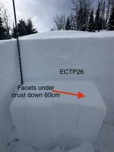
Advisory Archive

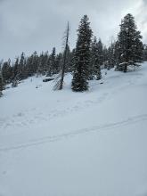
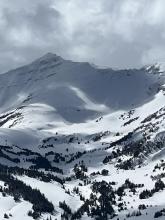
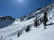
A surprise storm hit the Bridger Range yesterday morning and dropped 6” of low density snow (3%) with another 2” last night. 2” also fell in the northern Gallatin Range with only a trace elsewhere. Wind is 10-20 mph out of W-NW and skies are partly cloudy with temperatures in the single digits F. Today will warm into the 20s F with light westerly wind. Later this afternoon and tonight 1-2” may fall, mostly in the southern regions.

This morning, temperatures are in the single digits to teens F with 5-15 mph wind from the northeast to northwest. Winds are blowing 30-40 mph from the east to the north in the Bridger Range. The mountains received a trace to 1” of snow overnight. Today, temperatures will be in the teens to 20s F with 10-20 mph winds from the north. A trace to 2” of snow will fall by tomorrow morning.

The mountains around Big Sky, West Yellowstone and Cooke City received 1-3” of snow yesterday. Temperatures are in the single digits F, and winds calmed and shifted to the southwest to southeast at 5-10 mph. Today, temperatures will be in the 20s F with east to northeast winds blowing 5-15 mph. West Yellowstone will see up to 5” of snow by tomorrow morning, with a trace to 2” elsewhere.

Since yesterday morning, near West Yellowstone and Cooke City received 10-11” of heavy new snow, and 3-4” fell near Bozeman and Big Sky. Wind has been out of the southwest-west at 15-30 mph with gusts of 40-85 mph. Temperatures are singles to teens F and will reach 20s F today. Wind will continue at 15-30 mph out of the west with gusts to 40 mph. Snow showers will deliver 3-5” near Cooke City and Taylor Fork with 1-3” near Big Sky and West Yellowstone, and maybe 1” near Bozeman by tomorrow morning.

There are 3-4” of new snow around West Yellowstone and Cooke City, with 1-2” around Bozeman and Big Sky. Winds are SW-W at 15-25 mph with gusts of 30-55 mph. Temperatures are in the teens and 20s F. High temperatures will be in the 20s and 30s F. Gusty SW-W winds will continue. Snowfall will ramp up late this afternoon with a couple inches falling by nightfall and 6-8” by morning across much of the advisory area with about half as much expected around Bozeman.
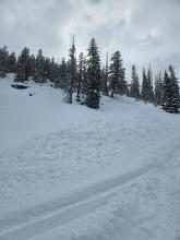
A trace to 3” of new snow fell yesterday morning. Winds are 10-20 mph out of the SW-W with gusts of 15-25 mph. Temperatures are in the teens F this morning and will rise into the 20s and 30s F this afternoon. Moderate SW-W winds will continue. Snow showers today and tonight will bring 1-2” of new snow tomorrow morning.

The mountains received 2-3” of snow in the last 24 hours with temperatures in the low 20s F and light SE-SW wind blowing 10-15 mph with gusts of 23 mph. Snow is starting to fall and will blanket the area with 4-7” by tomorrow morning. Temperatures will remain in the 20s and wind will be light to moderate from the SE-SW. Tomorrow looks to be sunny with more snow forecasted over the weekend.


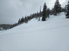
At 5 a.m., the mountains received 1-2” of snow with wind averaging 10-15 mph and gusting to 25-30 mph from the SE-SW. Temperatures are in the high teens under cloudy skies. Today will remain cloudy with similar wind and temperatures. Light snowfall will start late this afternoon and drop 1-2” by tomorrow morning, with the rest of Thursday forecasted to be snowy.

This morning, temperatures are in the single digits to teens F with 10-15 mph winds from the west to the south. Excepting Cooke City, the mountains received 1-2” of snow yesterday morning before this weekend’s storm exited the area. Today, temperatures will climb into the 20s to around 30 F with 10-15 mph wind from the southwest. A trace to 1” of snow is possible tonight.

Near Bozeman and Big Sky received 4-8” of new snow since yesterday morning, and 1-2” fell near West Yellowstone and Cooke City. Temperatures are singles to teens F. Wind has been out of the northwest-northeast at 5-10 mph with gusts of 15-30 mph. Today temperatures will reach low 20s F with westerly wind at 5-15 mph. Snow showers tapered off overnight, and today near Cooke City could get 1” of snow with no snow expected elsewhere.