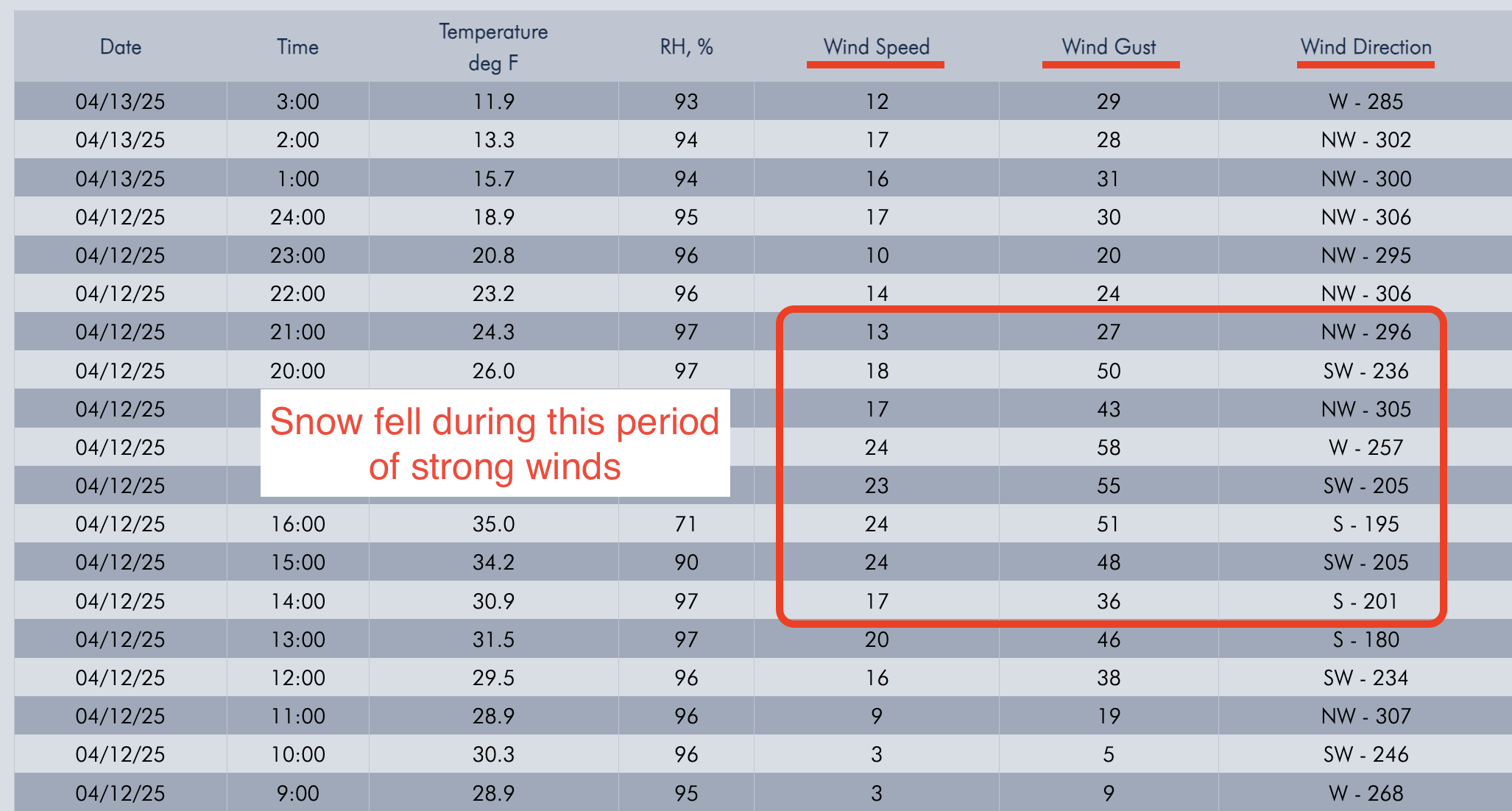
Screenshot of winds from Lulu Pass wind station during the storm.
Trip Planning for Cooke City Area

Primary Problem: Loose Wet
Bottom Line: Natural and human-triggered wet loose avalanches are likely on steep slopes facing the southern half of the compass rose. Move to shadier and cooler north-facing aspects before the day’s warmth melts the surface snow. Cinnamon roll-like roller balls and small wet snow avalanches indicate that slopes are destabilizing rapidly. Human-triggered avalanches are possible on wind-loaded slopes. Assess the stability of recent snow before considering skiing and riding steep terrain by watching for a moistening of the snow surface and obvious signs of instability. Past 5 Days
Thu Apr 10

Moderate
Moderate
Fri Apr 11
Moderate
Moderate
Sat Apr 12
Moderate
Moderate
Sun Apr 13

Considerable
Considerable
Today
Considerable
Considerable
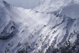
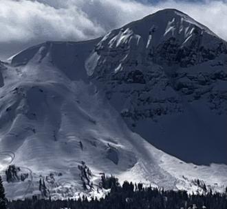
Relevant Avalanche Activity
Cooke City
COOKE CITY
Wind Slab Activity in Cooke City
COOKE CITY
SS-N-R2-D2-I
Coordinates: 45.0202, -109.9380
Caught: 0 ; Buried: 0
More Avalanche Details
SS-N-R2-D2-I
Coordinates: 45.0202, -109.9380
Caught: 0 ; Buried: 0
I rode the motorized zone and noticed natural wind slab avalanches running pretty far on: East Henderson, SE Scotch Bonnet, East Miller, NE Crown Butte. D1.5-2.0
Loose wet debris from yesterday were also present in many places.
More Avalanche Details
Cooke City
Hayden Creek
wet loose avalanches south of Cooke
Hayden Creek
WL-N-D1
Coordinates: 44.9952, -109.9080
Caught: 0 ; Buried: 0
More Avalanche Details
WL-N-D1
Coordinates: 44.9952, -109.9080
Caught: 0 ; Buried: 0
Today I was skiing in East Hayden Creek. I witnessed a cornice fall around 1230pm. Also I triggered multiple wet loose avalanches on several aspects including a north facing slope 9400 ft. None bigger than D1
More Avalanche Details
Cooke City
COOKE CITY
Skier triggered wind slab near Cooke
COOKE CITY
SS-ASc-R1-D1
Elevation: 9,800
Aspect: N
Coordinates: 45.0471, -109.9990
Caught: 0 ; Buried: 0
More Avalanche Details
SS-ASc-R1-D1
Elevation: 9,800
Aspect: N
Coordinates: 45.0471, -109.9990
Caught: 0 ; Buried: 0
Today A Skier triggered a 6”x20’ wide wind slab on a N aspect at 9,800’.
More Avalanche Details
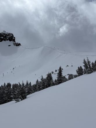
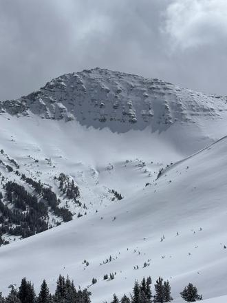
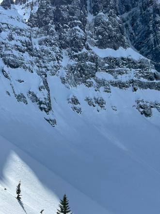
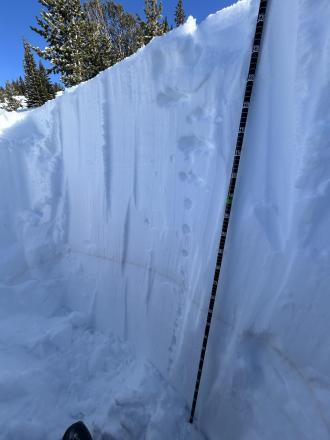
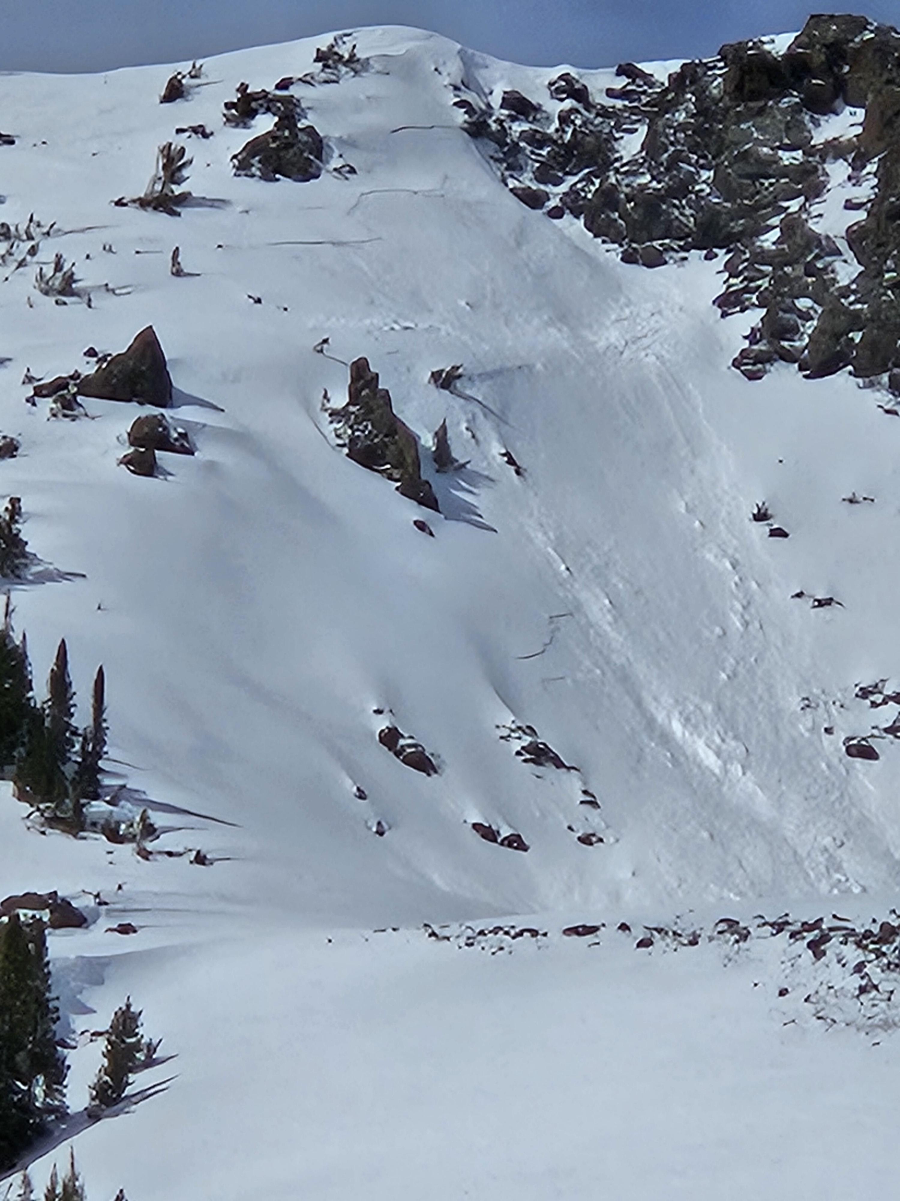
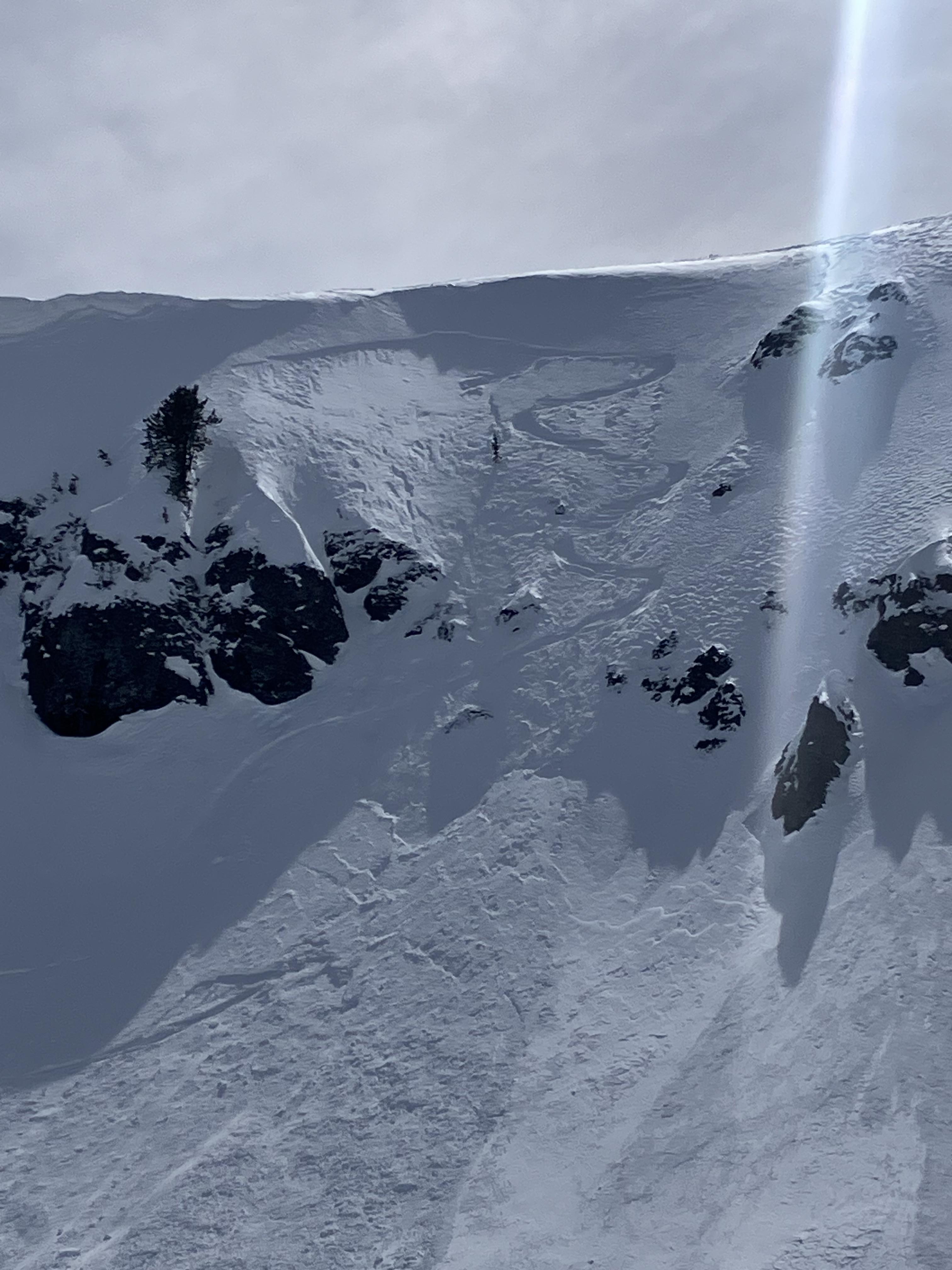
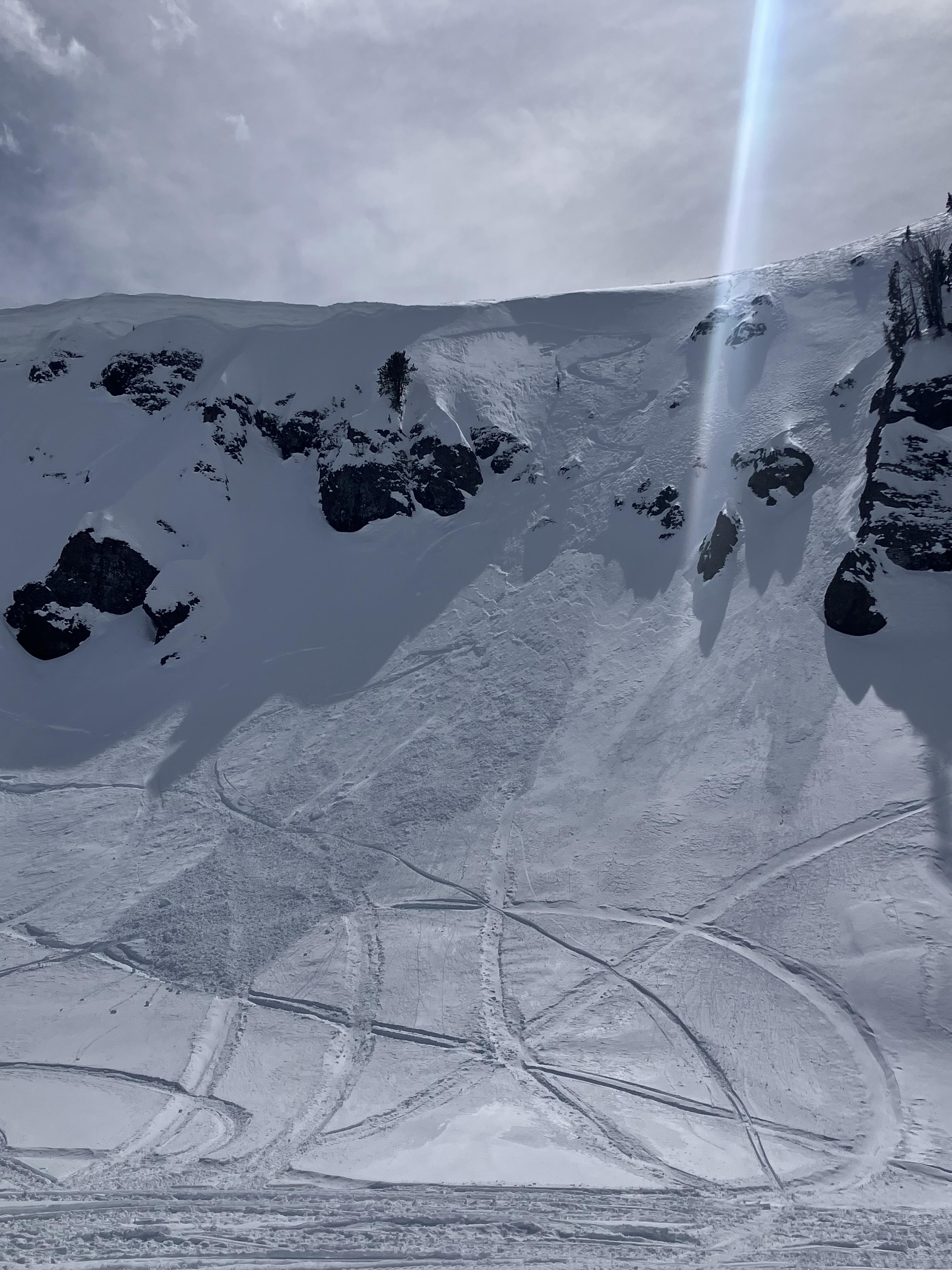
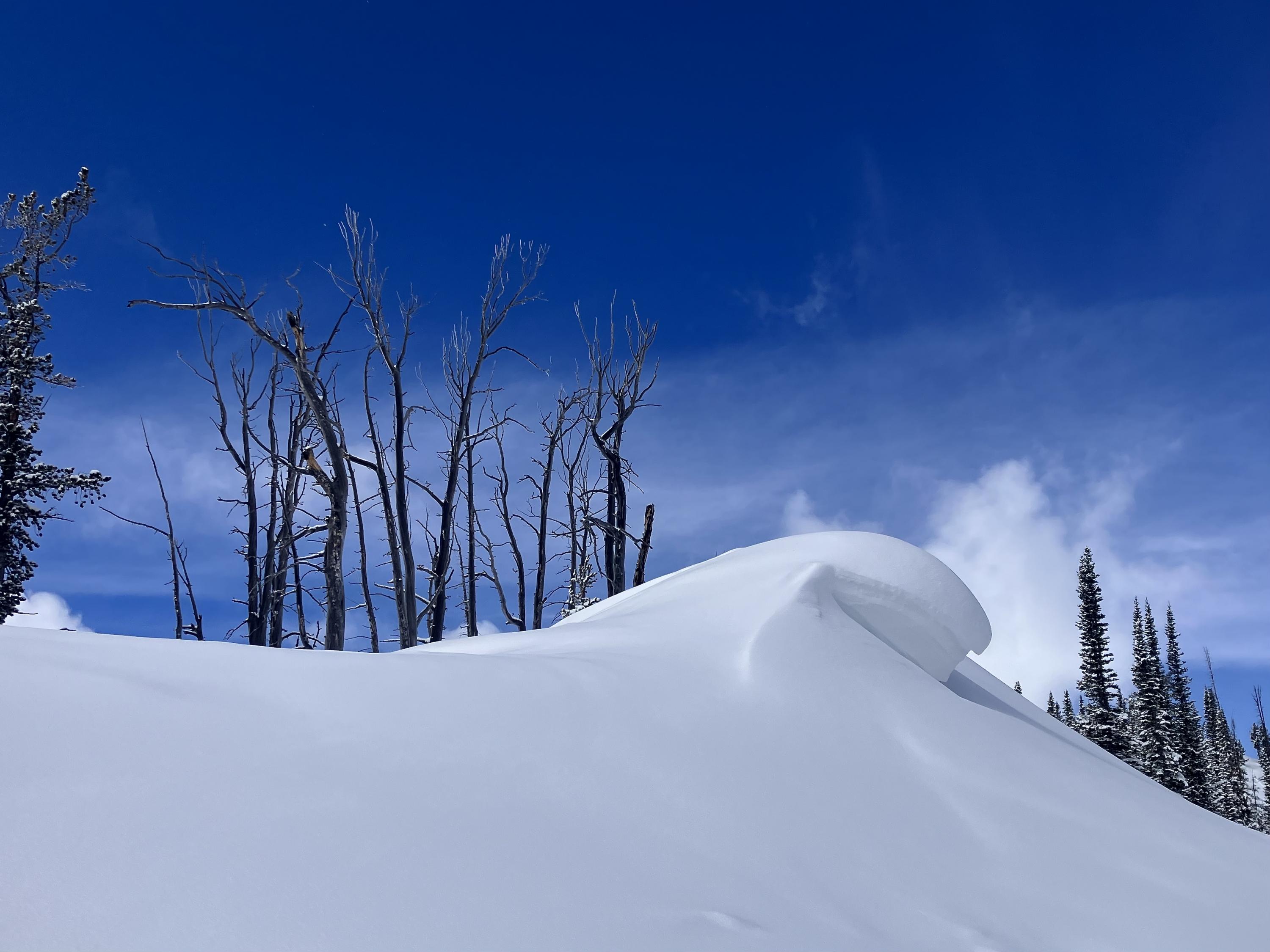
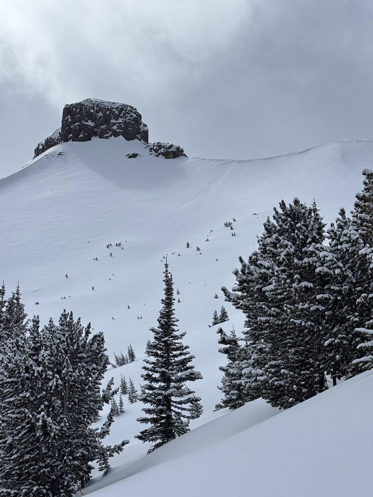
Relevant Photos
Displaying 1 - 40
-
-

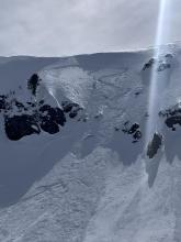
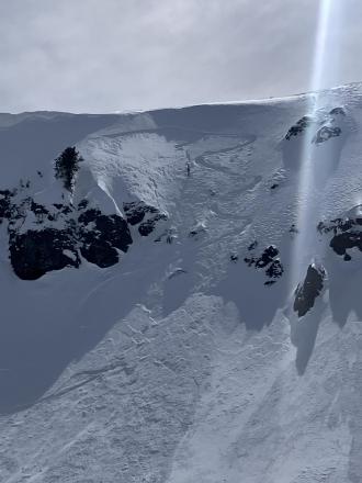
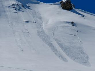
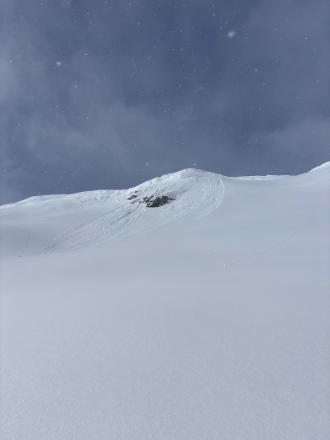
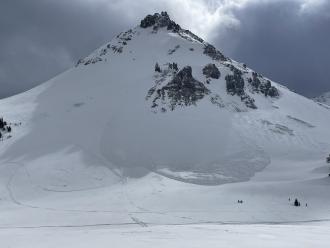
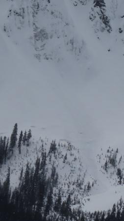
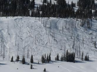
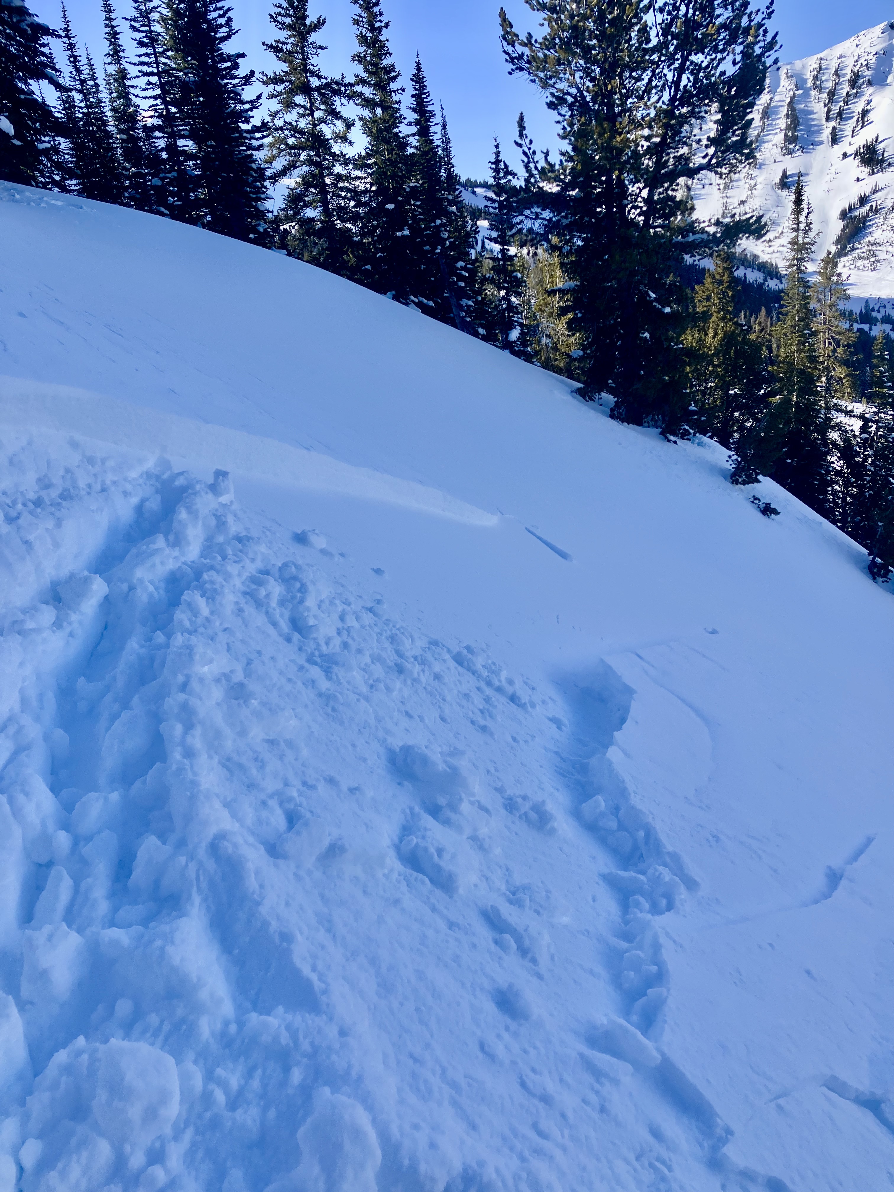
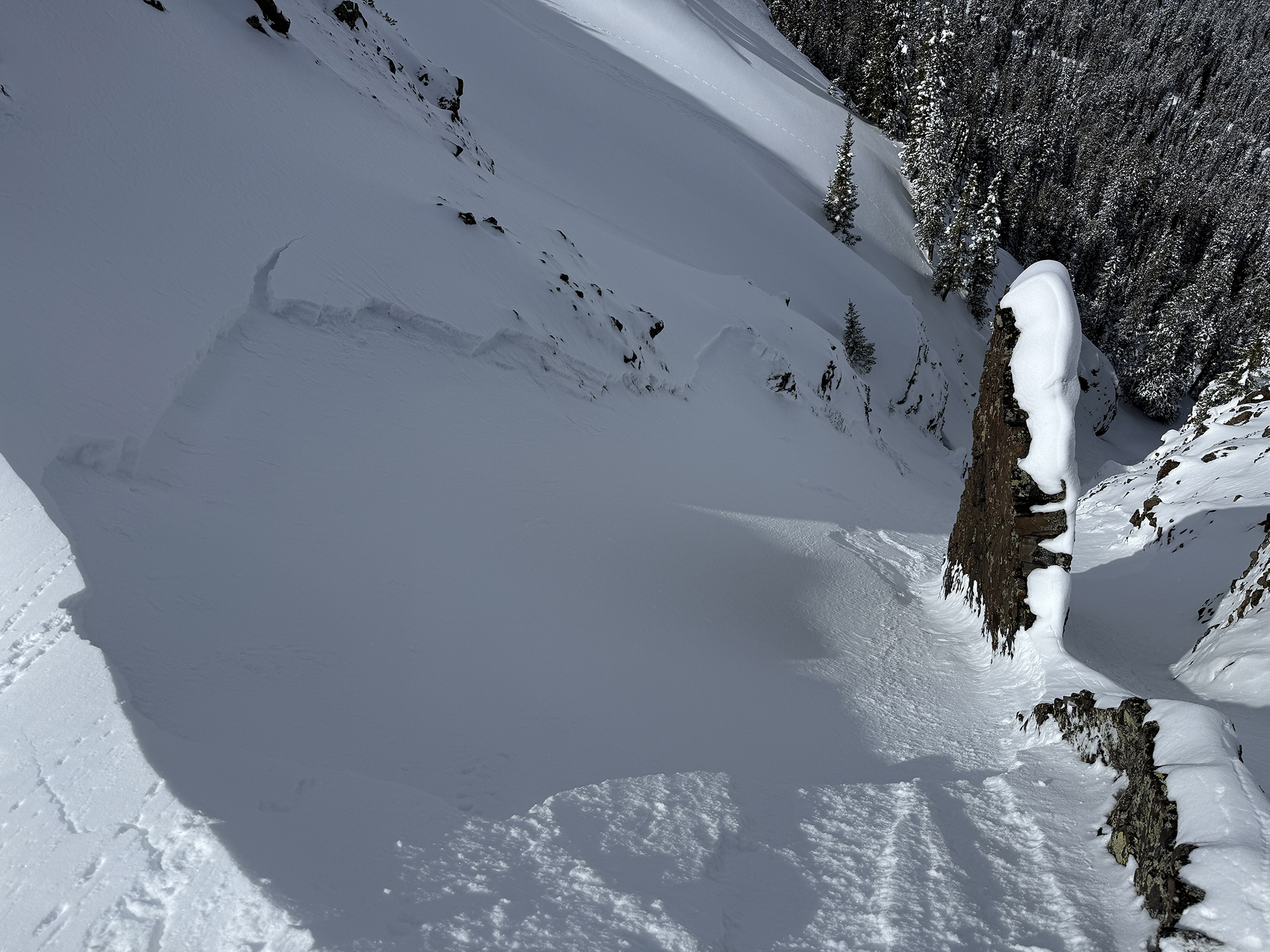
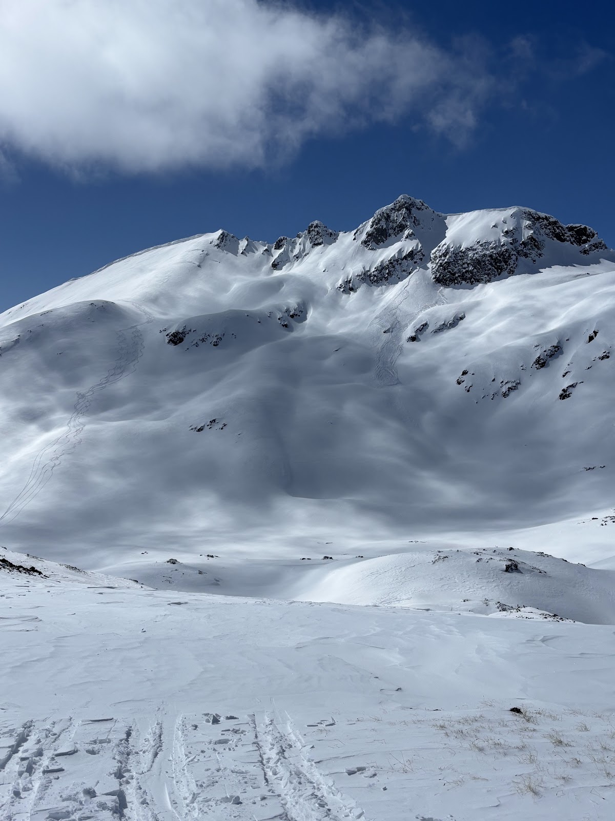
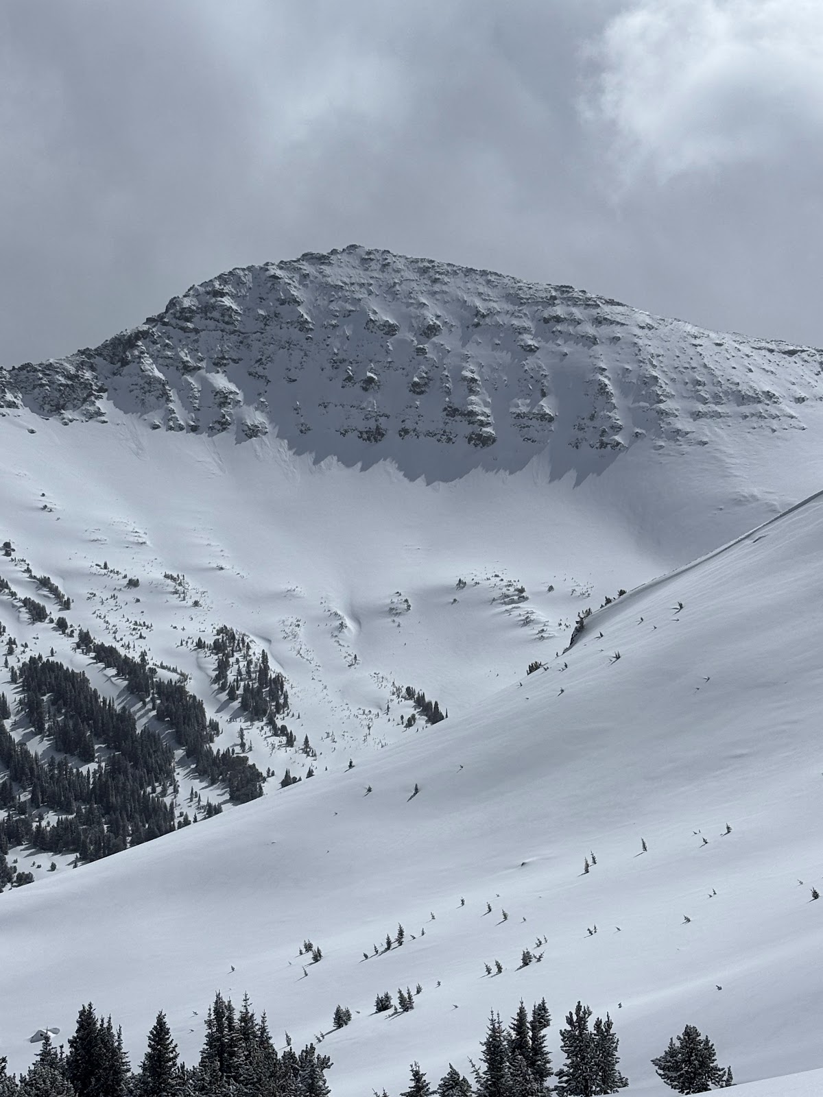
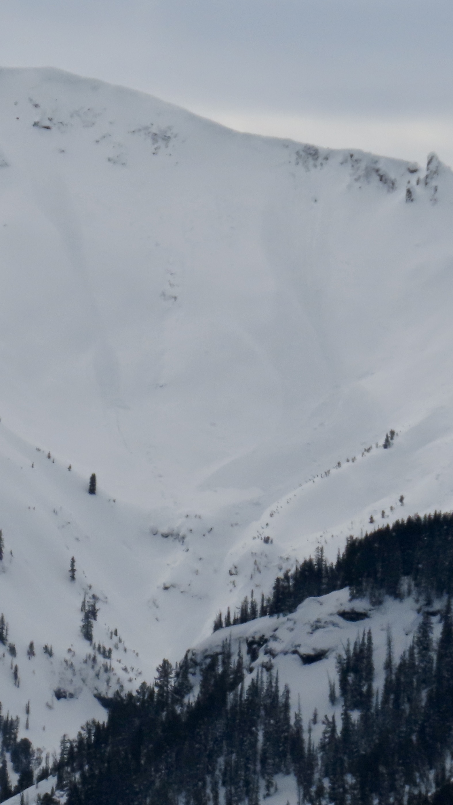
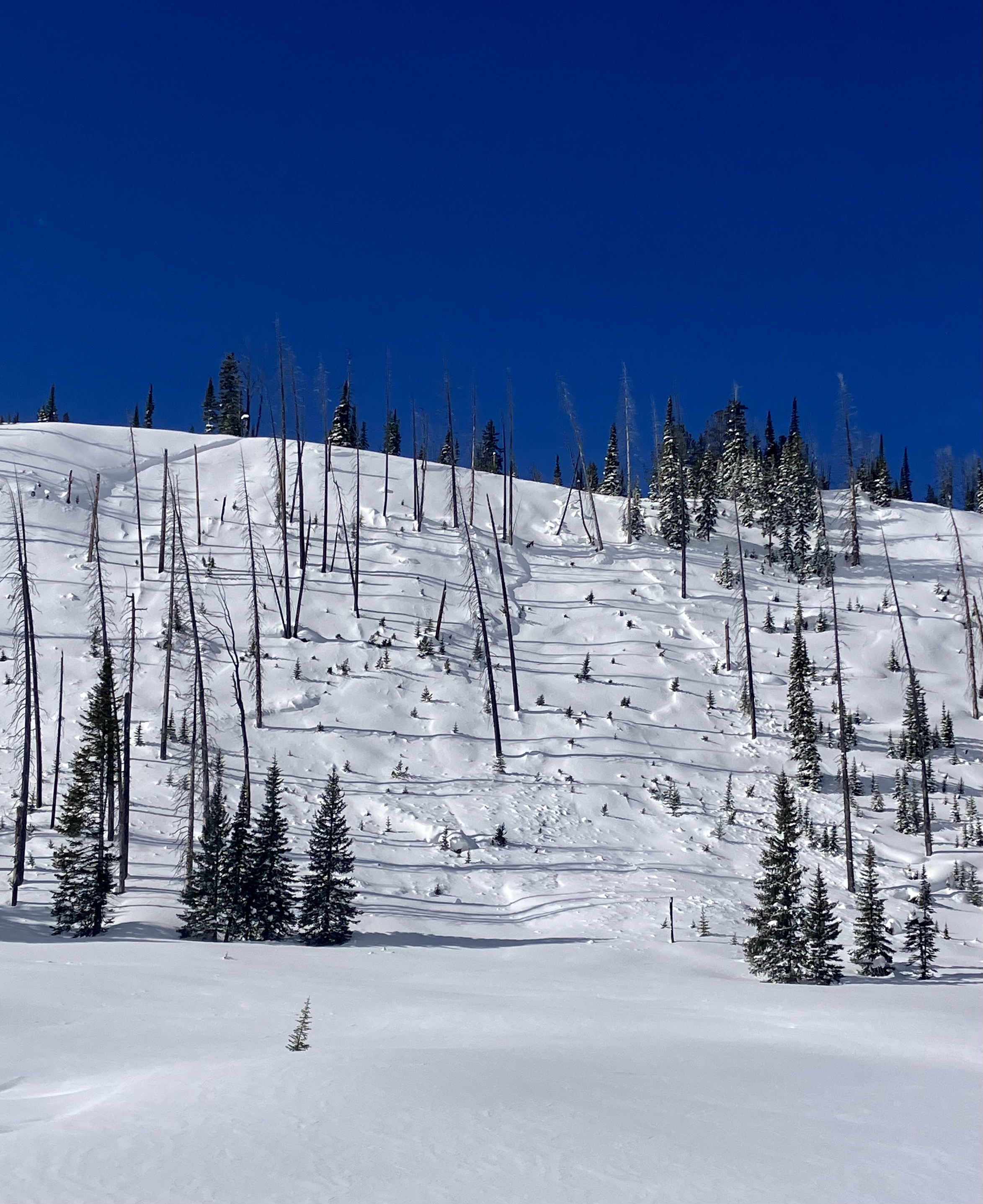
Old wind slab, South East on Scotch Bonnet. Photo: Anonymous
-
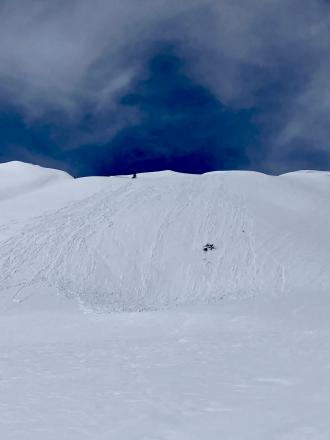
Apr 7 A Skier triggered a 6”x20’ wide wind slab on a N aspect at 9,800’.
-
Apr 7 A Skier triggered a 6”x20’ wide wind slab on a N aspect at 9,800’.
-
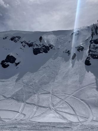
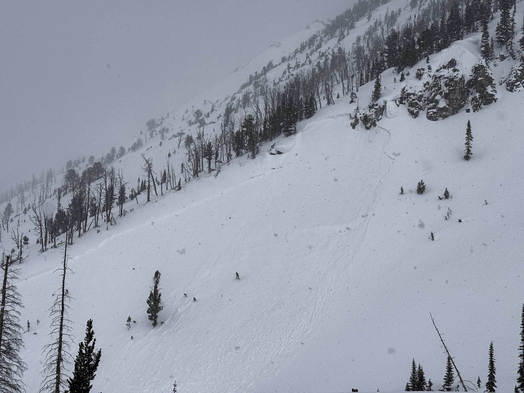
On Apr 7 Skiers triggered D1-D1.5 wet loose on SE aspect at 10,000’.
-

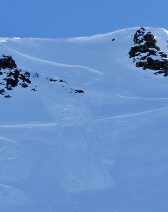
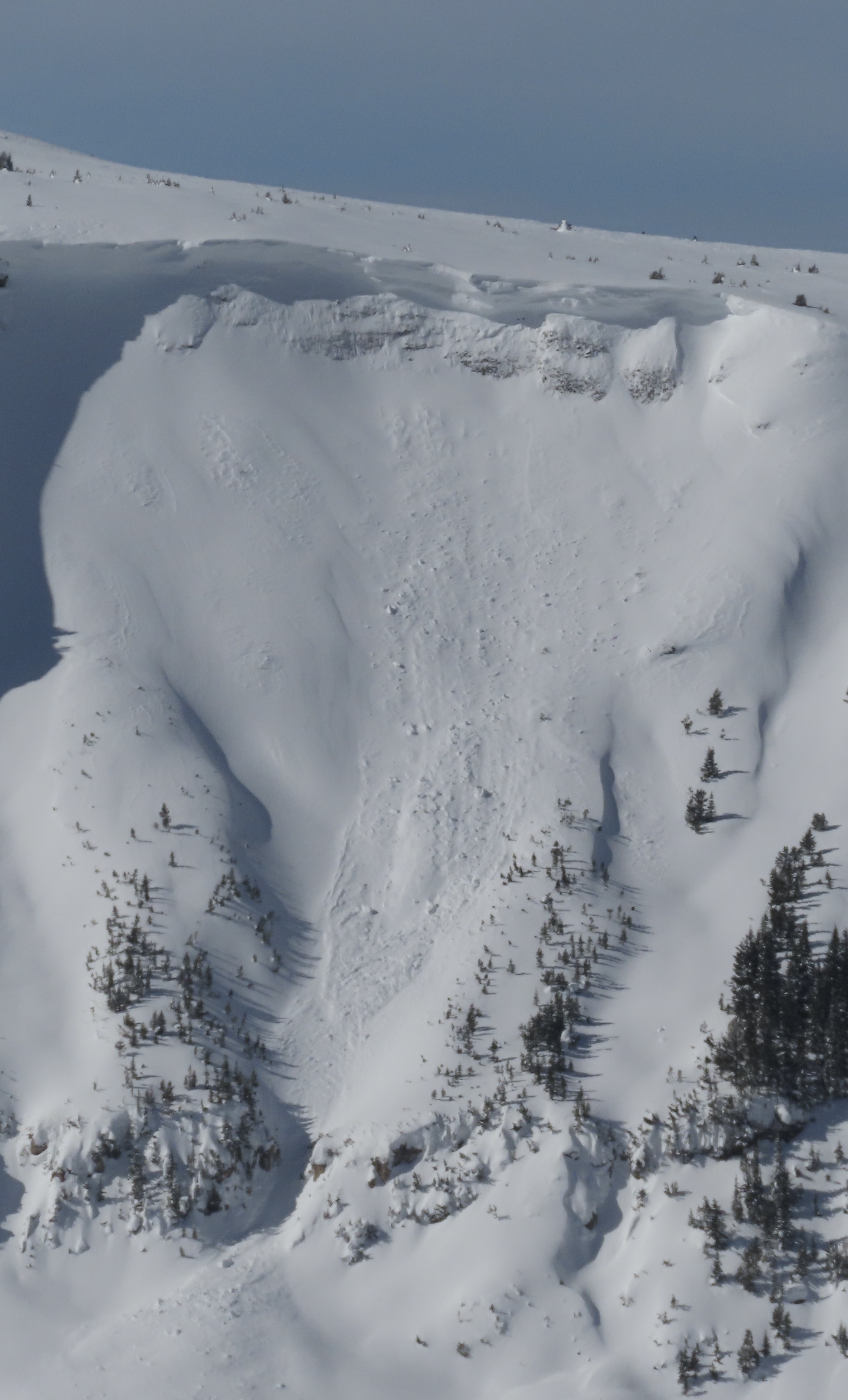
Apr 5 Wind slabs were still reactive. We triggered 3 small, 3-8" deep x 5-15' wide, hard wind (1F+) slabs on convex test slopes well below the main ridgelines. 9,800', NE aspects. Photo: GNFAC
-
Apr 5 Wind slabs were still reactive. We triggered 3 small, 3-8" deep x 5-15' wide, hard wind (1F+) slabs on convex test slopes well below the main ridgelines. 9,800', NE aspects. Also triggered one softer (4F) wind slab just below the high ridgeline, 10,200', NE aspect. 10-15' wide x 6-8" deep (Pictured). Photo: GNFAC
-
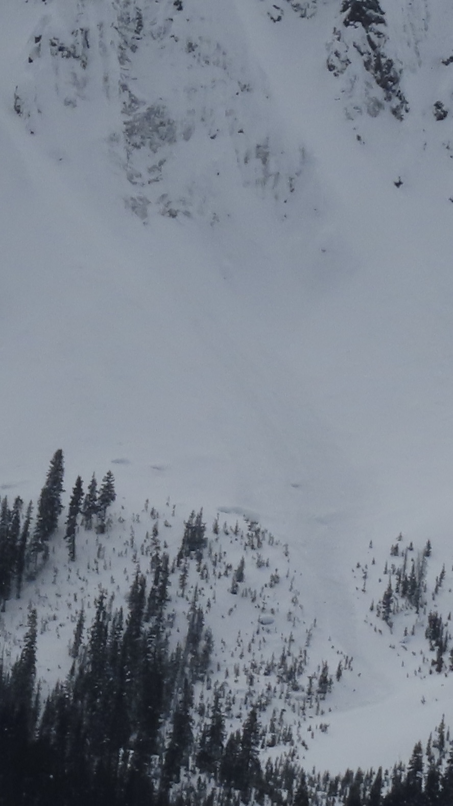
Apr 5 We saw a couple 3-6" deep natural wind slab avalanches and a few dry loose slides that looked to have happened within the last 24 hours. Photo: GNFAC
-
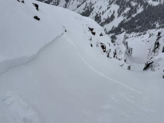
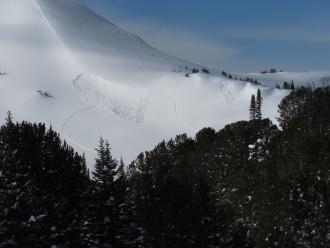
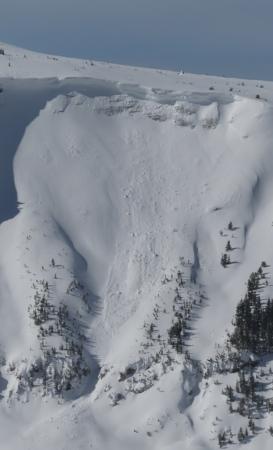
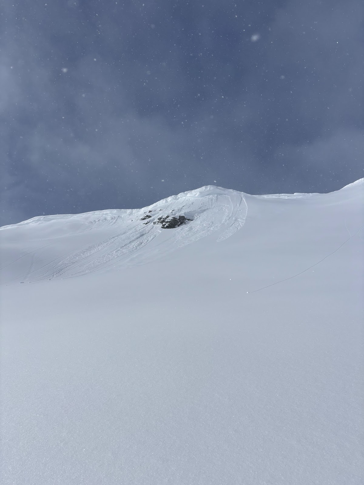
Wind slab near Cooke City from yesterday. Intentionally triggered. North aspect, 10,100'. 1' deep, 20' wide. Photo: B Fredlund
-

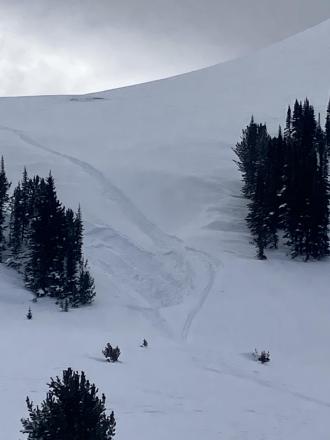
Skier took a left turn under cornices to scrub speed and released a 6-10" windslab 40' wide which ran 10' at most. Super soft and easy to ski through. Photo: J Lee
-
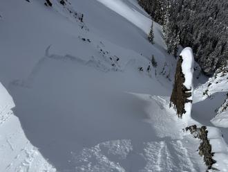
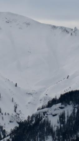
From email: "Ski touring near Cooke City today we intentionally triggered a storm slab/ wind slab on a steep north aspect around 9600'. It was about 6" deep, and 30' wide." Photo: B Fredlund
-
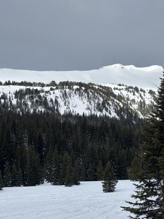
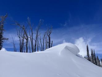
Today we noticed these natural small wind slabs on Mt Henderson. Photo: J Mundt
-

Understanding Avalanche Safety Preparedness – 5-Minute Survey for Motorized Users
We need your input! Eastern Oregon University is conducting a survey to better understand avalanche safety preparedness among motorized backcountry users like you. Your feedback will help us learn more about who is purchasing and practicing with avalanche rescue gear (beacon, probe, shovel) and participating in avalanche education—and why some riders aren’t. The survey is confidential and anonymous.
Your feedback is invaluable in improving avalanche education and awareness. Please take a moment to share your experience and help us make a difference.
https://eoustmhs.qualtrics.com/jfe/form/SV_3L8QKAuZzcxJBLo
Thank you for your time and for being a part of this important effort!
-
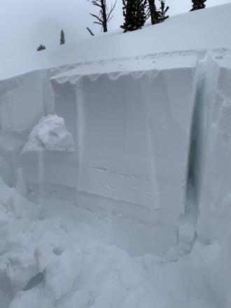
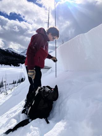
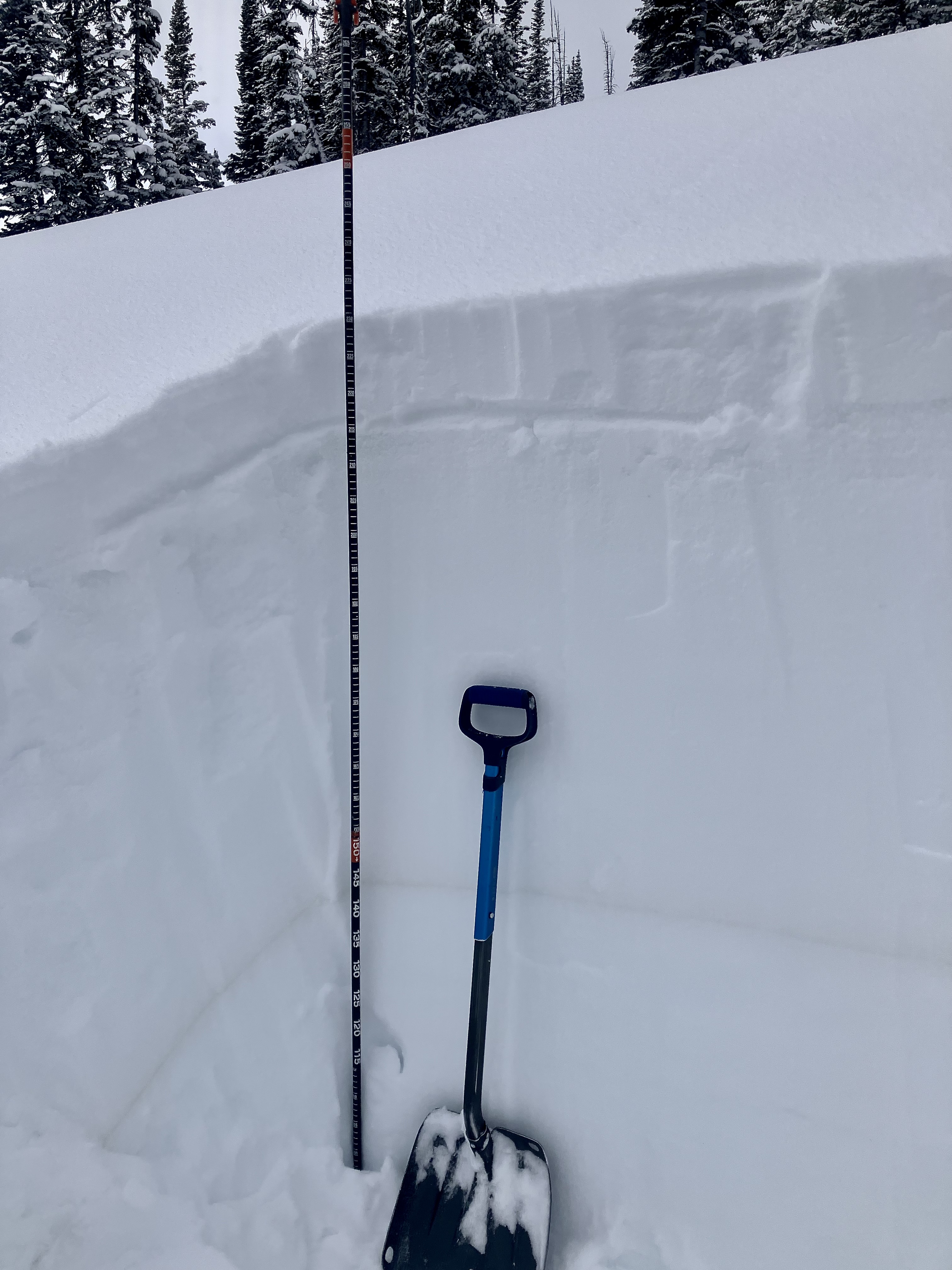
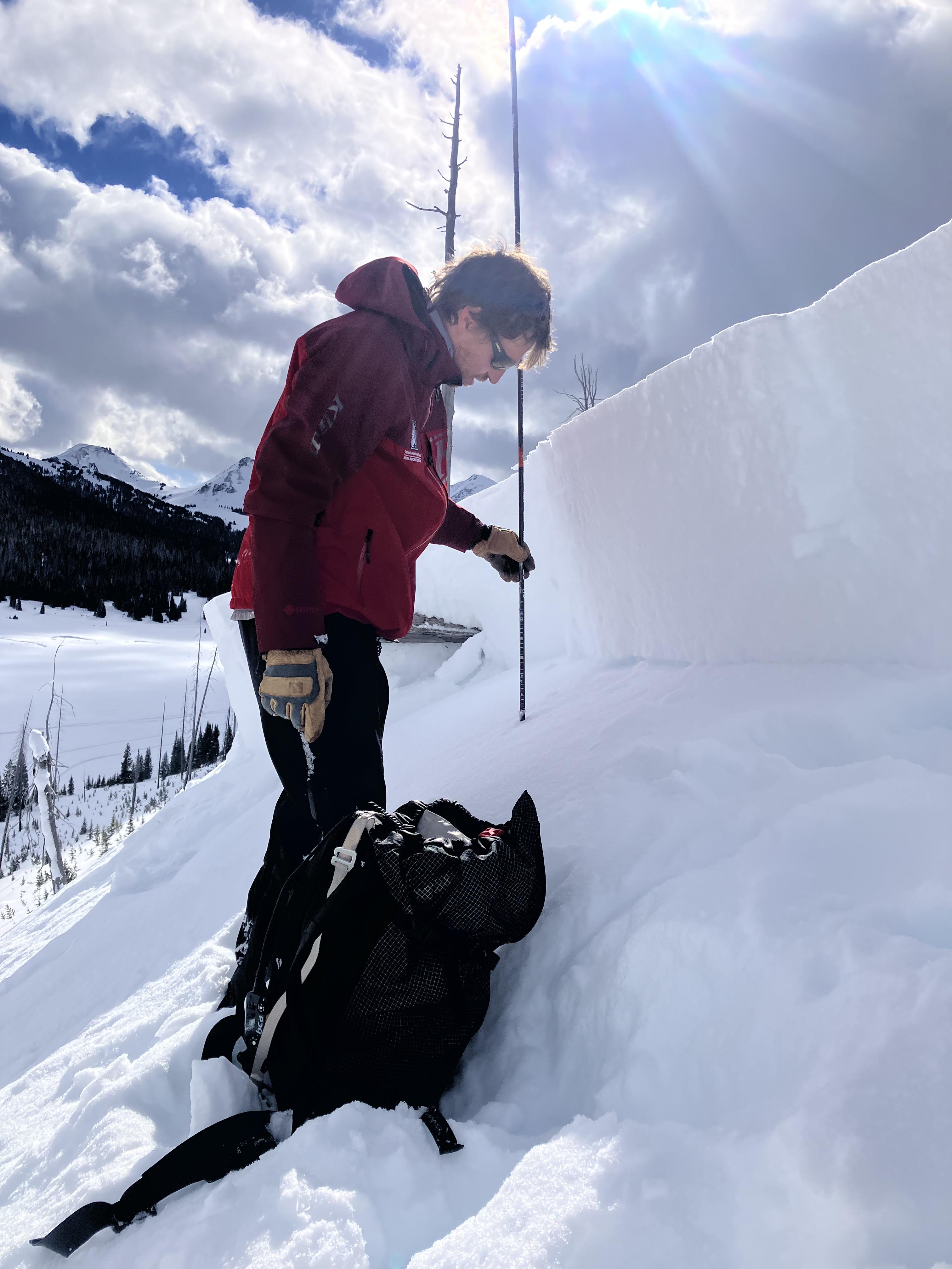
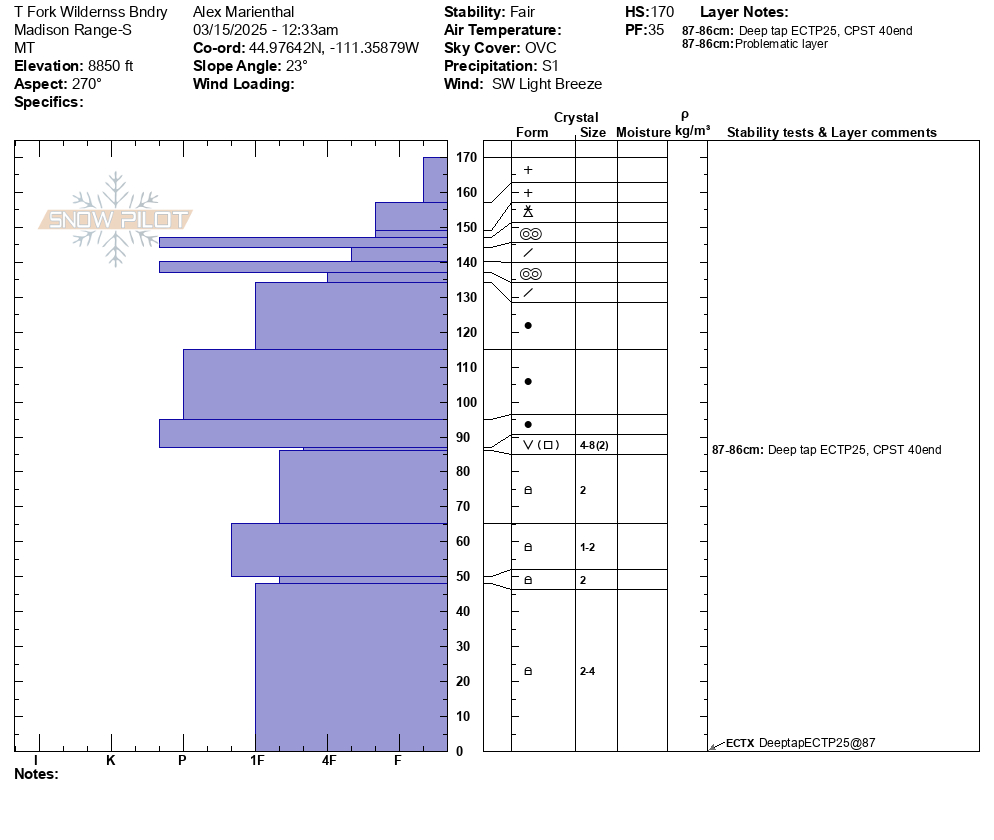
As we rode, we dug a few snowpits looking for the weak layer that we found yesterday buried about 2 feet deep. While we were able to find this layer, we only got propagation in one of three tests (ECTP 26, E aspect, 9070'). Photo: GNFAC
-

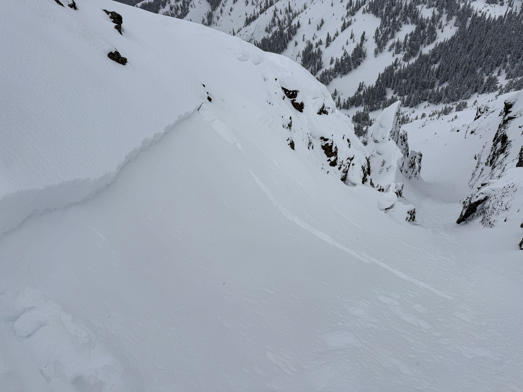
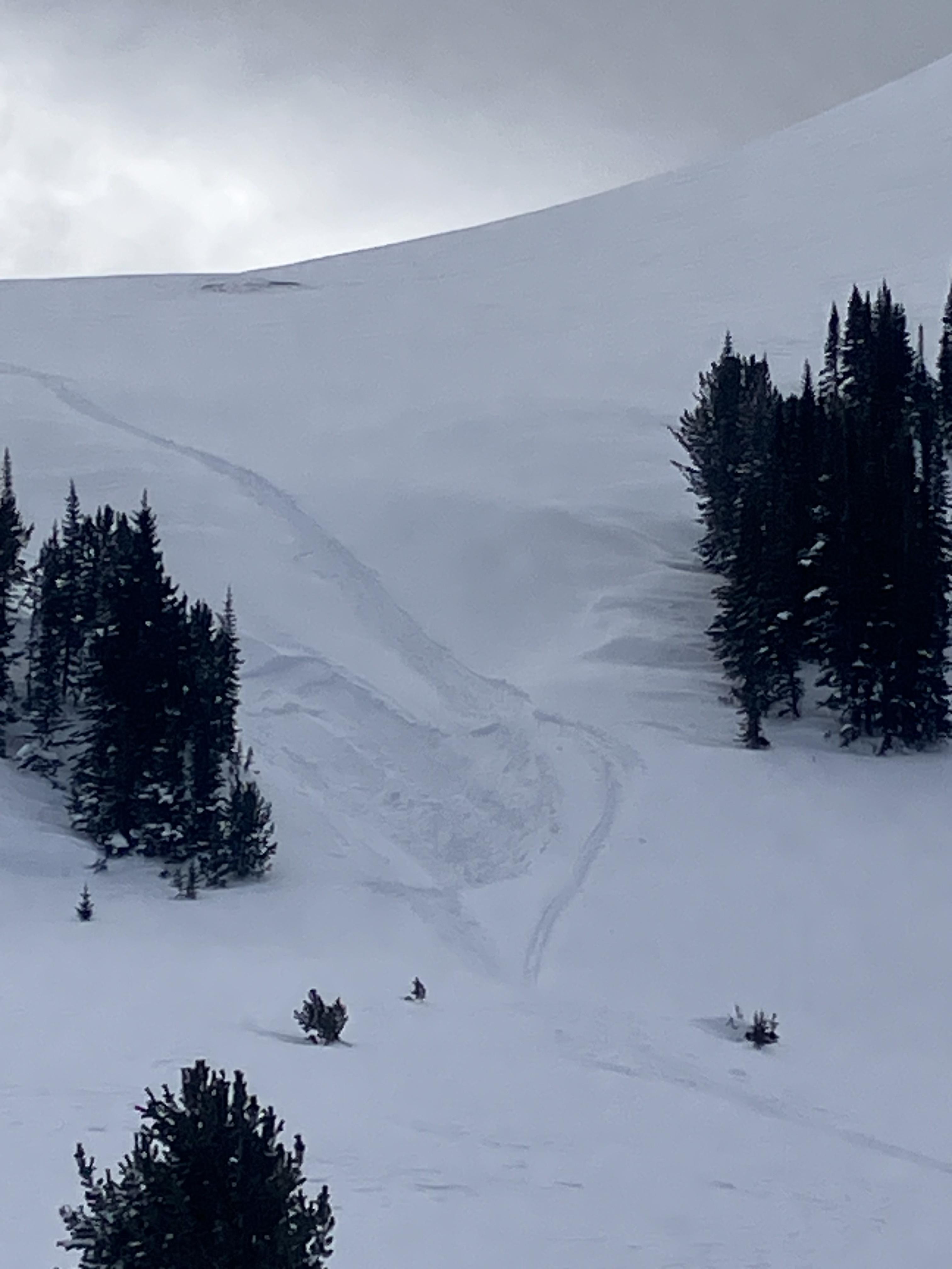
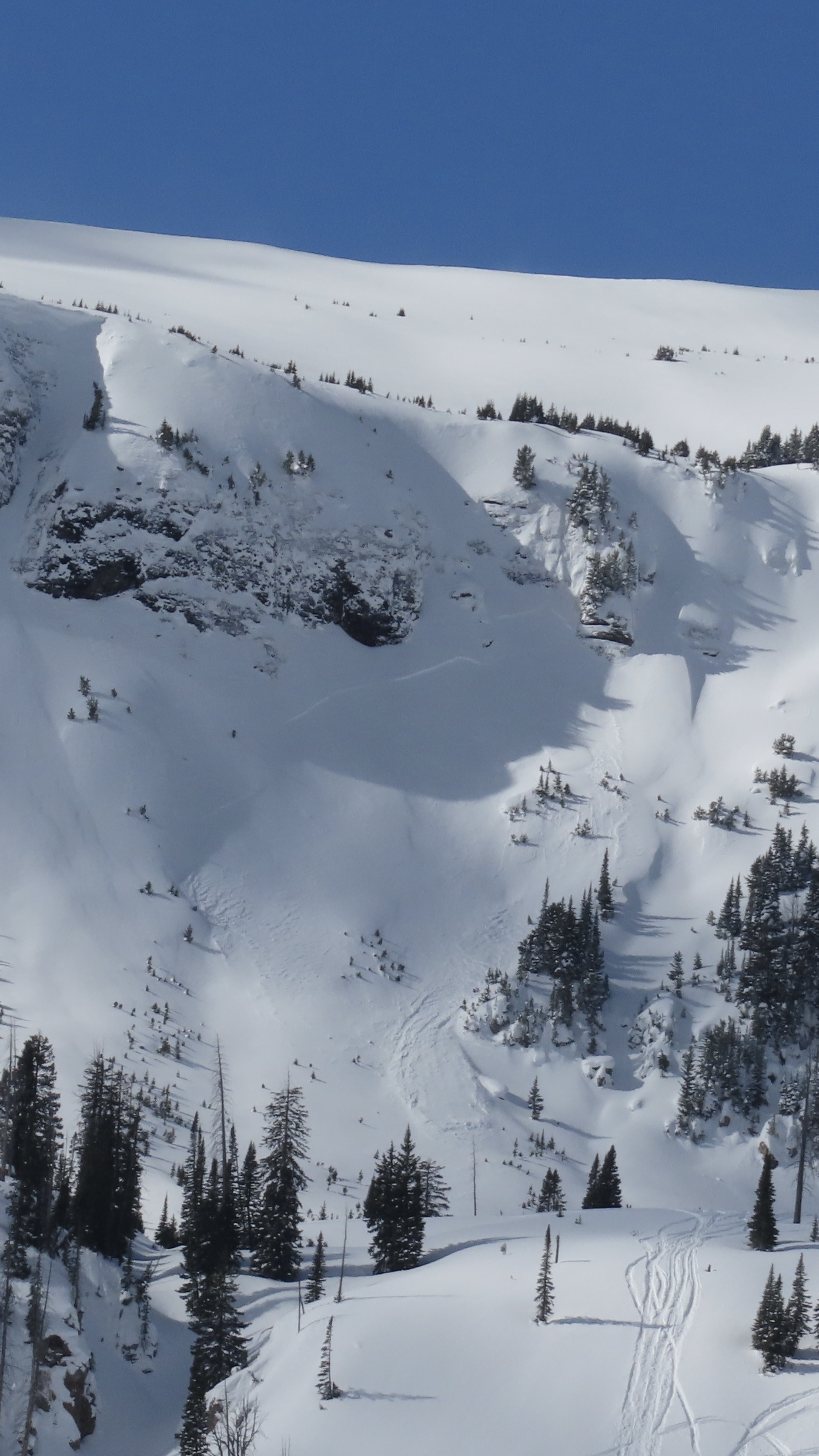
We noted one avalanche on the Fin that likely occurred yesterday or early this morning from a wind slab or cornice fall. Photo: GNFAC
-
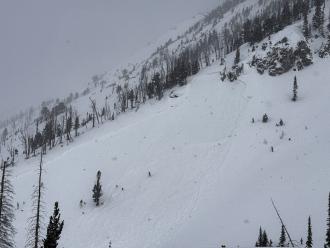
Photo of a recent natural avalanche north of Cooke City, observed today (3/23/25). A S, SE aspect in Sheep Creek at about 9000'. Photo: B Fredlund
-

Today we saw a D2 slab avalanche at Goose Lake, E facing, 10800 ft. We estimate this avalanche to have ran in the early hours of 3/17. Photo: BPG
-
No fresh avalanche activity observed. Attached is a photo of the only sign of a recent avalanche we could find. (an old crown on an East aspect at 9600'). Photo: B Fredlund
-
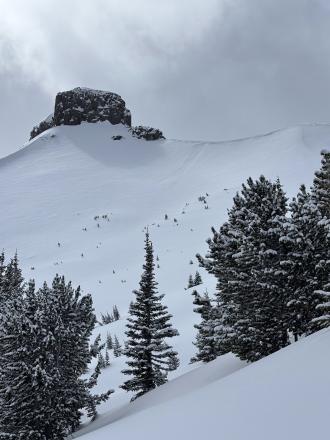
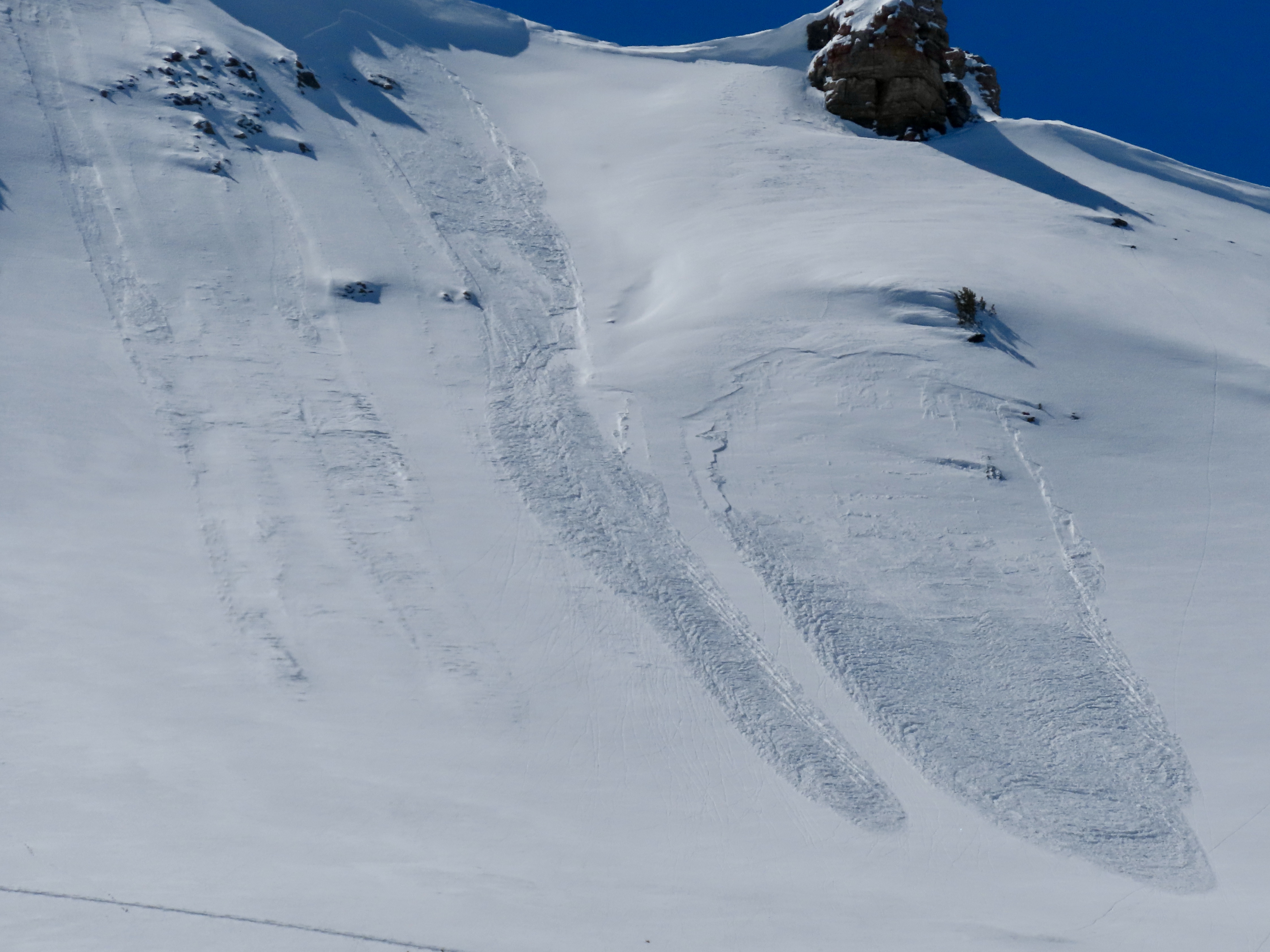
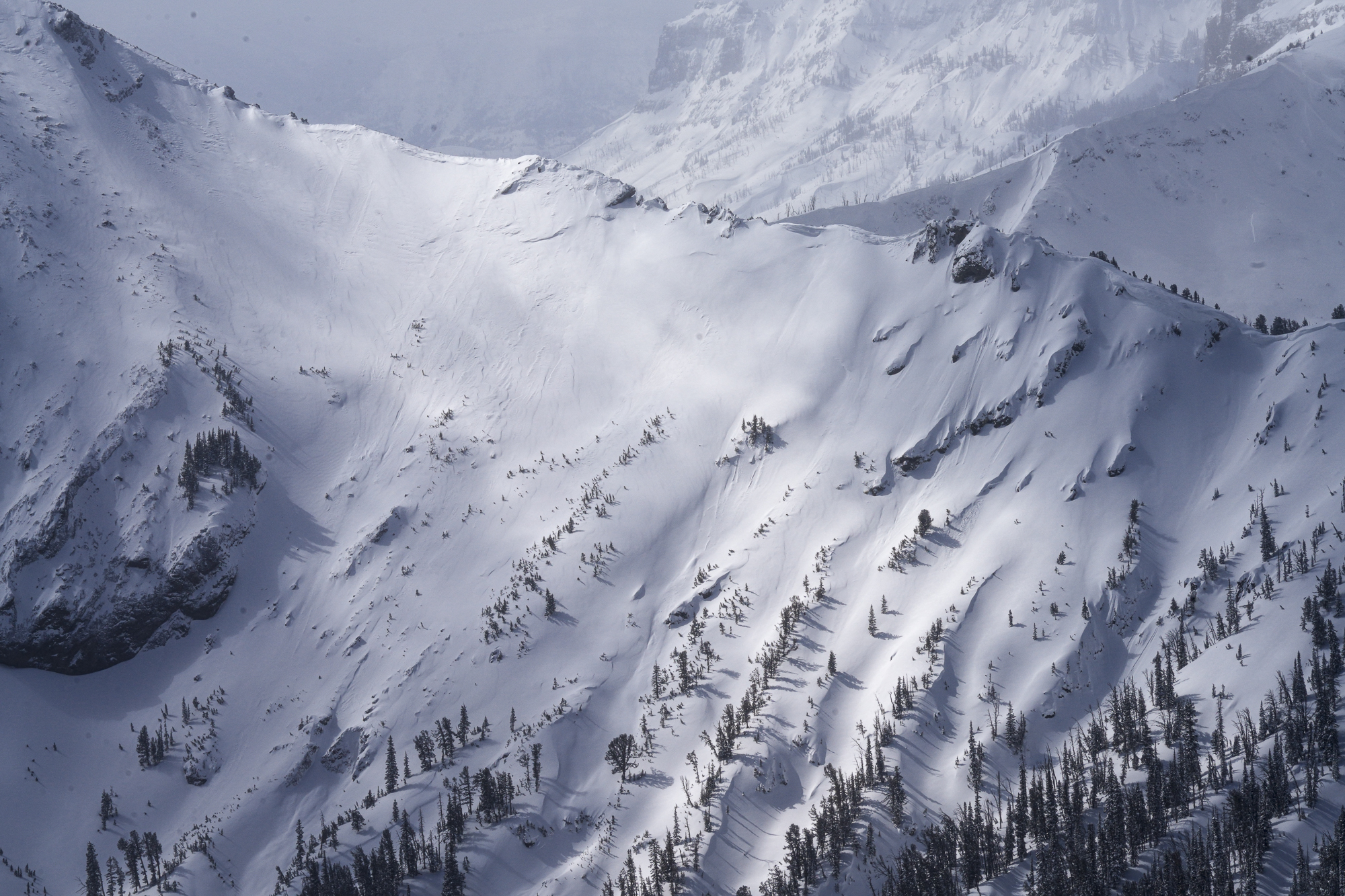
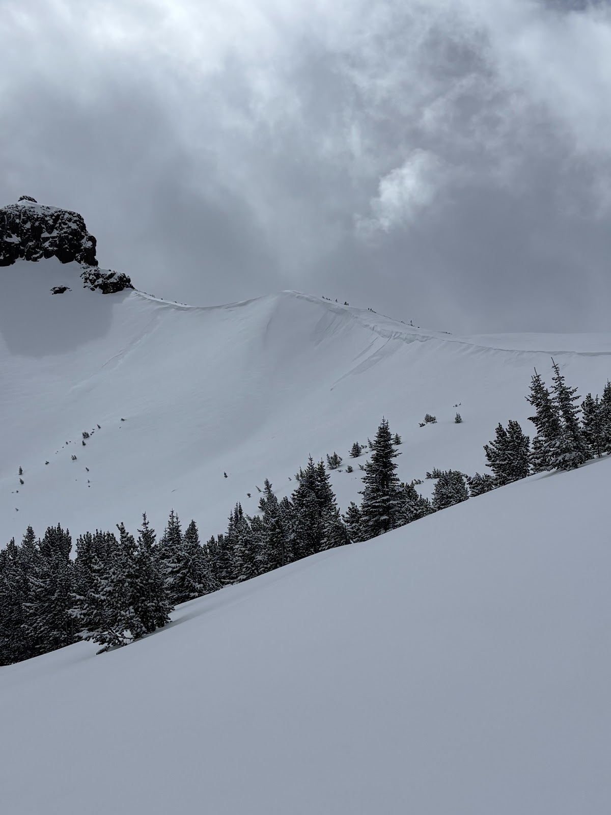
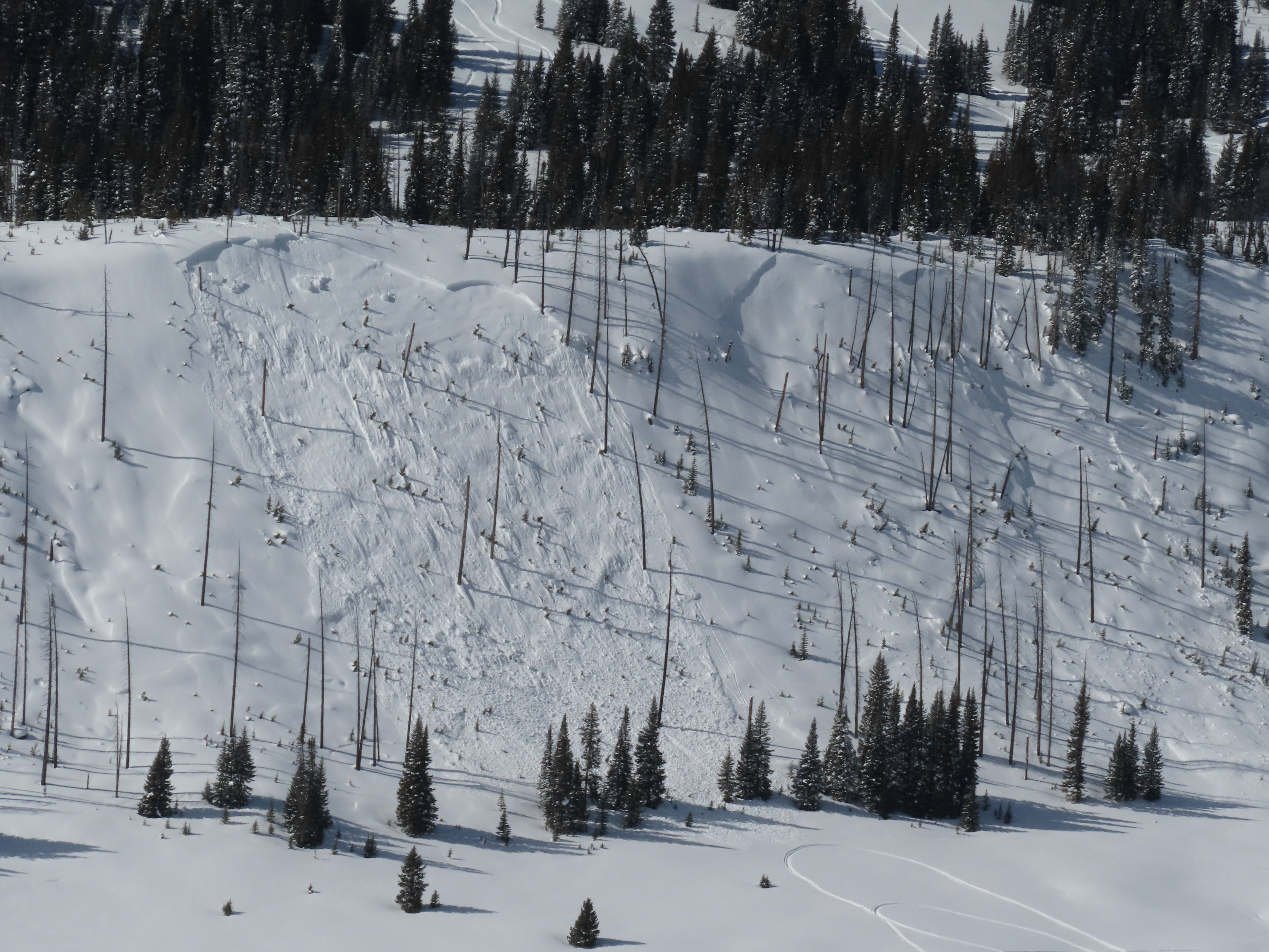
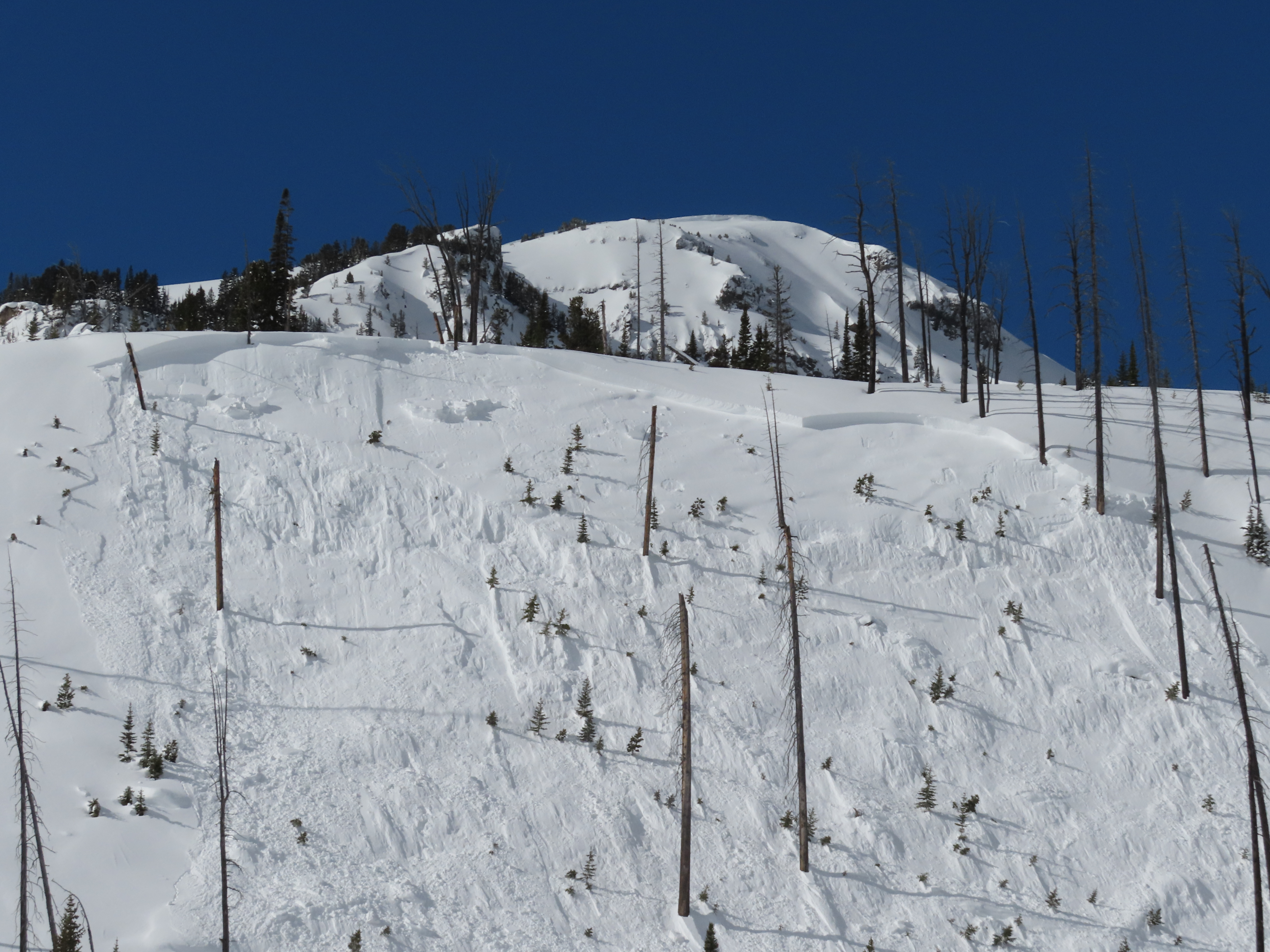
Avalanche on the SE face of Scotch Bonnet in Tragenic Bowl and one on the NE face of Wolverine. They both broke 2-4’ deep. The avalanche on Wolverine slide aprx 1500’. Both were in wind loaded areas at upper elevations. Photo: BPG
-
"Today I triggered a D1 dry loose avalanche on a E facing 35 degree slope, 9300 ft on Mt Henderson. The new snow is very low density and is not bonding well to the old interface. I also observed some more dry loose activity/small wind slabs on Sheep Mt, NE facing, 10400 ft."
-
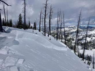
Near Cooke City on Mar 14 there was 6" of new snow and wind was calm, even along the ridge near regularly wind-loaded slopes, and there was no snow blowing off ridgelines. The photo shows a slope that normally receives a lot of wind effect, but the new snow is unaffected indicating the wind has been calm. Photo: GNFAC
-
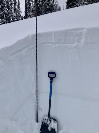
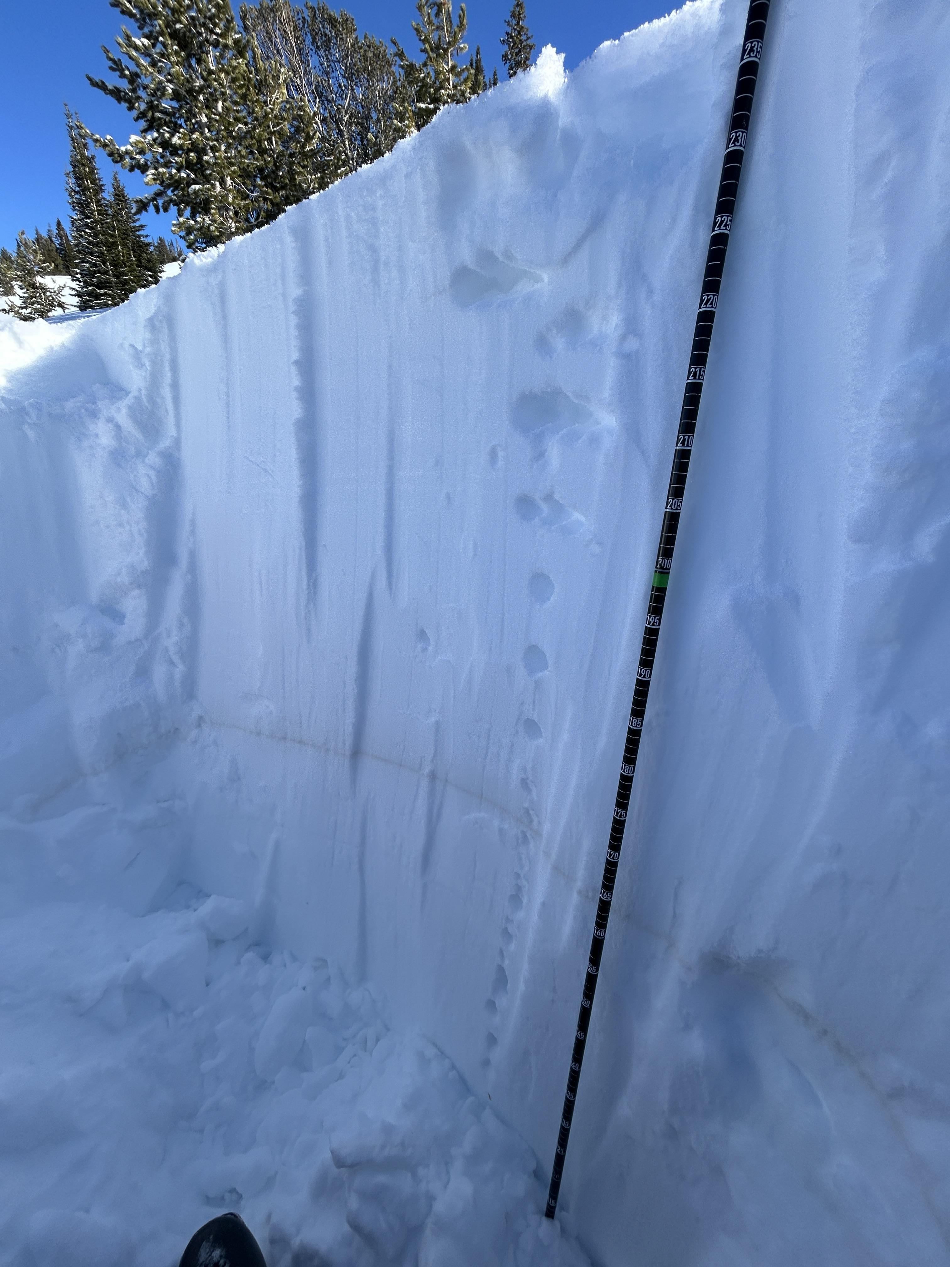
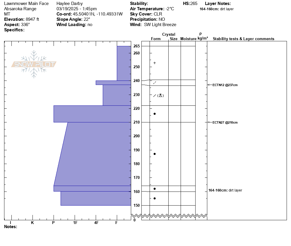
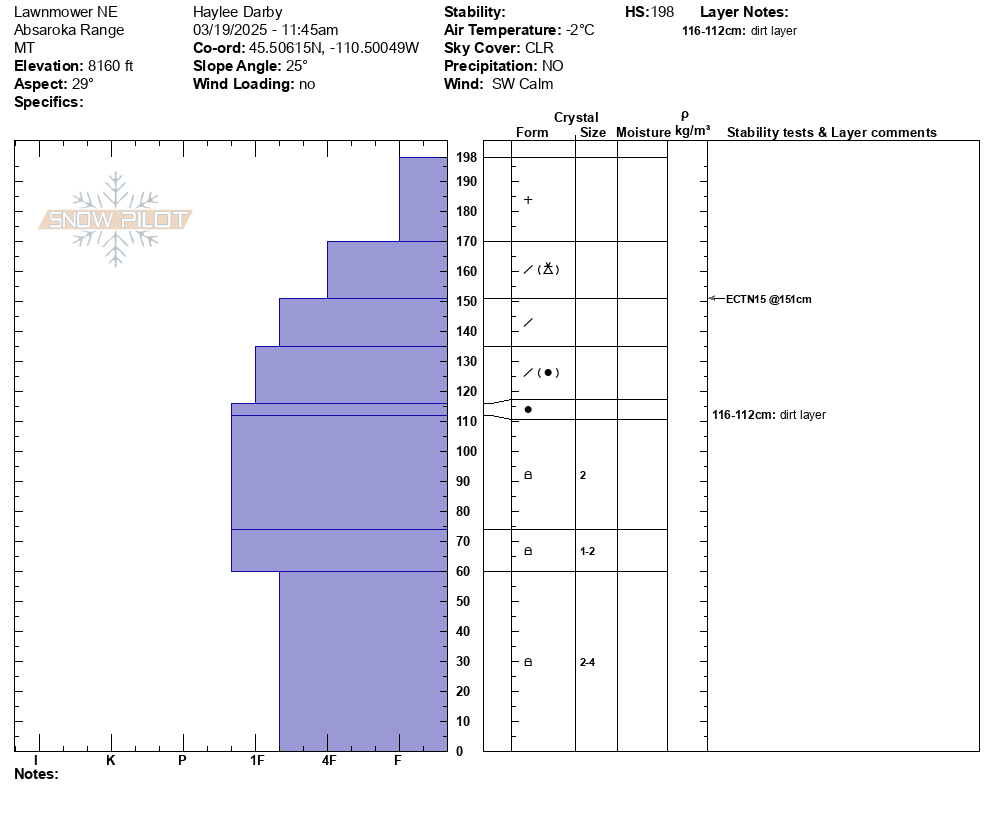
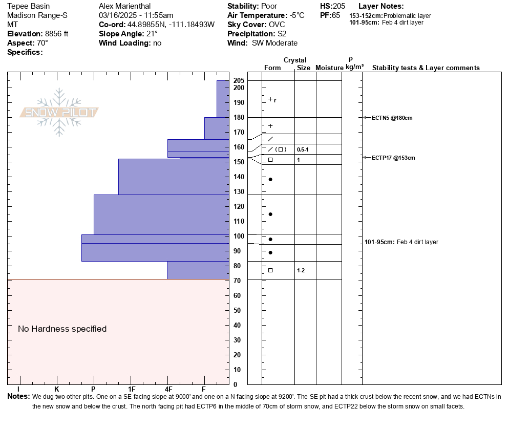
Dug a pit on a northeast facing slope, 9300' (profile and pic attached) near Cooke City. Snow depth was 7-8 feet. 6" of new snow was right side up. Below the new snow was a soft (1F-) melt-freeze crust with soft decomposing and slightly faceted particles below. ECTN13 broke below the crust. Below that the snowpack was 1F to P+ hard and lacked weak layers. The Feb 4 dirt layer was clearly visible. Photo: GNFAC
-
Today I observed multiple small wind slab avalanches off Woody Ridge. NE and E facing, 10000 ft. Max size D1. Photo: BPG
-
Today I observed multiple small wind slab avalanches off Woody Ridge. NE and E facing, 10000 ft. Max size D1. Photo: BPG
-
Many dry loose slides on Cooke Peak in Hayden Creek. Photo: BPG
-
We also witnessed a falling cornice today that washed some snow through rocks. Be aware of what's above you.
-
Above Goose Creek -hard, dense, strong, and deep snow. Facets from late January are 1F+ hardness
-
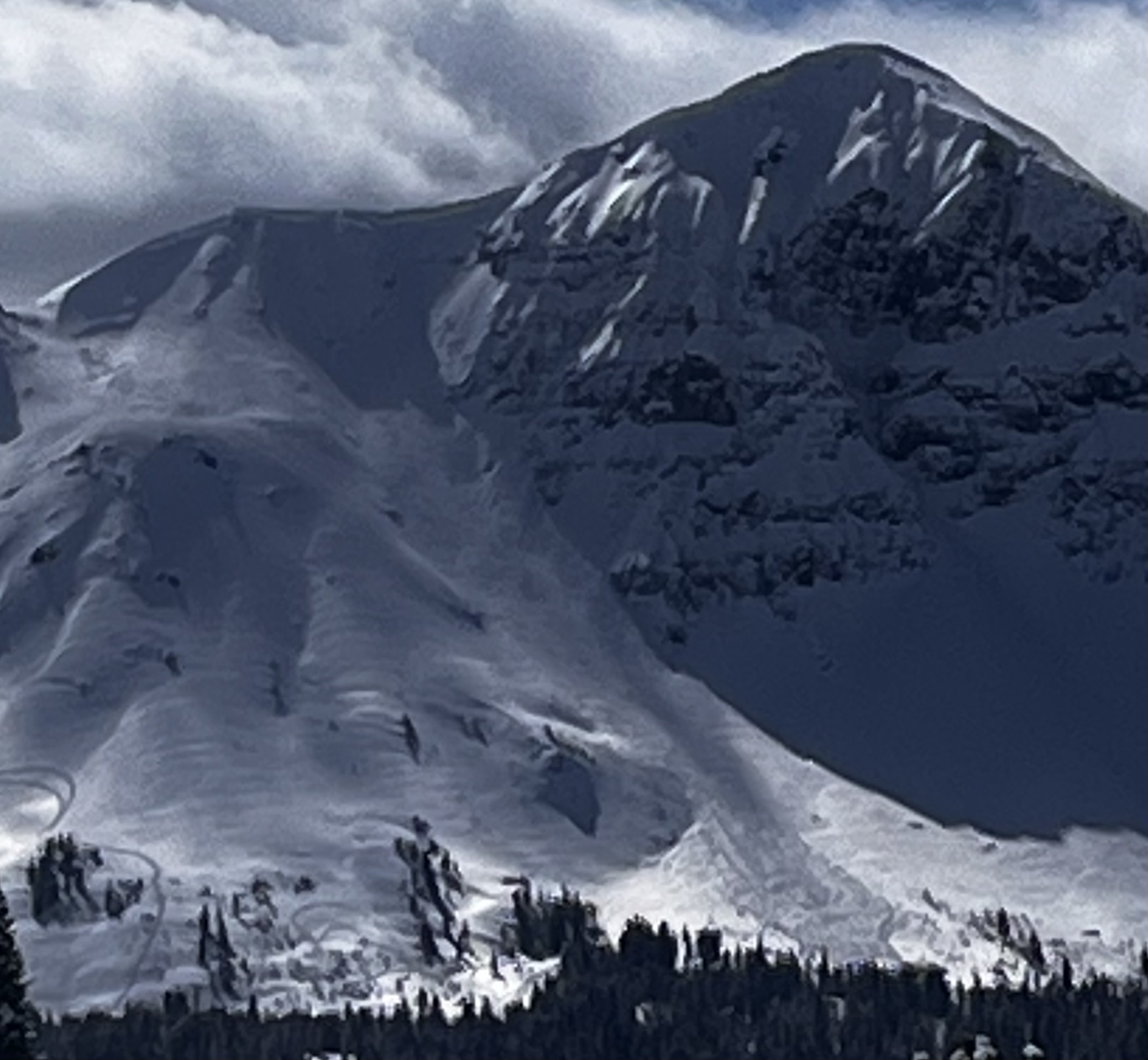
Fresh wind slab avalanche seen this afternoon, possibly rider triggered. Photo: N. Meyers
-
On Feb 24 we saw at least 3 rider triggered wind slabs, 4-5 natural wind slab avalanches, and a couple large cornice falls. Strong wid had affected almost every piece of terrain, scouring some slopes, loading others, just stiffening the slab in many areas, and forming fresh drifts on every convex roll and along the edges of trails. Riding was still soft and fairly consistent in many areas. Photo GNFAC
-

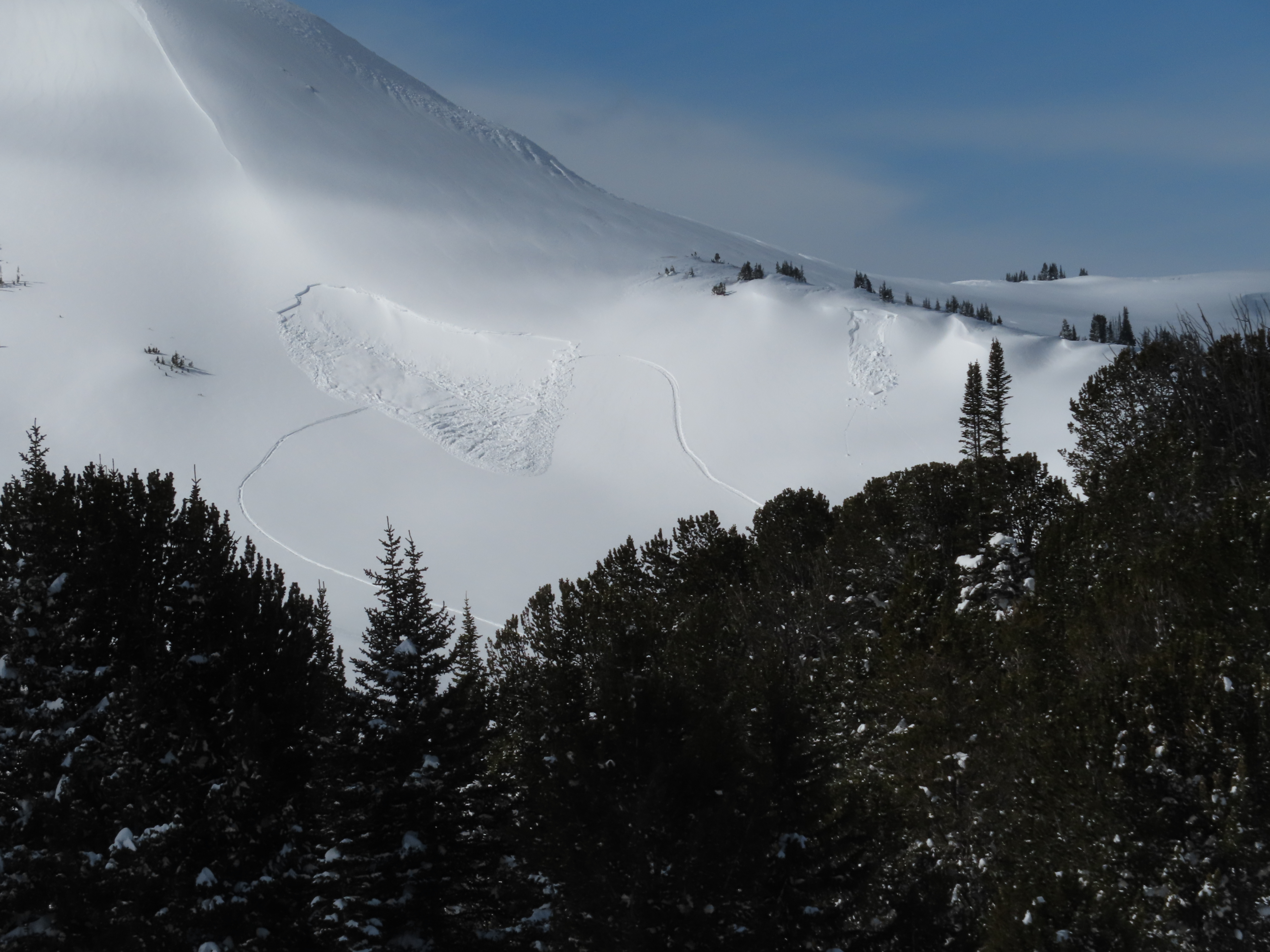
While looking for a recent avalanche from the flat bench above we triggered a similar sized slide directly adjacent to the previous slide. They broke on weak layers of facets and surface hoar that formed at the end of January. 2-3 feet deep and 150-200' wide. Photo: GNFAC
-
While looking for a recent avalanche from the flat bench above we triggered a similar sized slide directly adjacent to the previous slide. They broke on weak layers of facets and surface hoar that formed at the end of January. 2-3 feet deep and 150-200' wide. Observing the snowpack that caused the avalanche. Photo: GNFAC
-
While looking for a recent avalanche from the flat bench above we triggered a similar sized slide directly adjacent to the previous slide. They broke on weak layers of facets and surface hoar that formed at the end of January. 2-3 feet deep and 150-200' wide. Photo: GNFAC
-
While looking for a recent avalanche from the flat bench above we triggered a similar sized slide directly adjacent to the previous slide. They broke on weak layers of facets and surface hoar that formed at the end of January. 2-3 feet deep and 150-200' wide. Photo: GNFAC
-

While looking for a recent avalanche from the flat bench above we triggered a similar sized slide directly adjacent to the previous slide. They broke on weak layers of facets and surface hoar that formed at the end of January. 2-3 feet deep and 150-200' wide. Photo: GNFAC
-

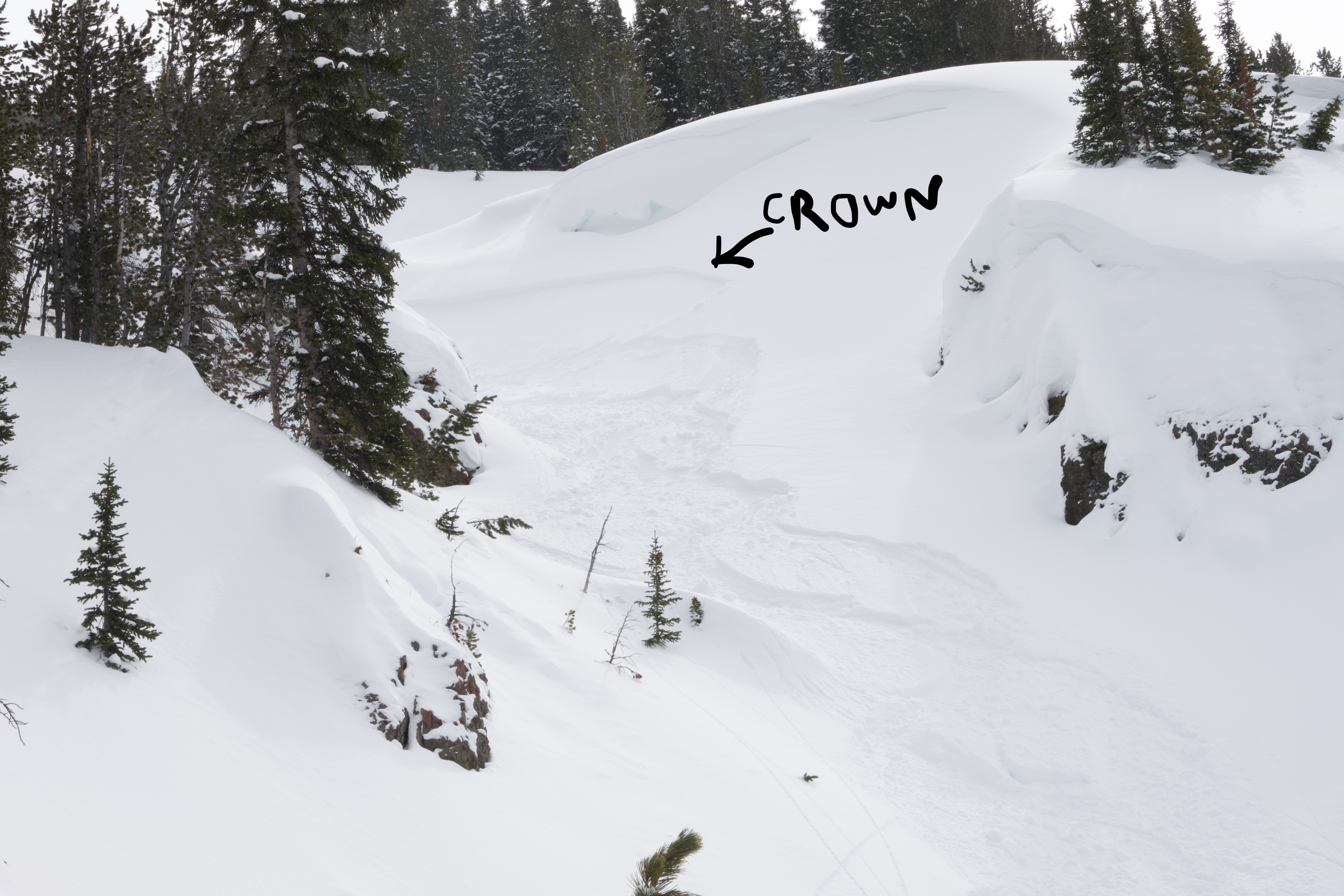
An avalanche that was triggered two days ago (Feb 22), remotely from flat terrain above a steep slope, on the northeast end of Mt. Abundance. Photo: GNFAC


Videos- Cooke City Area
WebCams
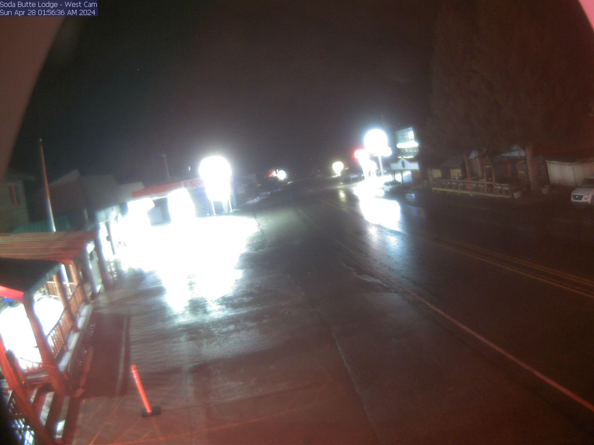
Soda Butte Lodge, looking West
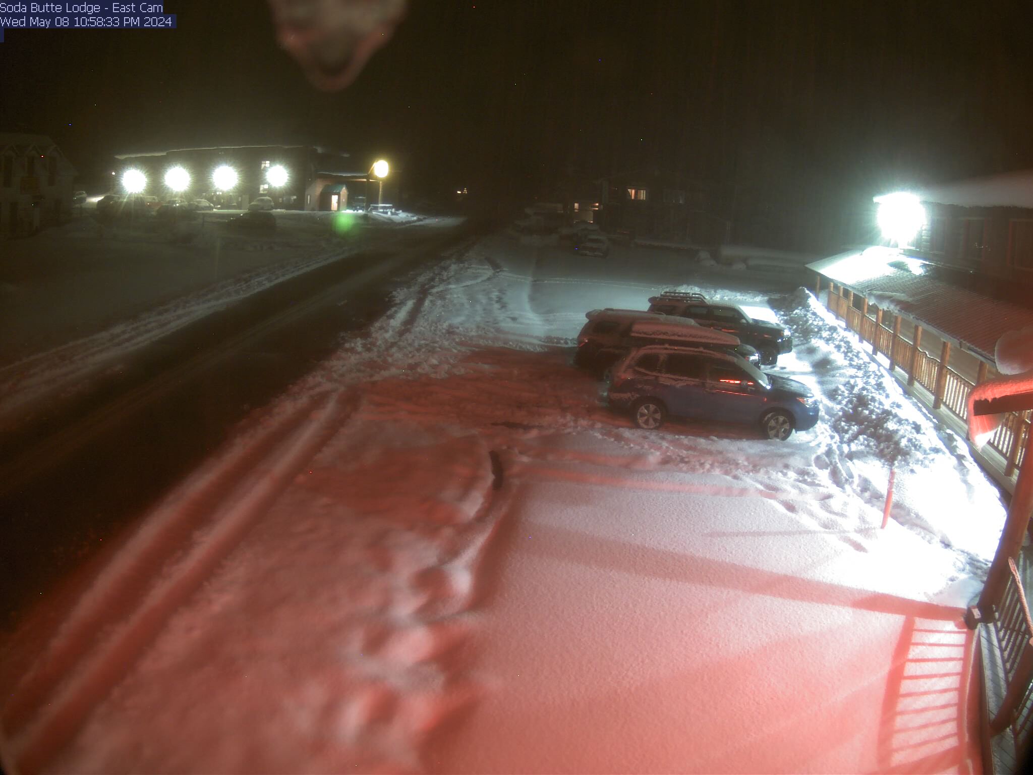
Soda Butte Lodge, looking East


Weather Stations- Cooke City Area
Weather Forecast Cooke City Area
Extended Forecast for2 Miles NNE Cooke City MT
Tonight

Low: 24 °F
Clear
Tuesday

High: 51 °F
Sunny
Tuesday Night

Low: 28 °F
Partly Cloudy
Wednesday
High: 49 °F
Sunny then
Chance SnowWednesday Night

Low: 22 °F
Heavy Snow
Thursday

High: 24 °F
Snow
Thursday Night

Low: 13 °F
Snow Likely
Friday
High: 31 °F
Chance Snow
then Partly
SunnyFriday Night

Low: 14 °F
Mostly Clear
The Last Word
Our last daily avalanche forecast will be Sunday, April 20th. We will issue updates on Mondays and Fridays through the end of April.