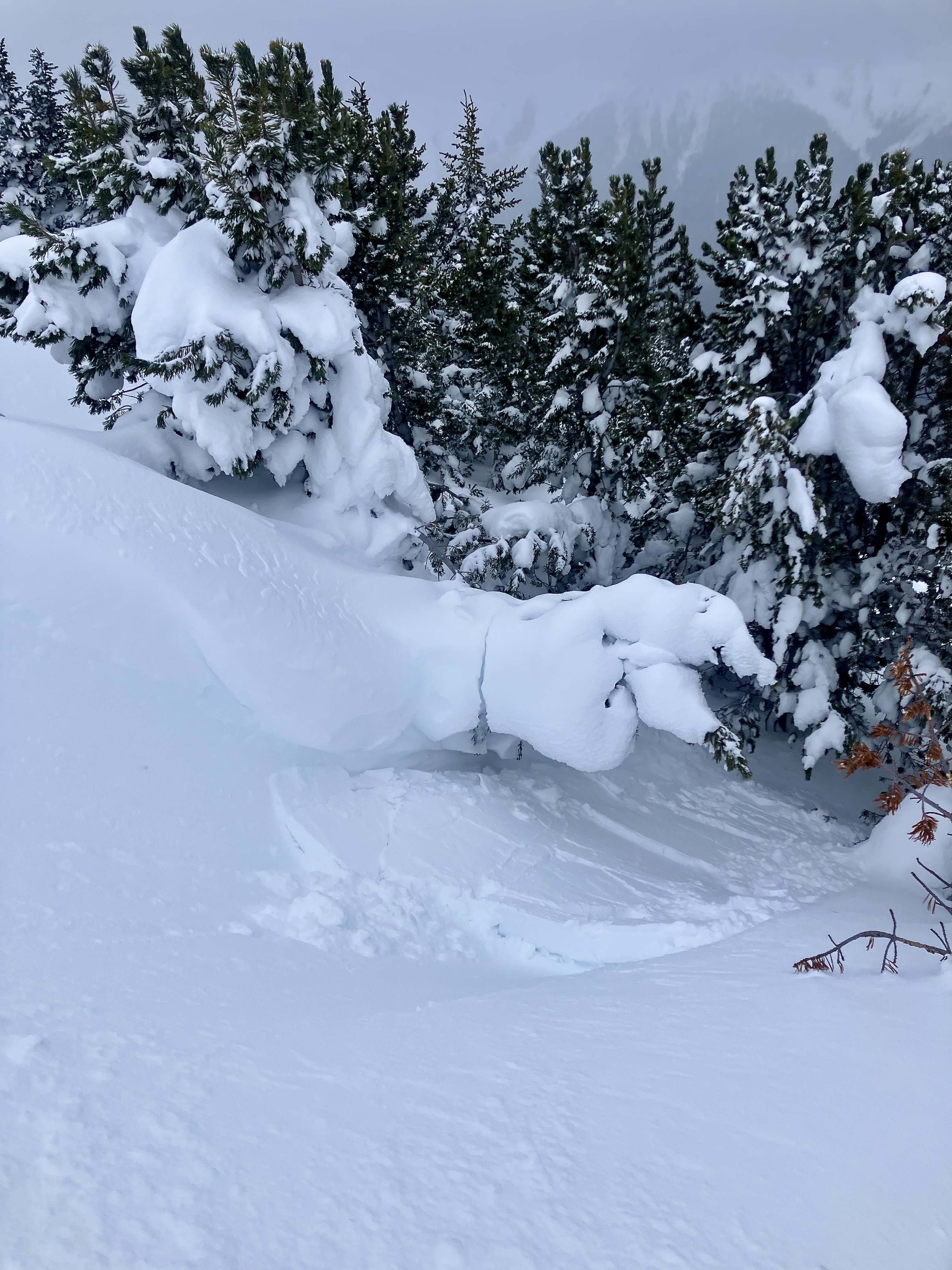
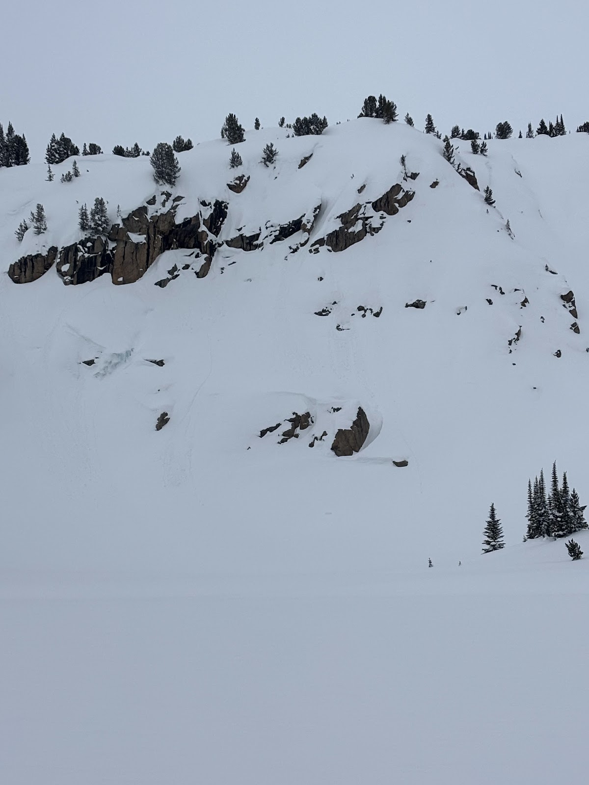
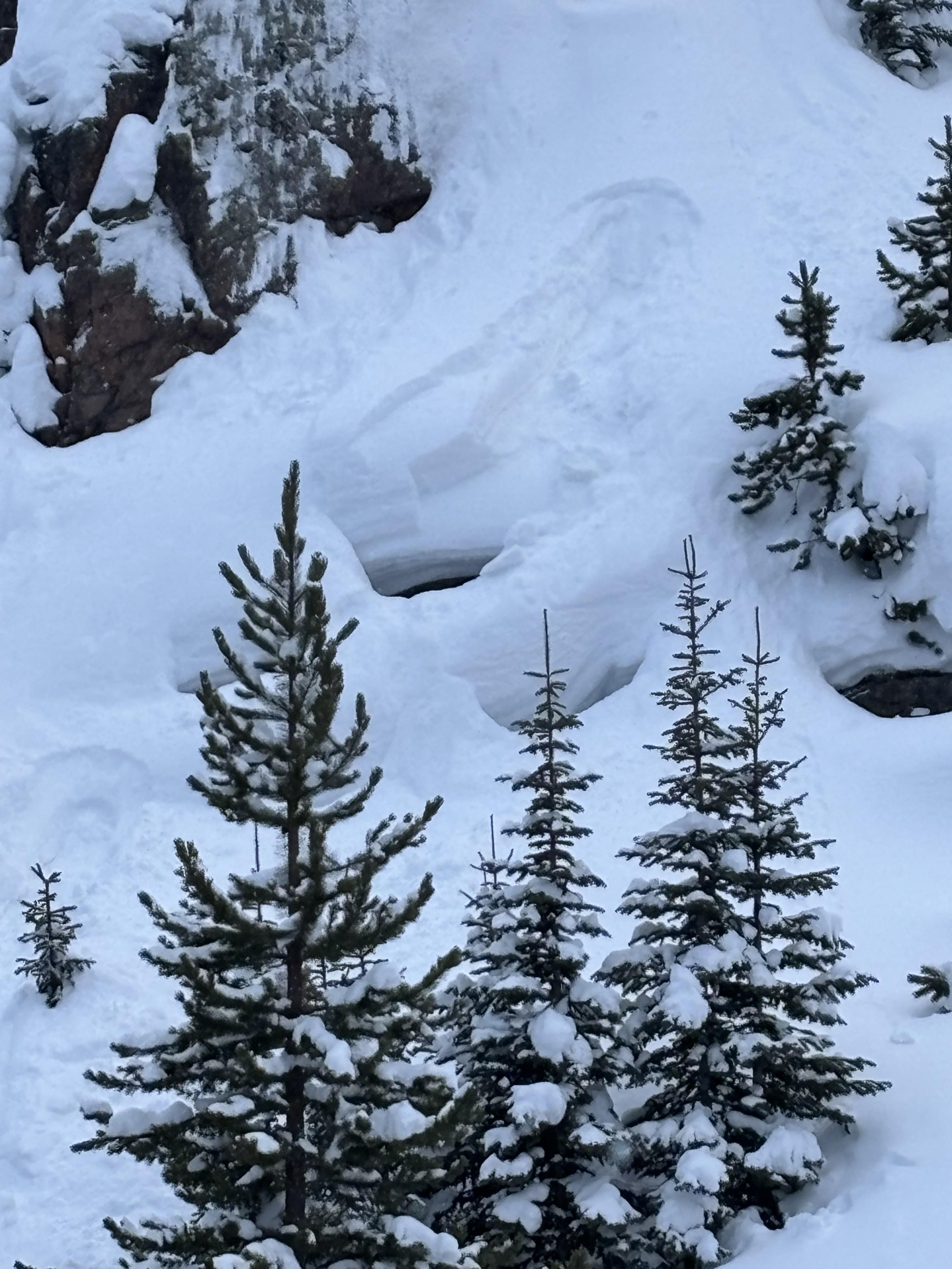
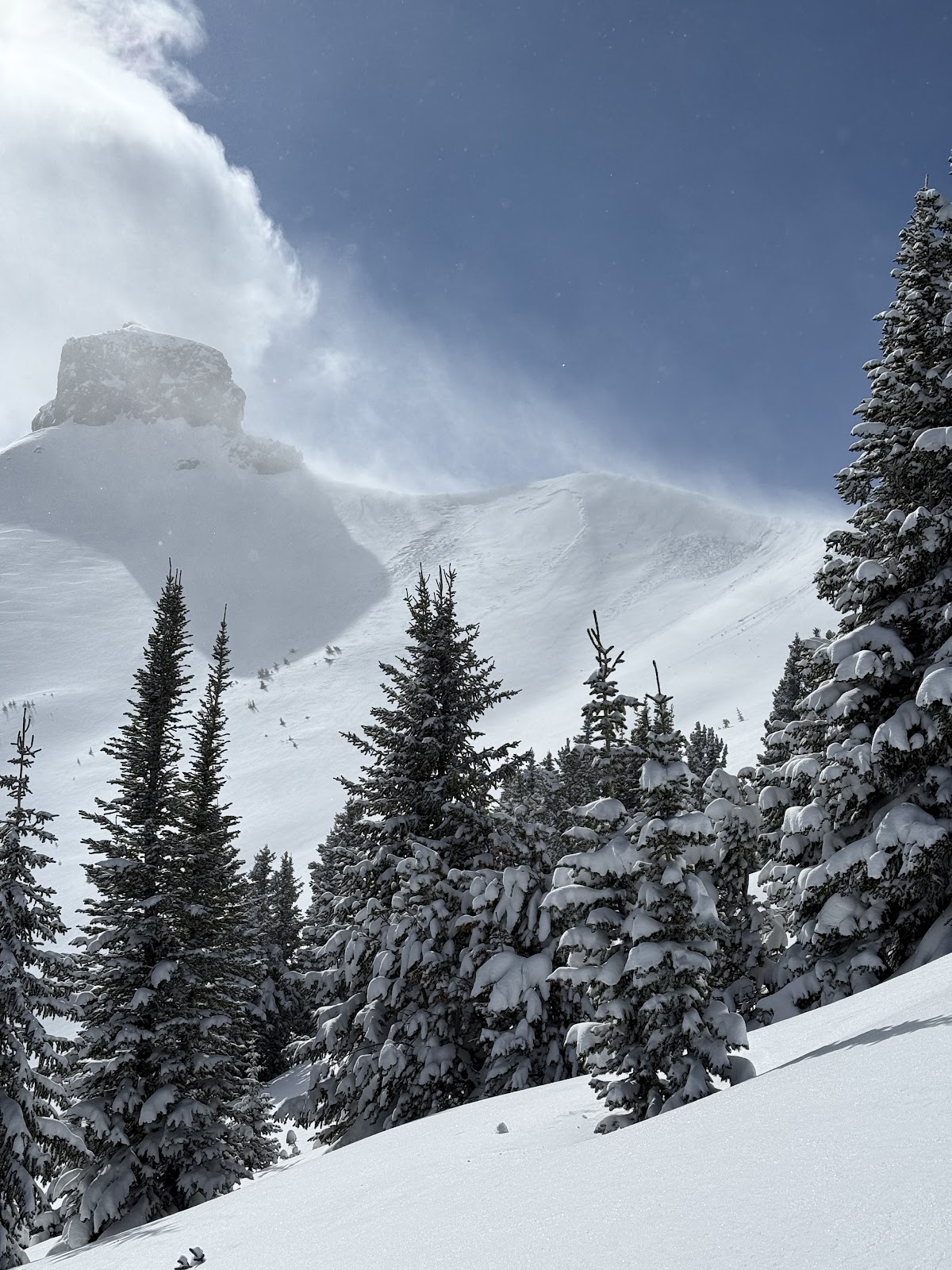
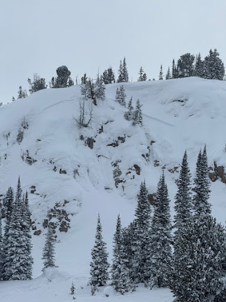
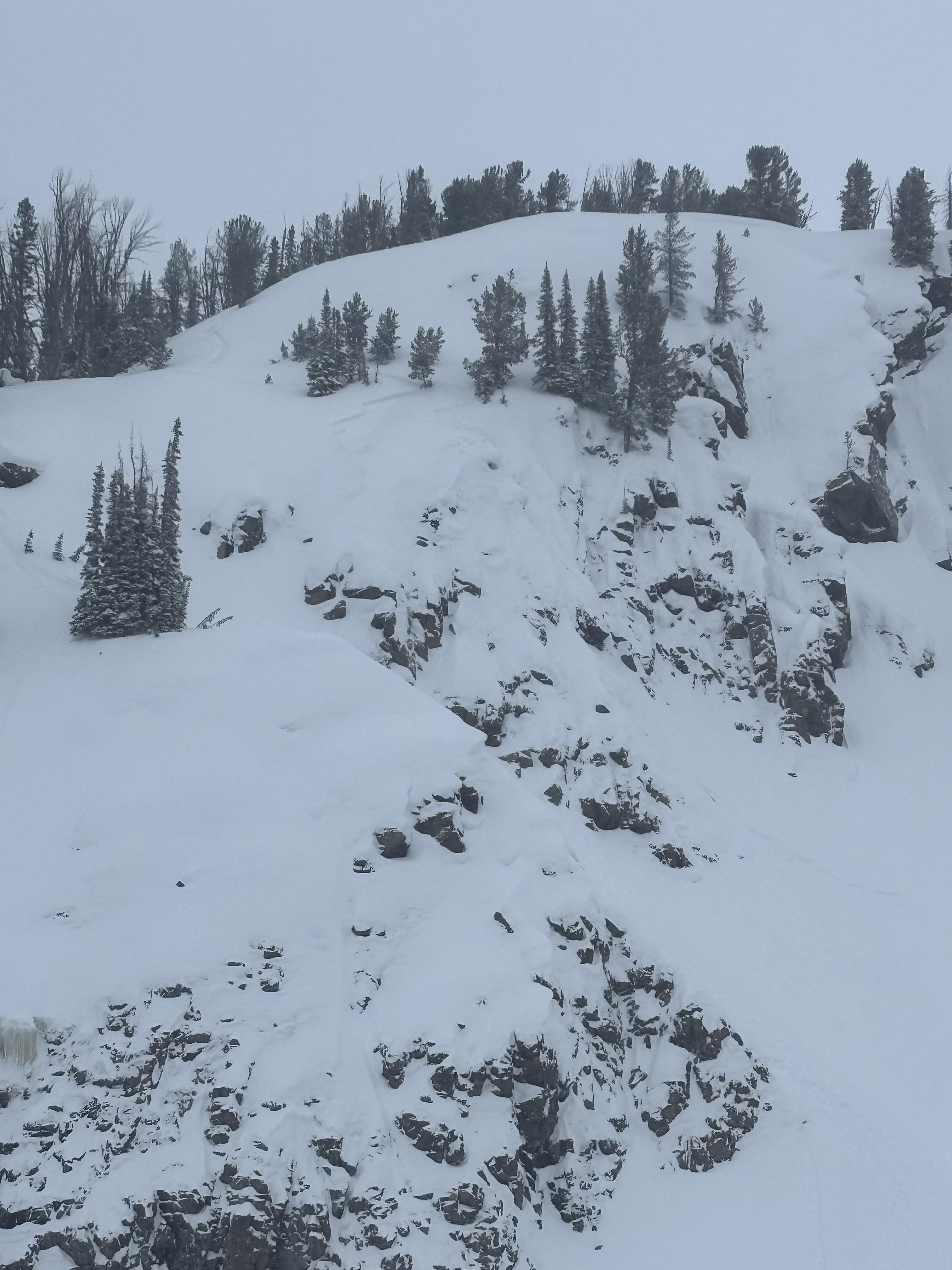
We also witnessed a falling cornice today that washed some snow through rocks. Be aware of what's above you.


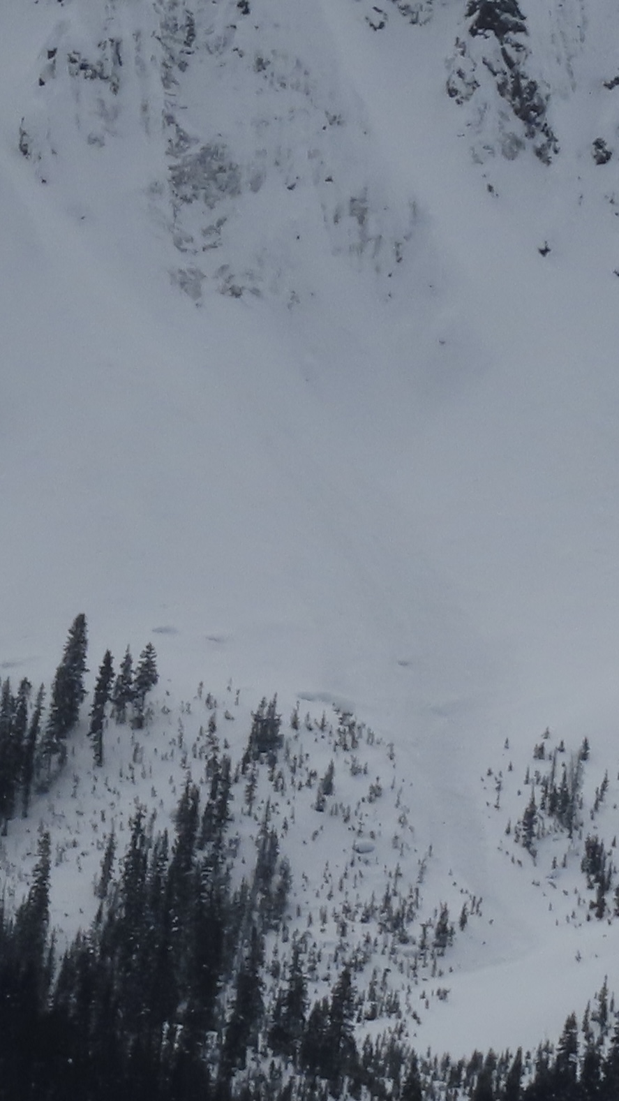
Today we observed wet loose avalanches in steep, rocky terrain on the west side of Miller ridge. SW facing, 9500 ft
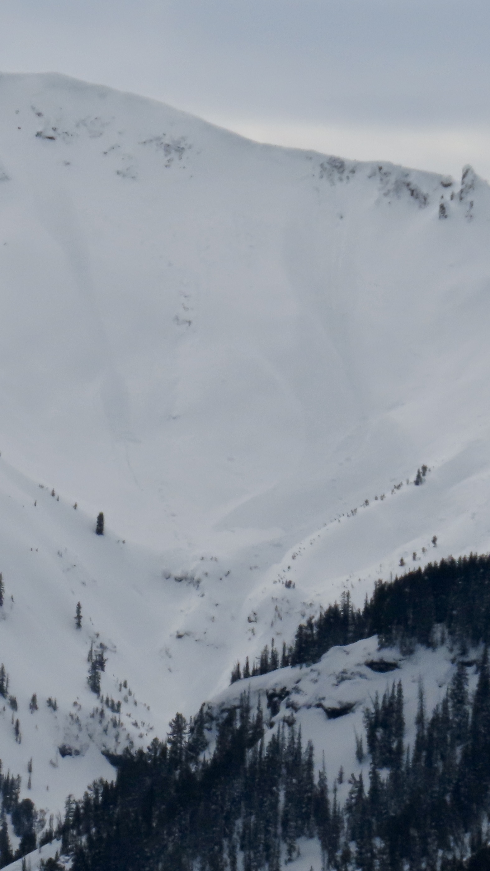
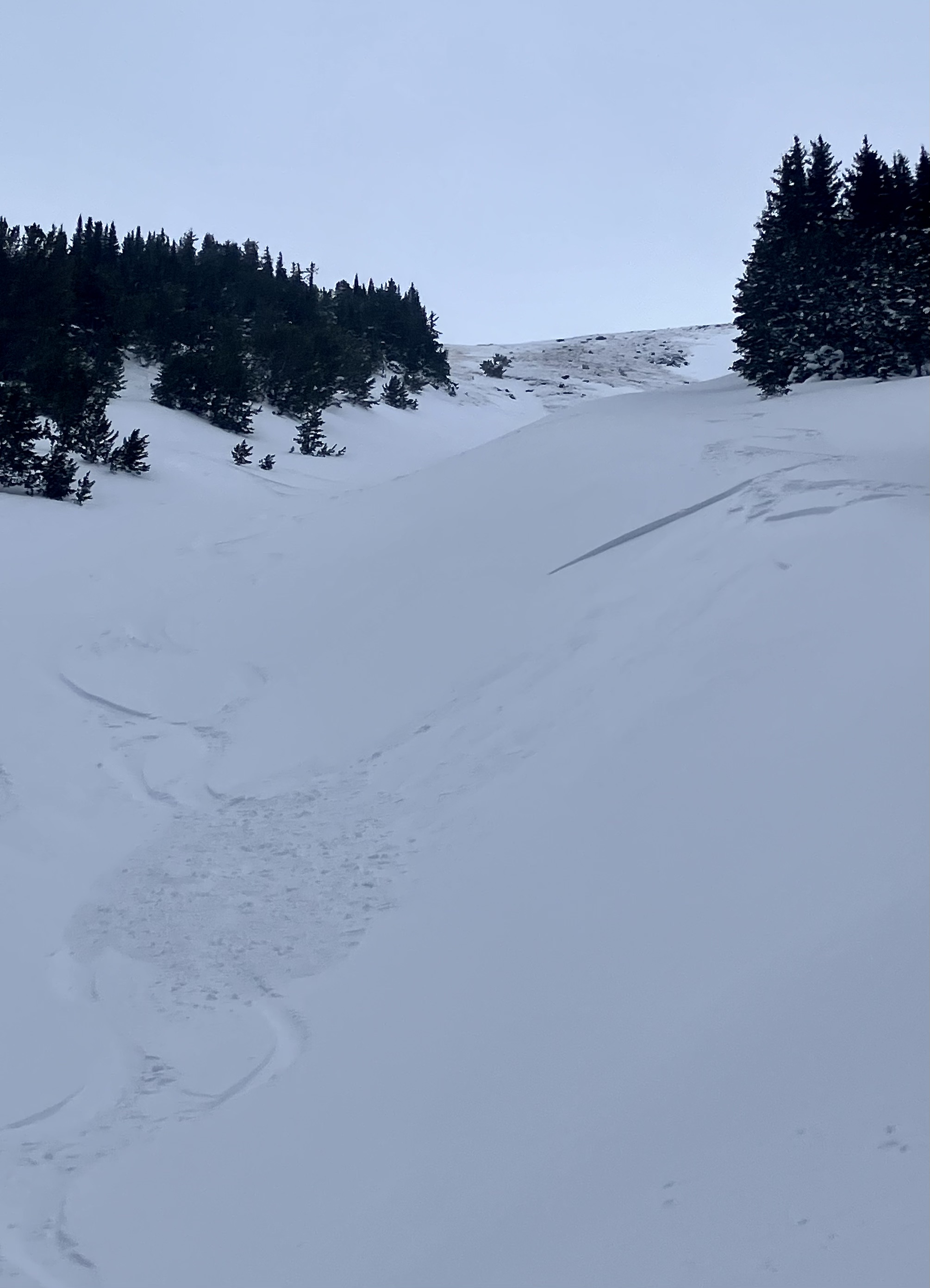
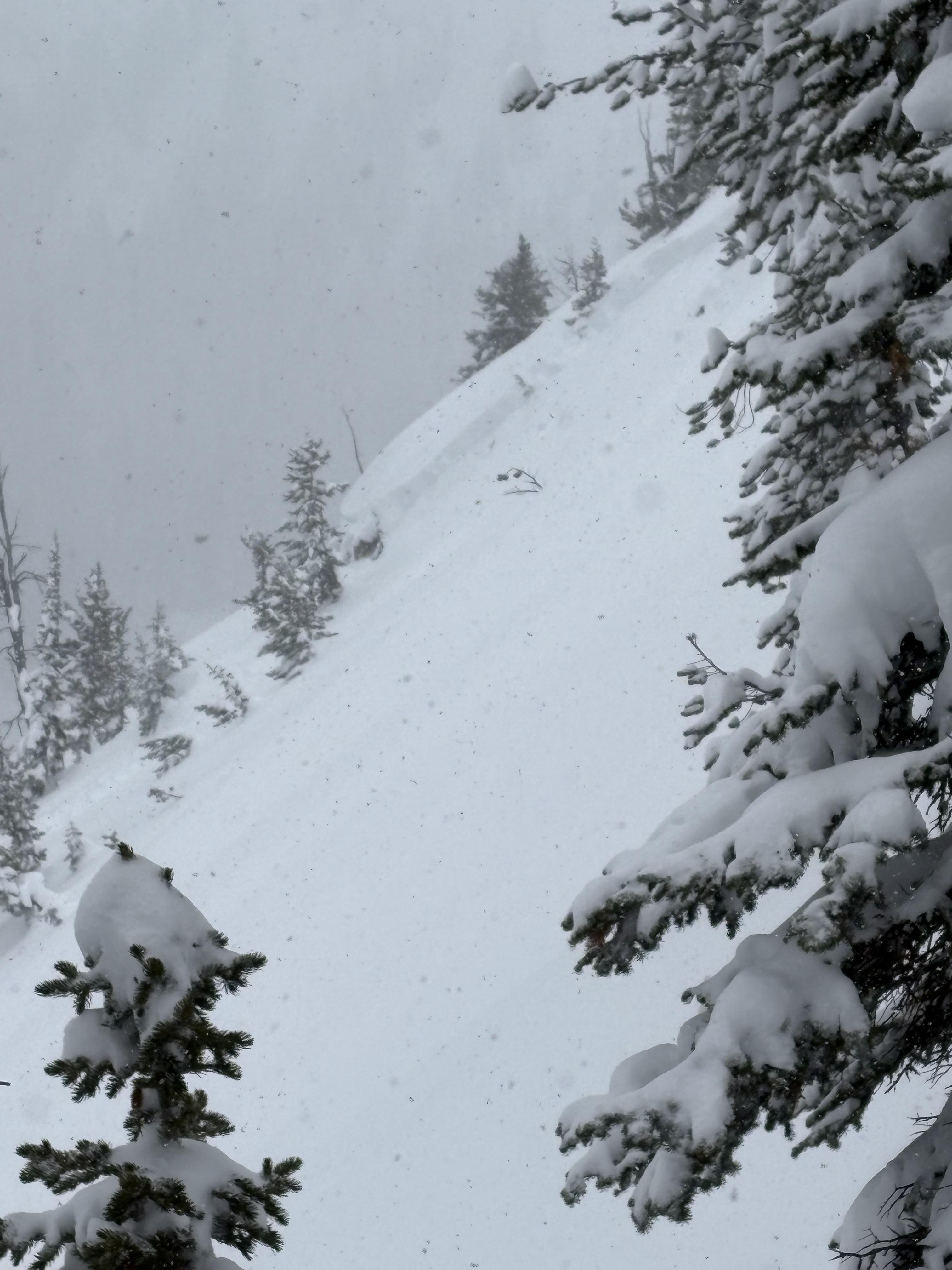
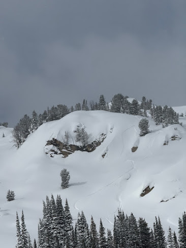
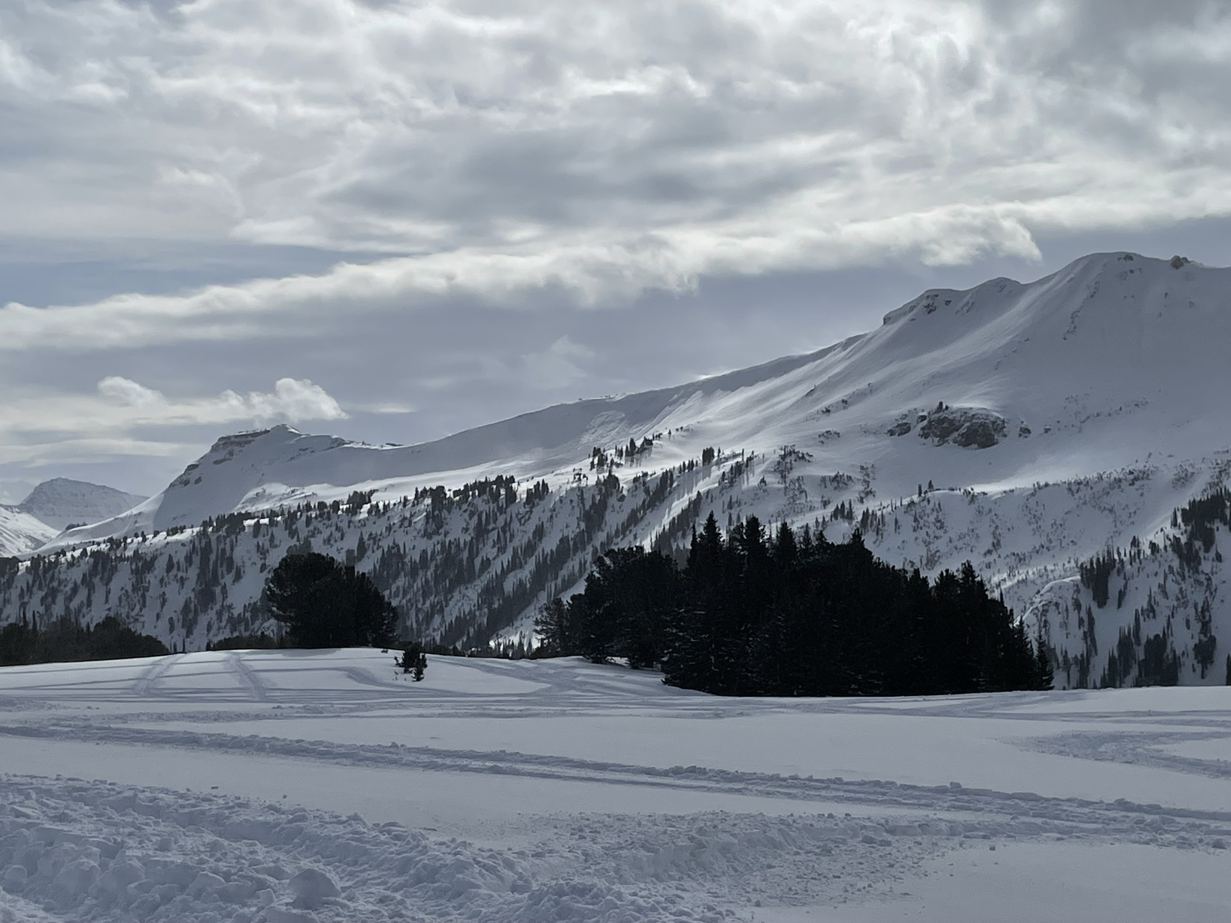
Fresh wind slab avalanche seen this afternoon, possibly rider triggered.
We received a call (from a third party) about a snowmobiler that was buried with their head 5 feet below the snow and their foot sticking out of the snow. Their partners saw the foot and dug them out. The riders face was blue, but quickly became responsive after a "chest thump".
They were riding on the north side of Miller Mtn. Given the widespread winds and drifting, we suspect it was likely a hard wind slab avalanche similar to one spotted on Crown Butte the same day .
We also witnessed a falling cornice today that washed some snow through rocks. Be aware of what's above you.
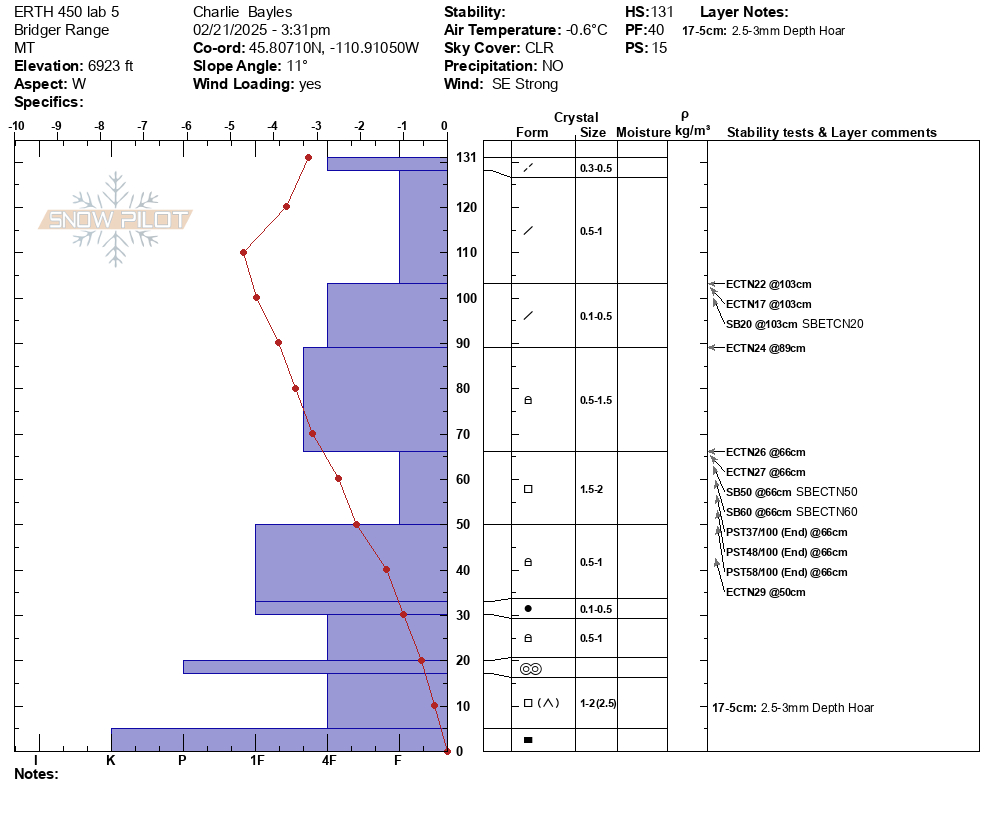
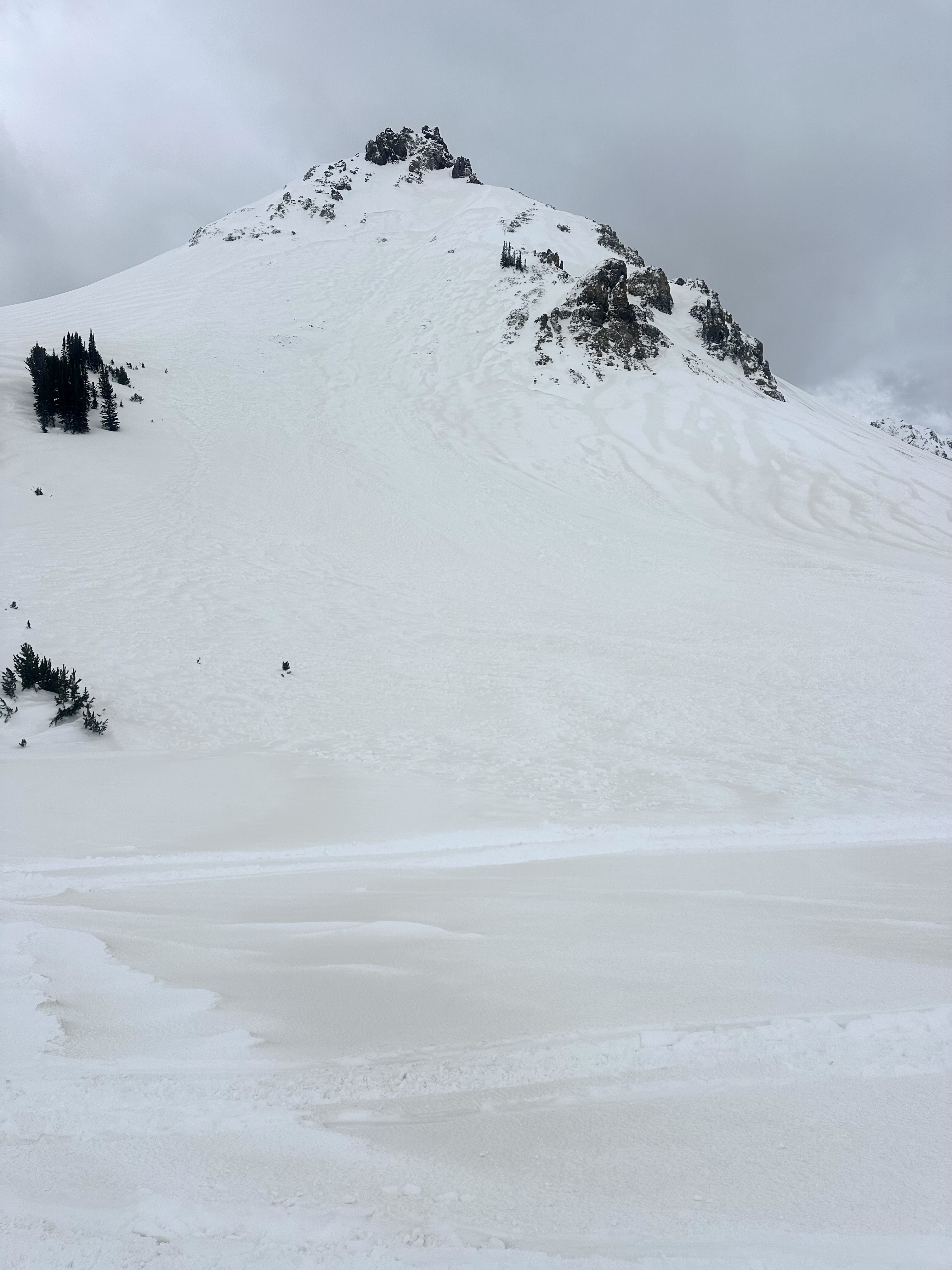
Above Goose Creek -hard, dense, strong, and deep snow. Facets from late January are 1F+ hardness
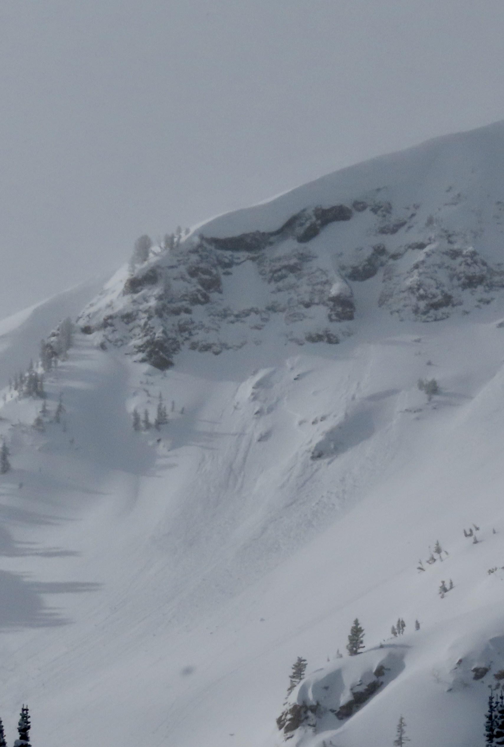
Fresh wind slab avalanche seen this afternoon, possibly rider triggered. Photo: N. Meyers
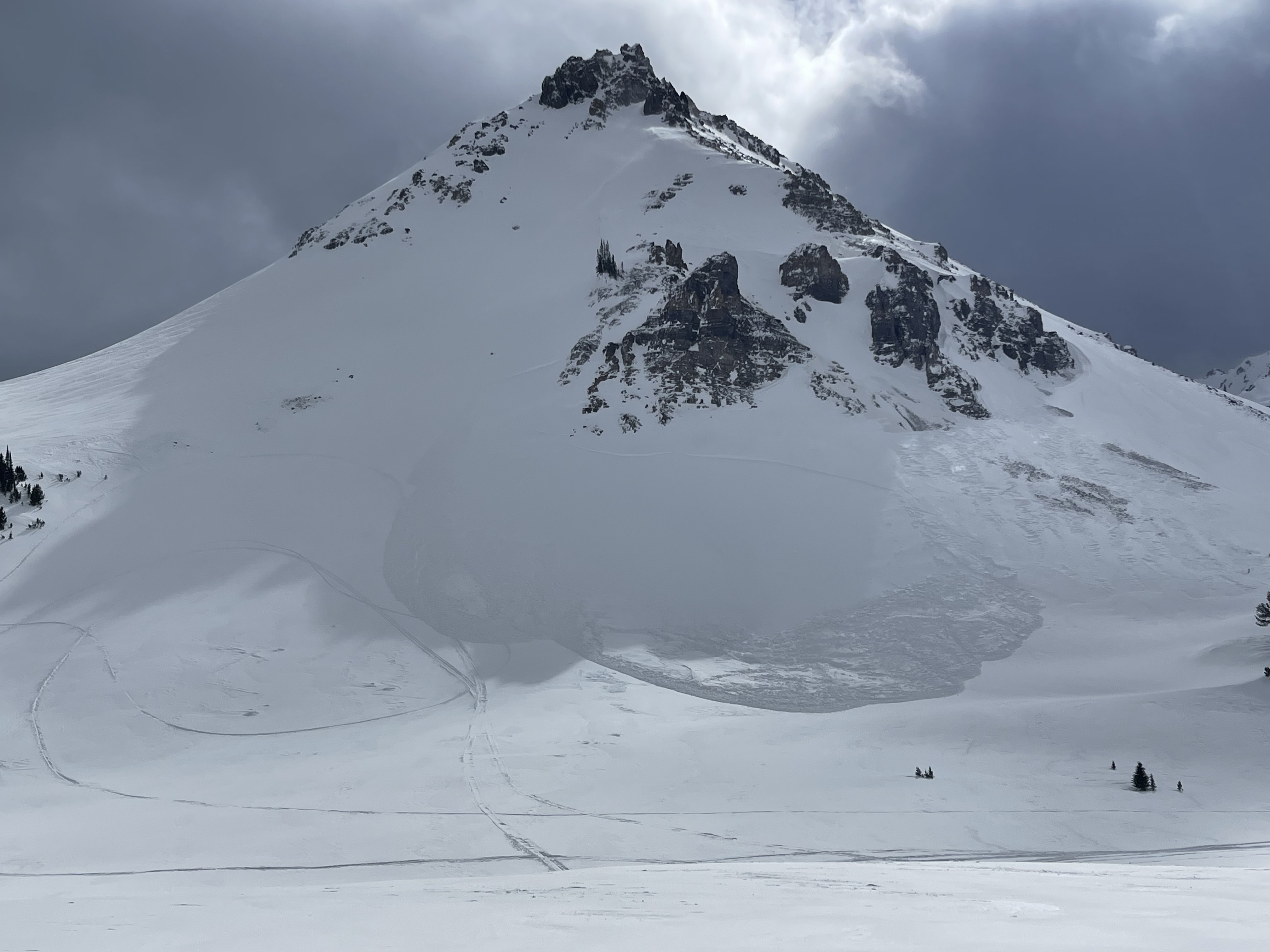
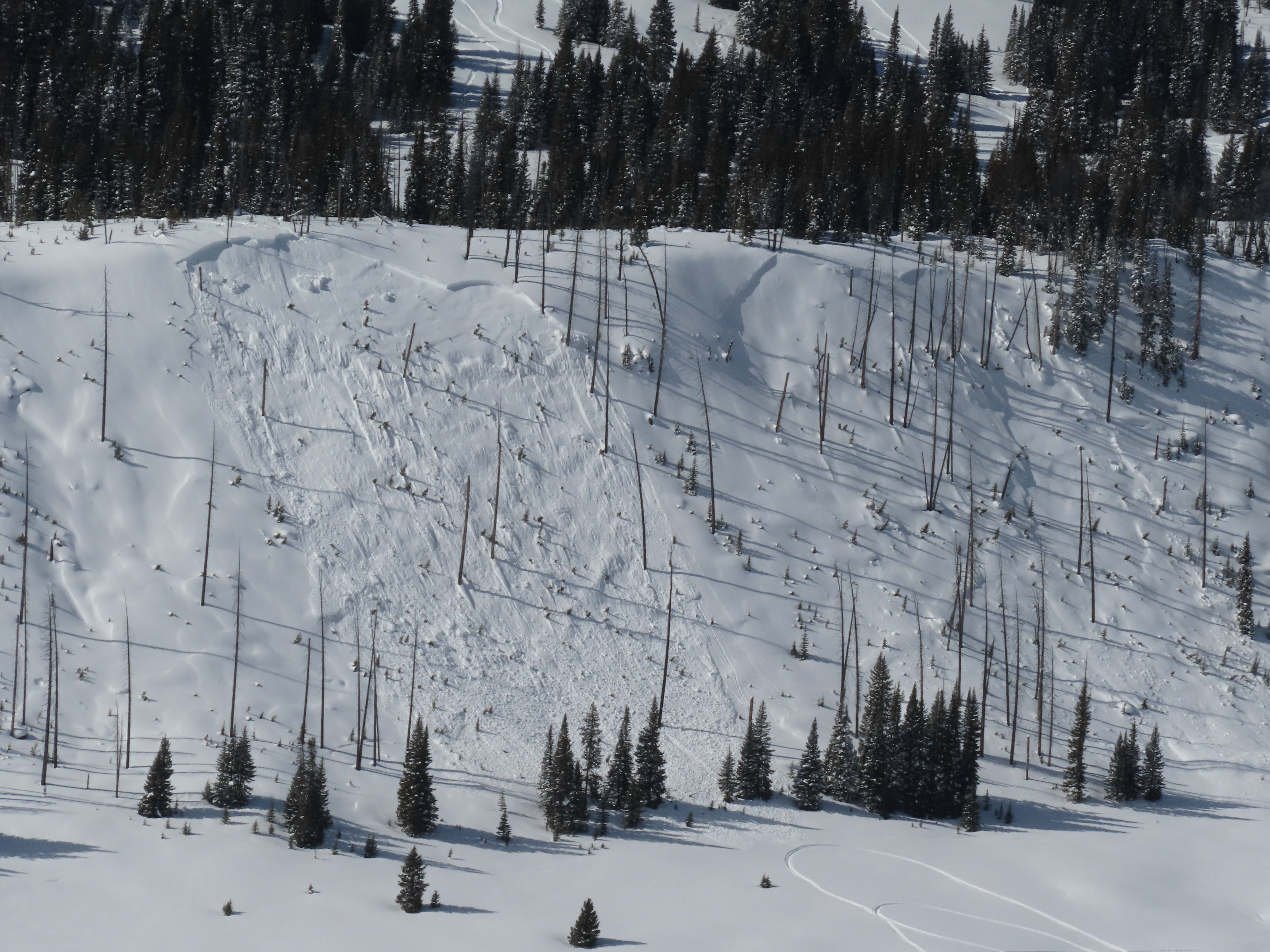
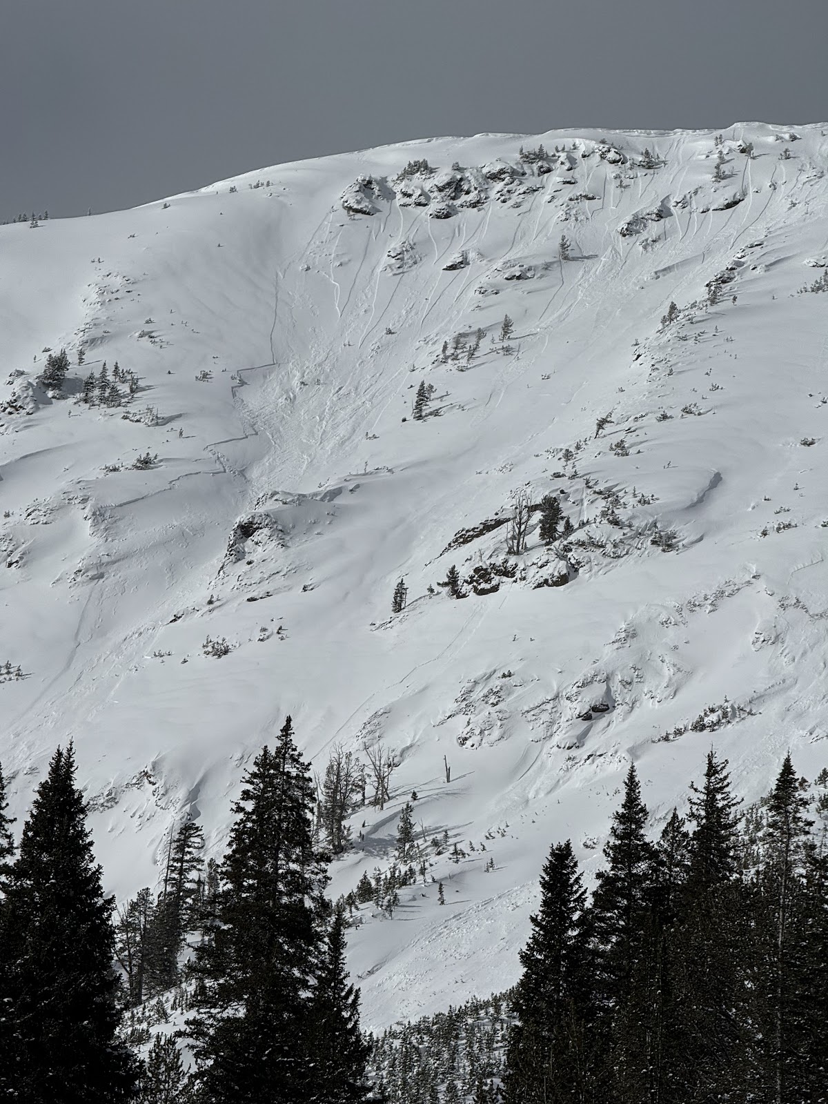
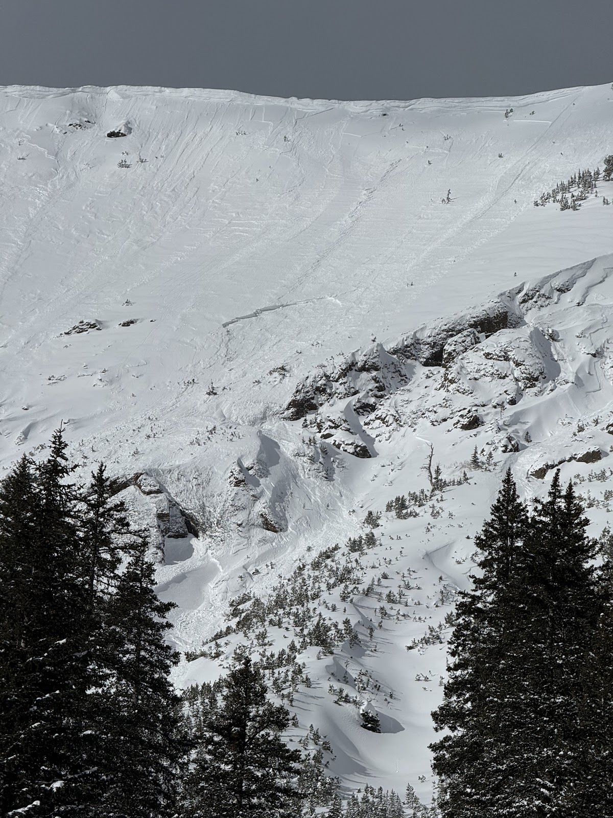
On Feb 24 we saw at least 3 rider triggered wind slabs, 4-5 natural wind slab avalanches, and a couple large cornice falls. Strong wid had affected almost every piece of terrain, scouring some slopes, loading others, just stiffening the slab in many areas, and forming fresh drifts on every convex roll and along the edges of trails. Riding was still soft and fairly consistent in many areas. Photo GNFAC
On Feb 24 we saw at least 3 rider triggered wind slabs, 4-5 natural wind slab avalanches, and a couple large cornice falls. Strong wid had affected almost every piece of terrain, scouring some slopes, loading others, just stiffening the slab in many areas, and forming fresh drifts on every convex roll and along the edges of trails. Riding was still soft and fairly consistent in many areas. Photo GNFAC
On Feb 24 we saw at least 3 rider triggered wind slabs, 4-5 natural wind slab avalanches, and a couple large cornice falls. Strong wid had affected almost every piece of terrain, scouring some slopes, loading others, just stiffening the slab in many areas, and forming fresh drifts on every convex roll and along the edges of trails. Riding was still soft and fairly consistent in many areas. Photo GNFAC
On Feb 24 we saw at least 3 rider triggered wind slabs, 4-5 natural wind slab avalanches, and a couple large cornice falls. Strong wid had affected almost every piece of terrain, scouring some slopes, loading others, just stiffening the slab in many areas, and forming fresh drifts on every convex roll and along the edges of trails. Riding was still soft and fairly consistent in many areas. Photo GNFAC
On Feb 24 we saw at least 3 rider triggered wind slabs, 4-5 natural wind slab avalanches, and a couple large cornice falls. Strong wid had affected almost every piece of terrain, scouring some slopes, loading others, just stiffening the slab in many areas, and forming fresh drifts on every convex roll and along the edges of trails. Riding was still soft and fairly consistent in many areas. Photo GNFAC
On Feb 24 we saw at least 3 rider triggered wind slabs, 4-5 natural wind slab avalanches, and a couple large cornice falls. Strong wid had affected almost every piece of terrain, scouring some slopes, loading others, just stiffening the slab in many areas, and forming fresh drifts on every convex roll and along the edges of trails. Riding was still soft and fairly consistent in many areas. Photo GNFAC
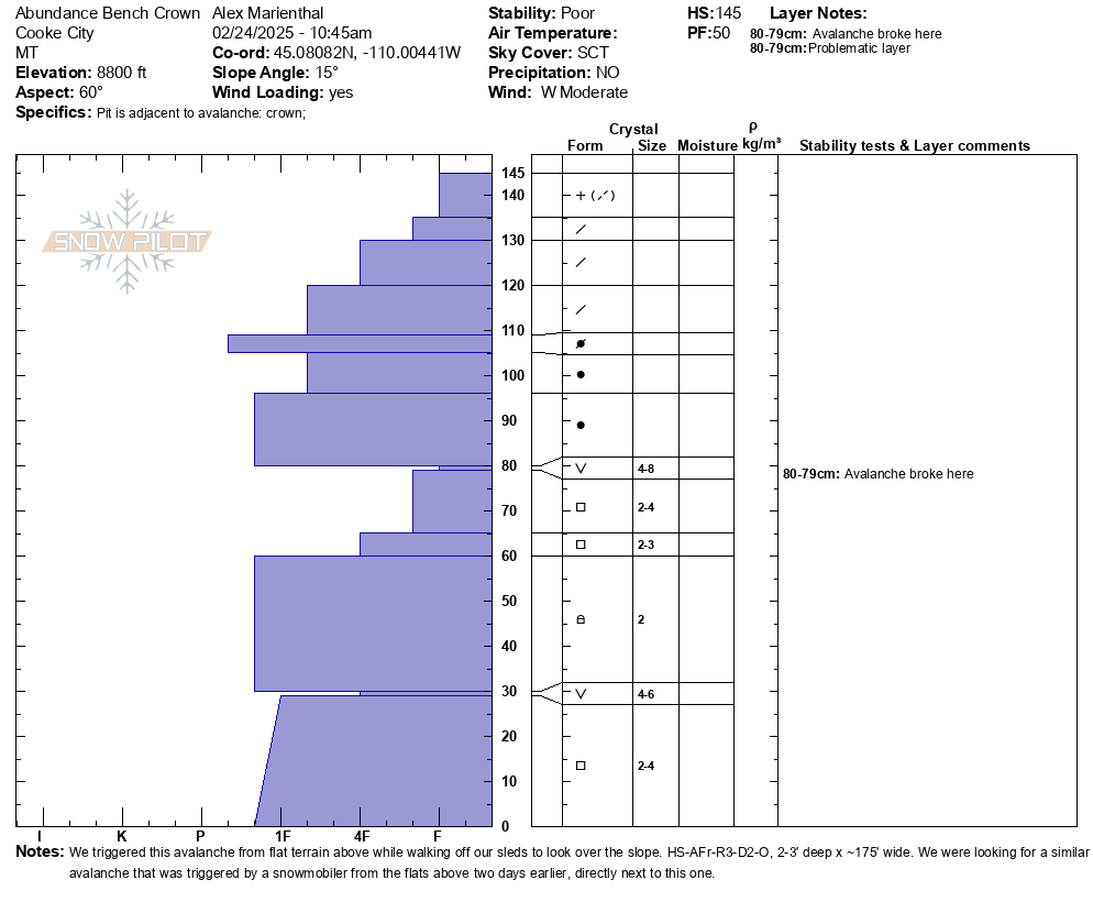
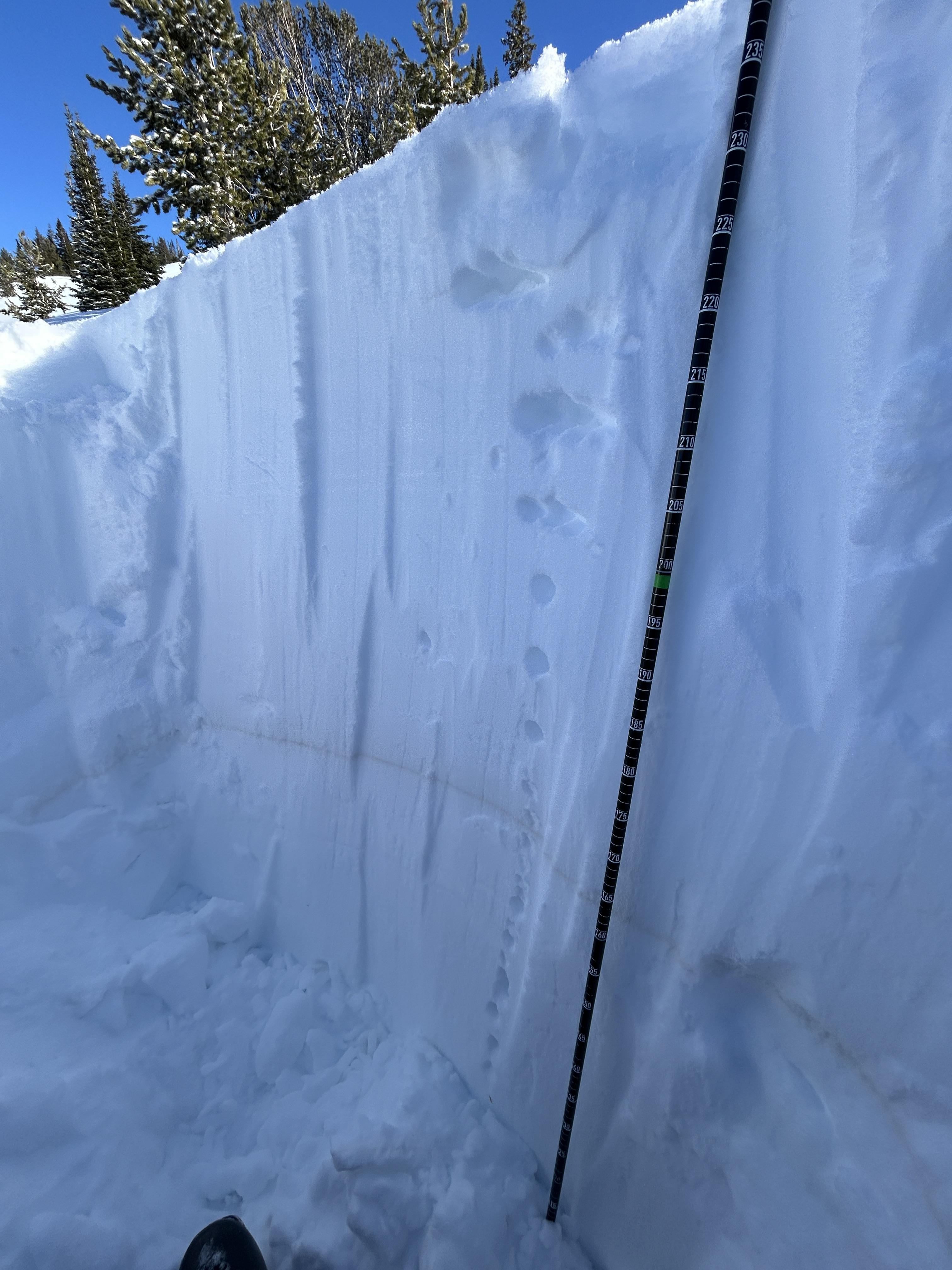
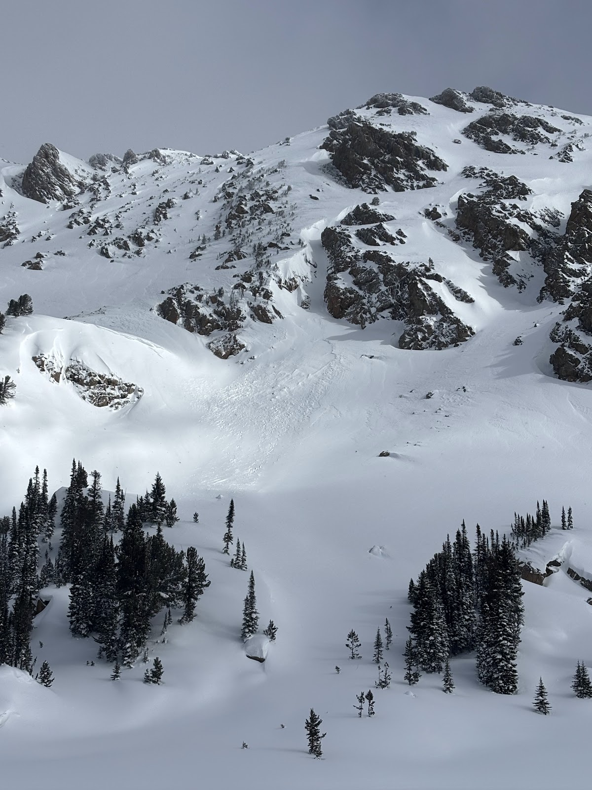
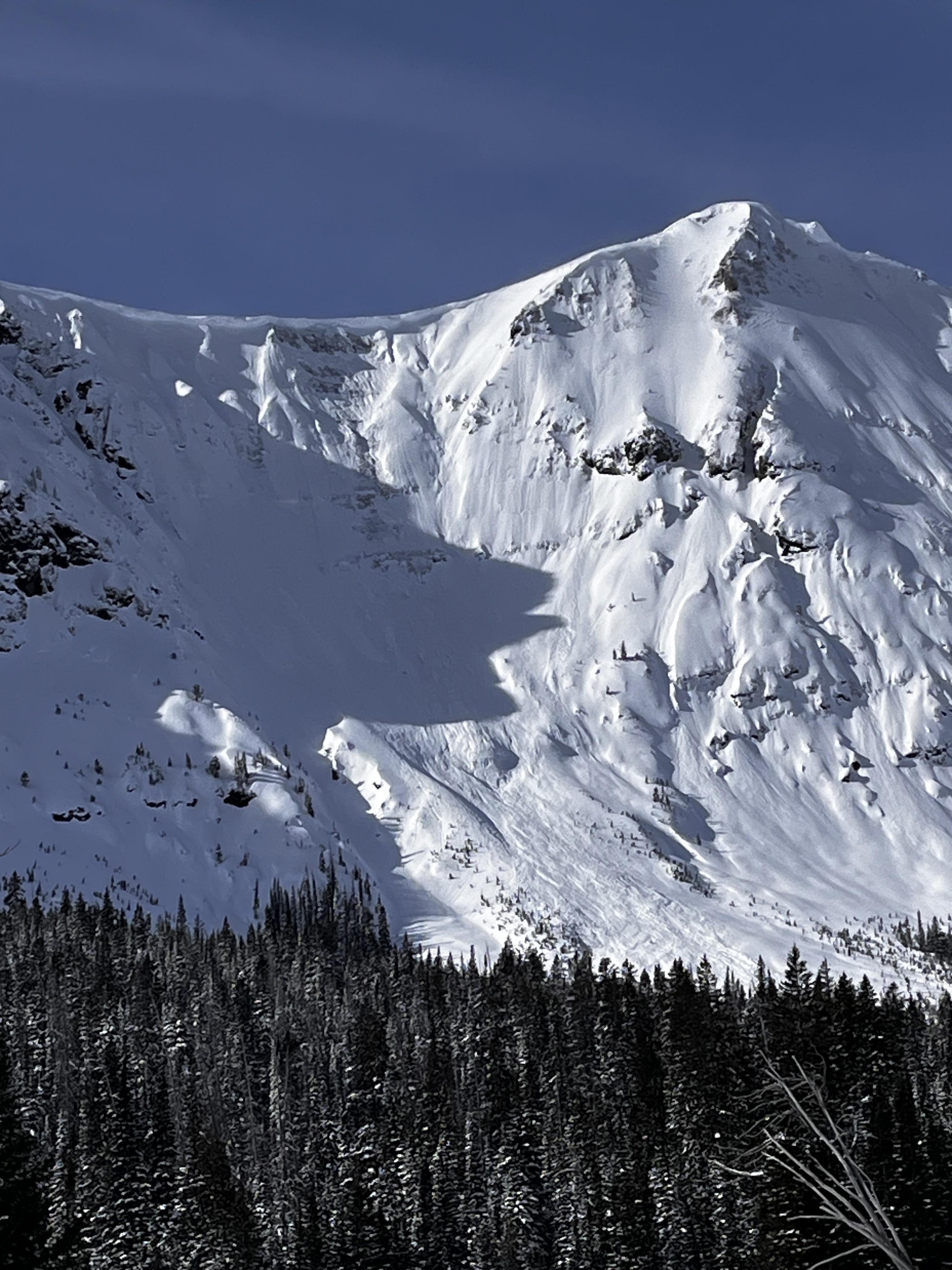
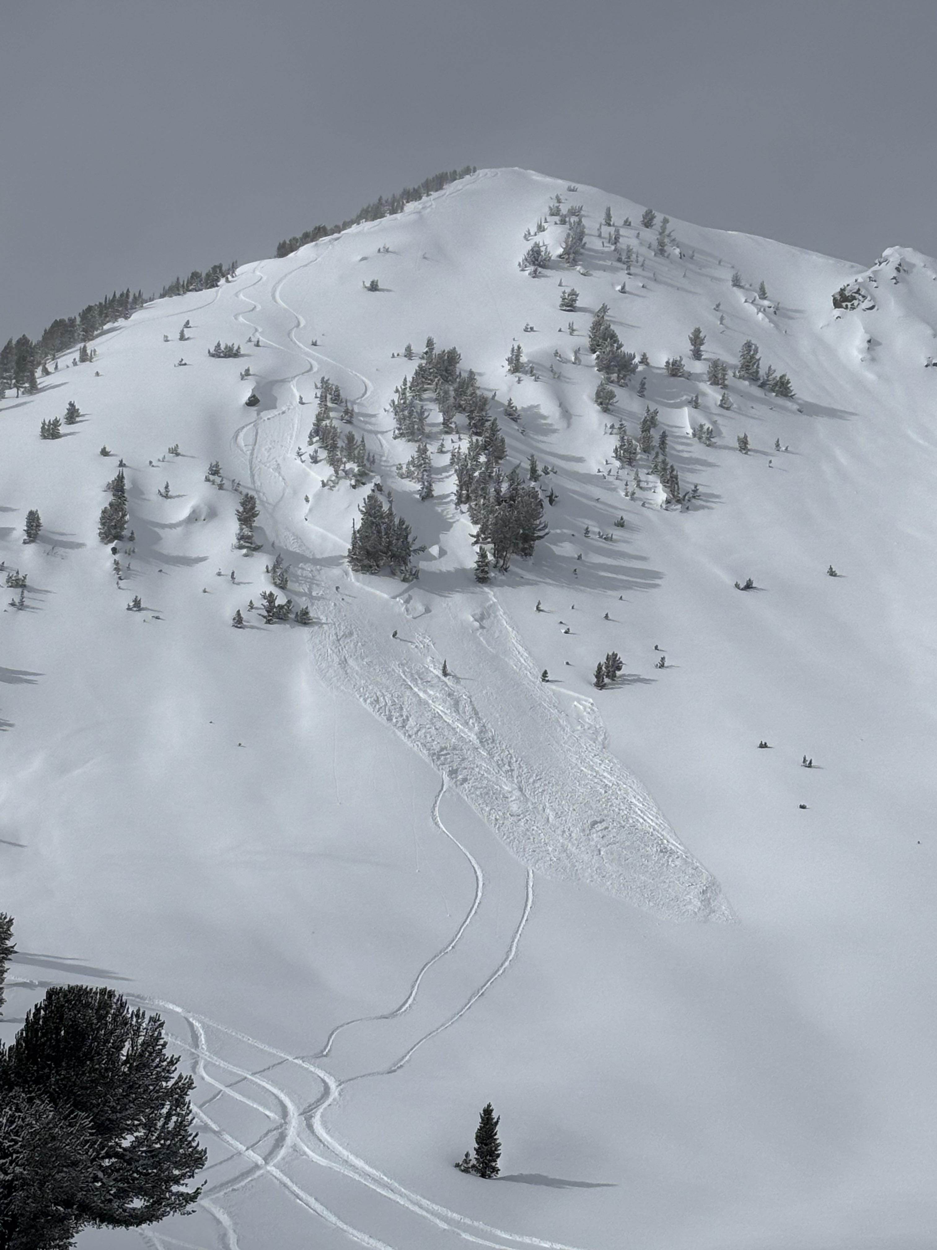
While looking for a recent avalanche from the flat bench above we triggered a similar sized slide directly adjacent to the previous slide. They broke on weak layers of facets and surface hoar that formed at the end of January. 2-3 feet deep and 150-200' wide. Photo: GNFAC
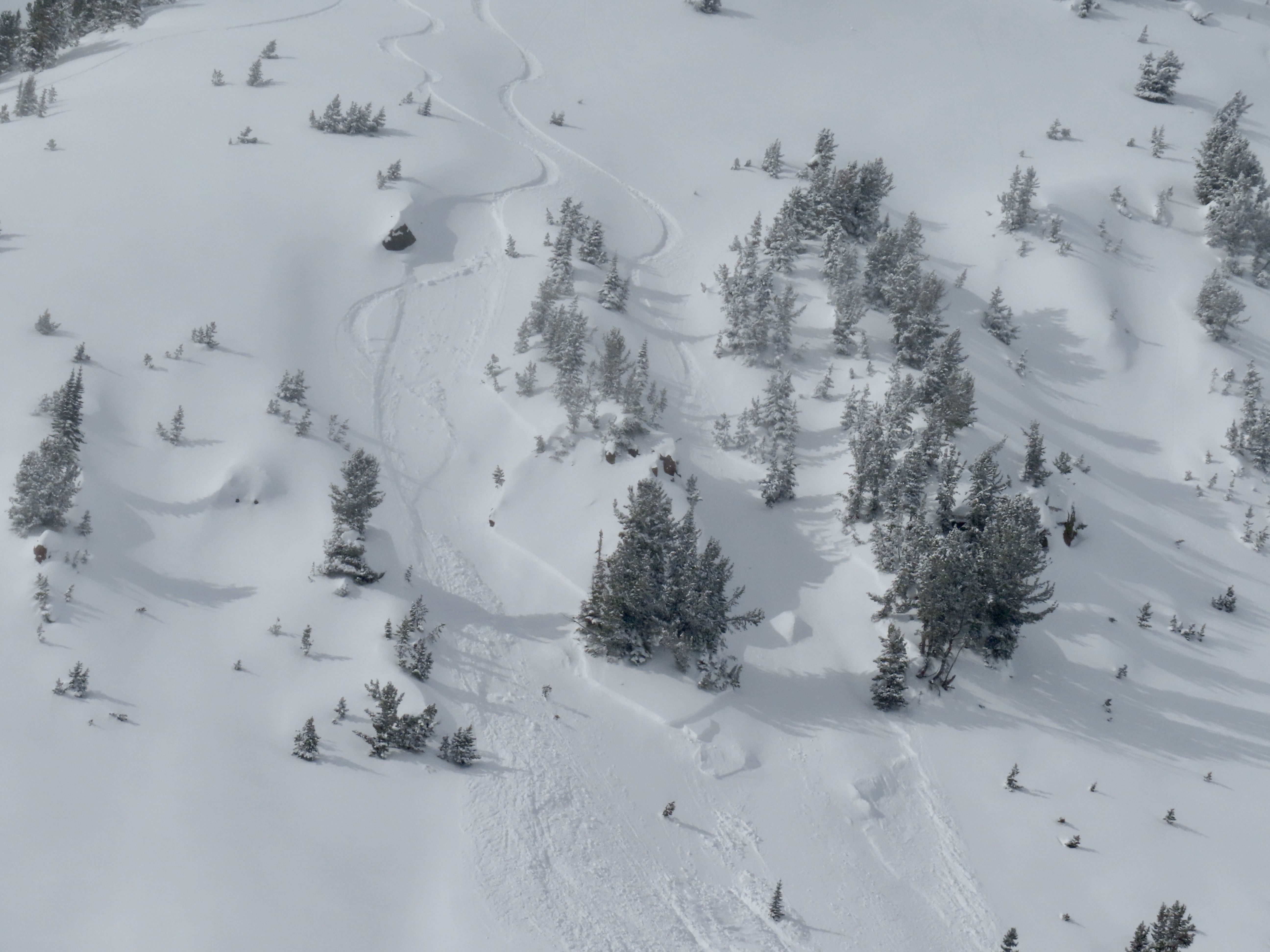
While looking for a recent avalanche from the flat bench above we triggered a similar sized slide directly adjacent to the previous slide. They broke on weak layers of facets and surface hoar that formed at the end of January. 2-3 feet deep and 150-200' wide. Observing the snowpack that caused the avalanche. Photo: GNFAC
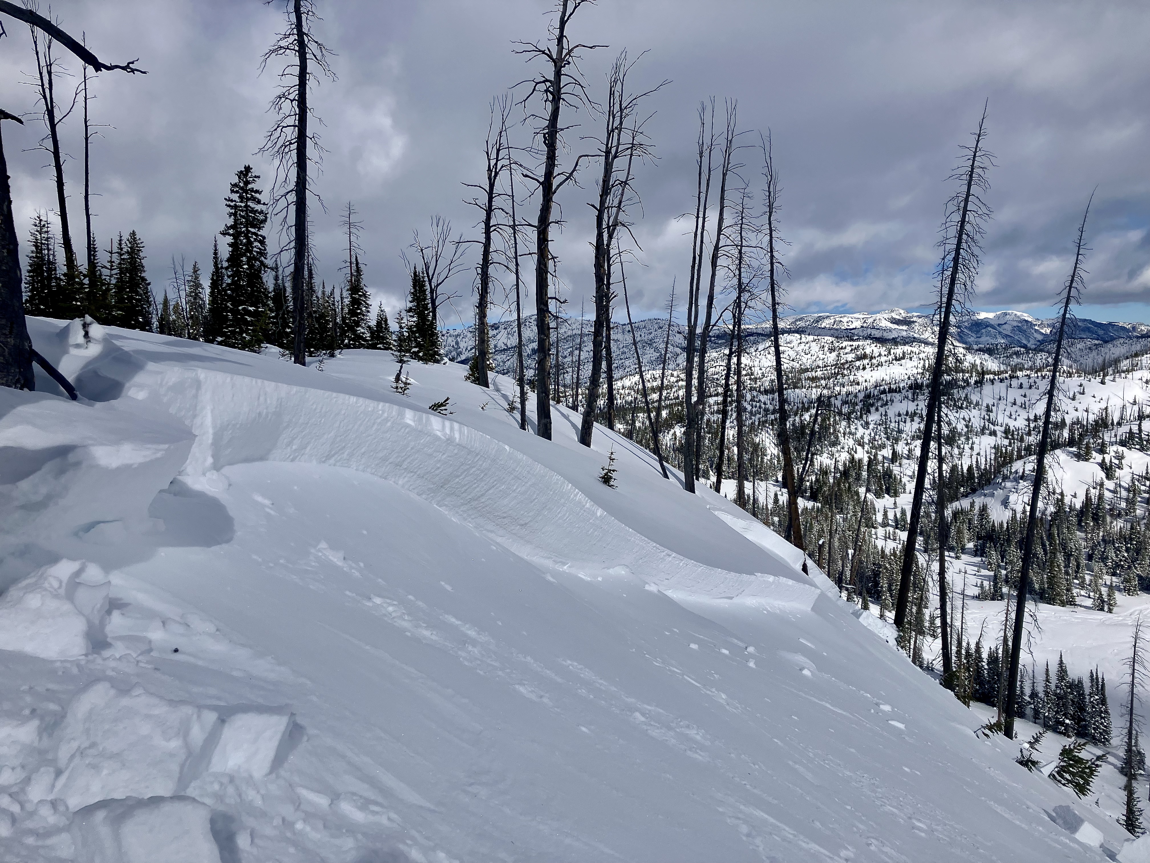
While looking for a recent avalanche from the flat bench above we triggered a similar sized slide directly adjacent to the previous slide. They broke on weak layers of facets and surface hoar that formed at the end of January. 2-3 feet deep and 150-200' wide. Photo: GNFAC
While looking for a recent avalanche from the flat bench above we triggered a similar sized slide directly adjacent to the previous slide. They broke on weak layers of facets and surface hoar that formed at the end of January. 2-3 feet deep and 150-200' wide. Photo: GNFAC
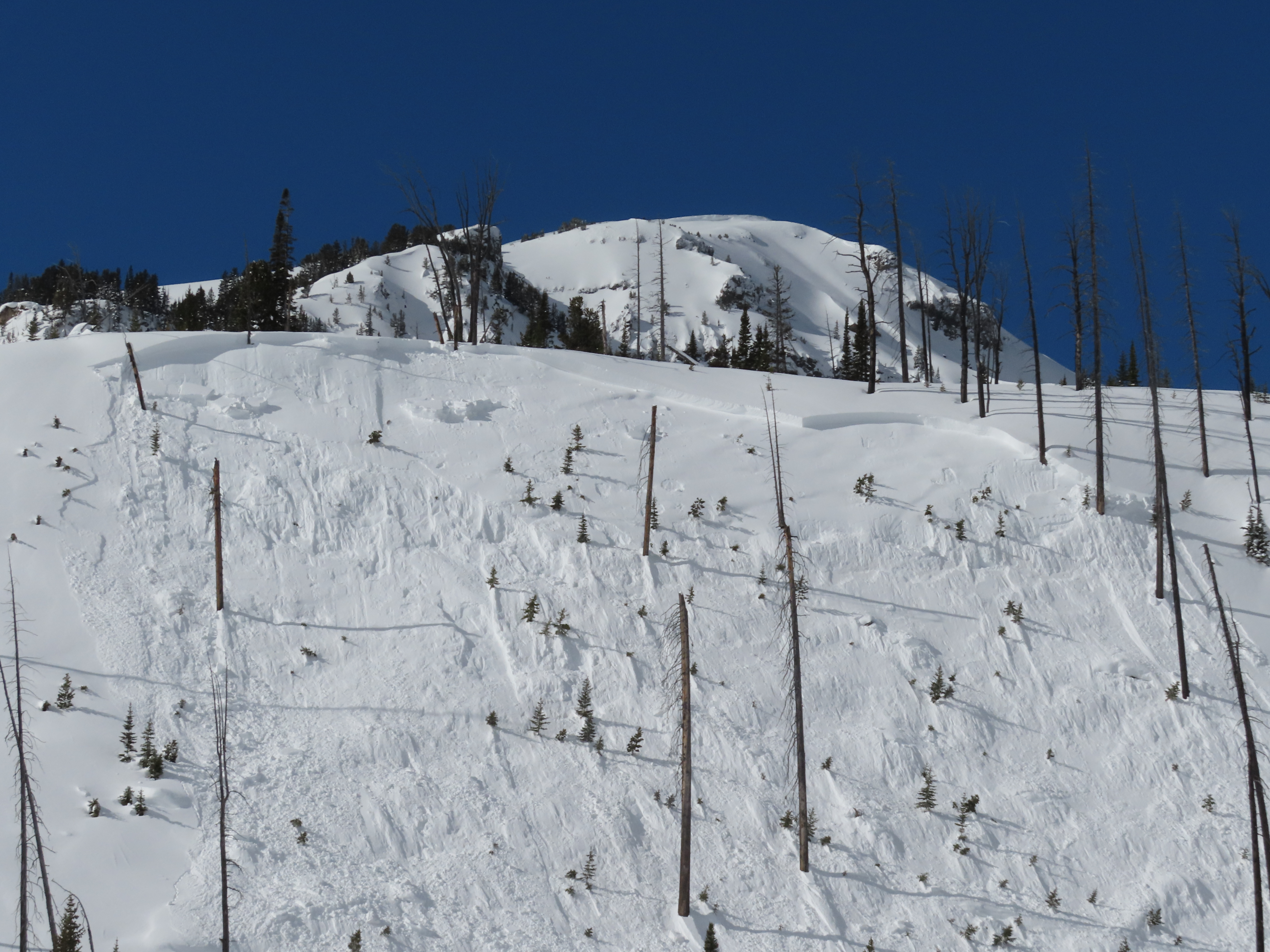
While looking for a recent avalanche from the flat bench above we triggered a similar sized slide directly adjacent to the previous slide. They broke on weak layers of facets and surface hoar that formed at the end of January. 2-3 feet deep and 150-200' wide. Photo: GNFAC
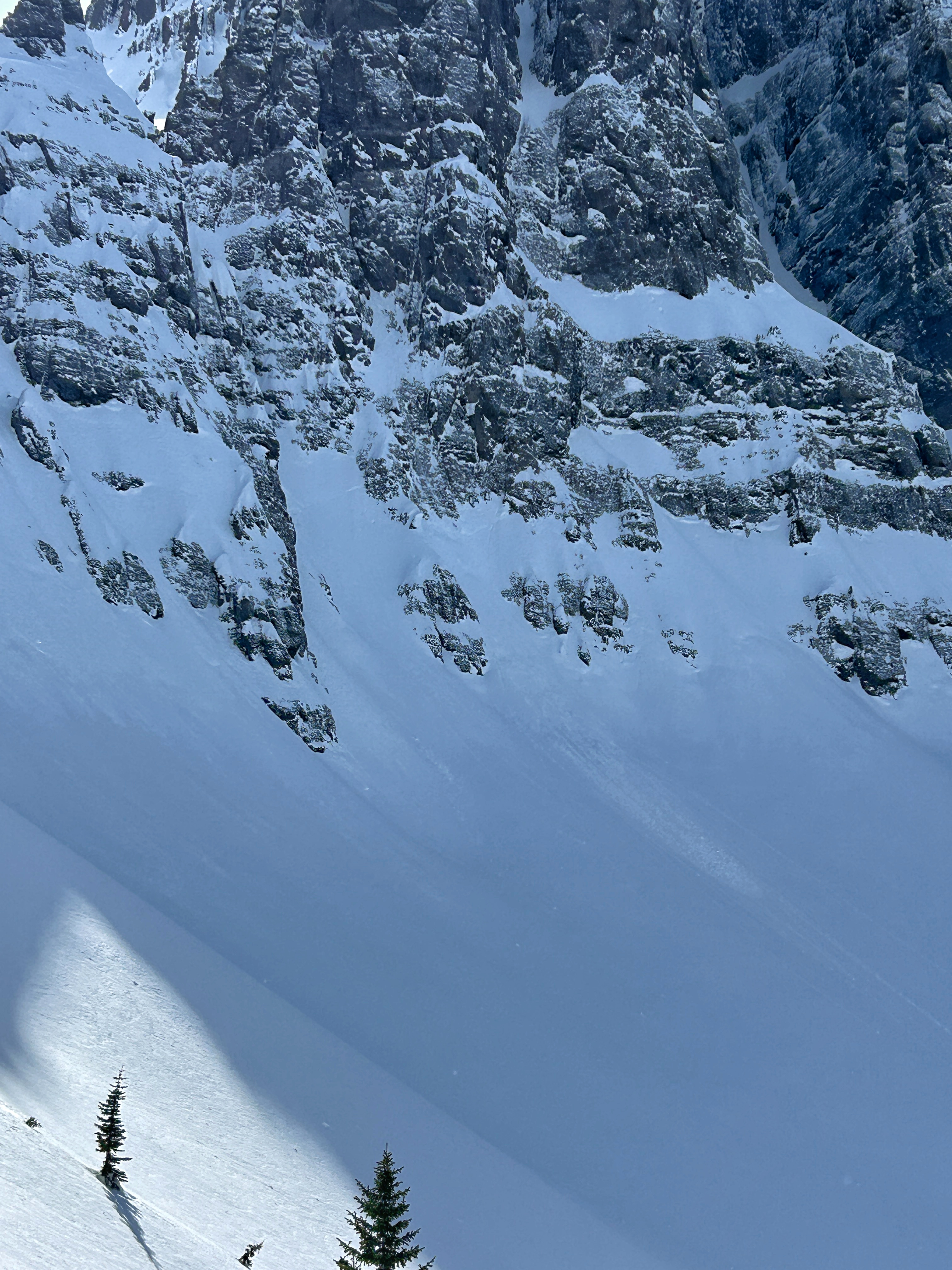
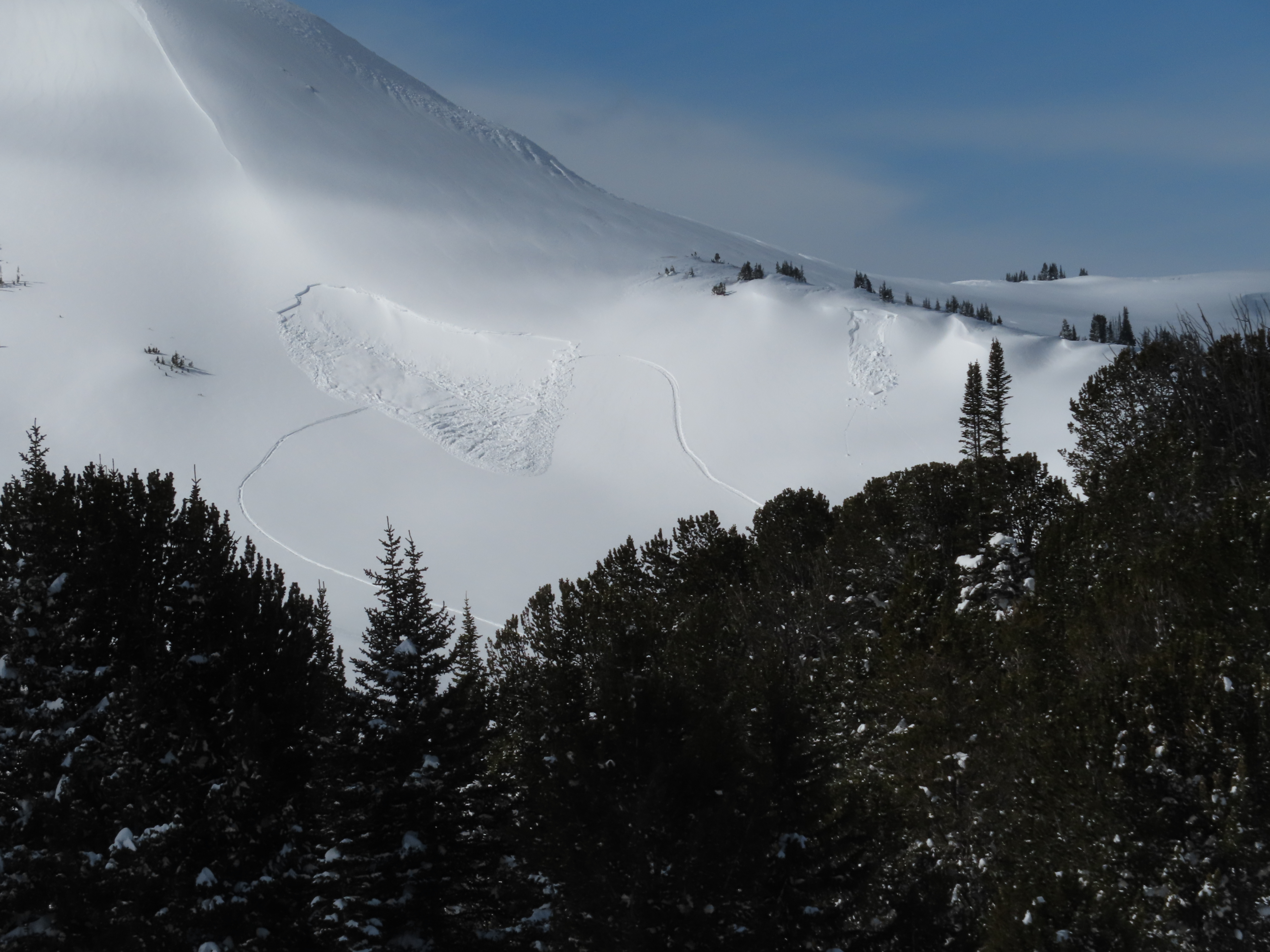
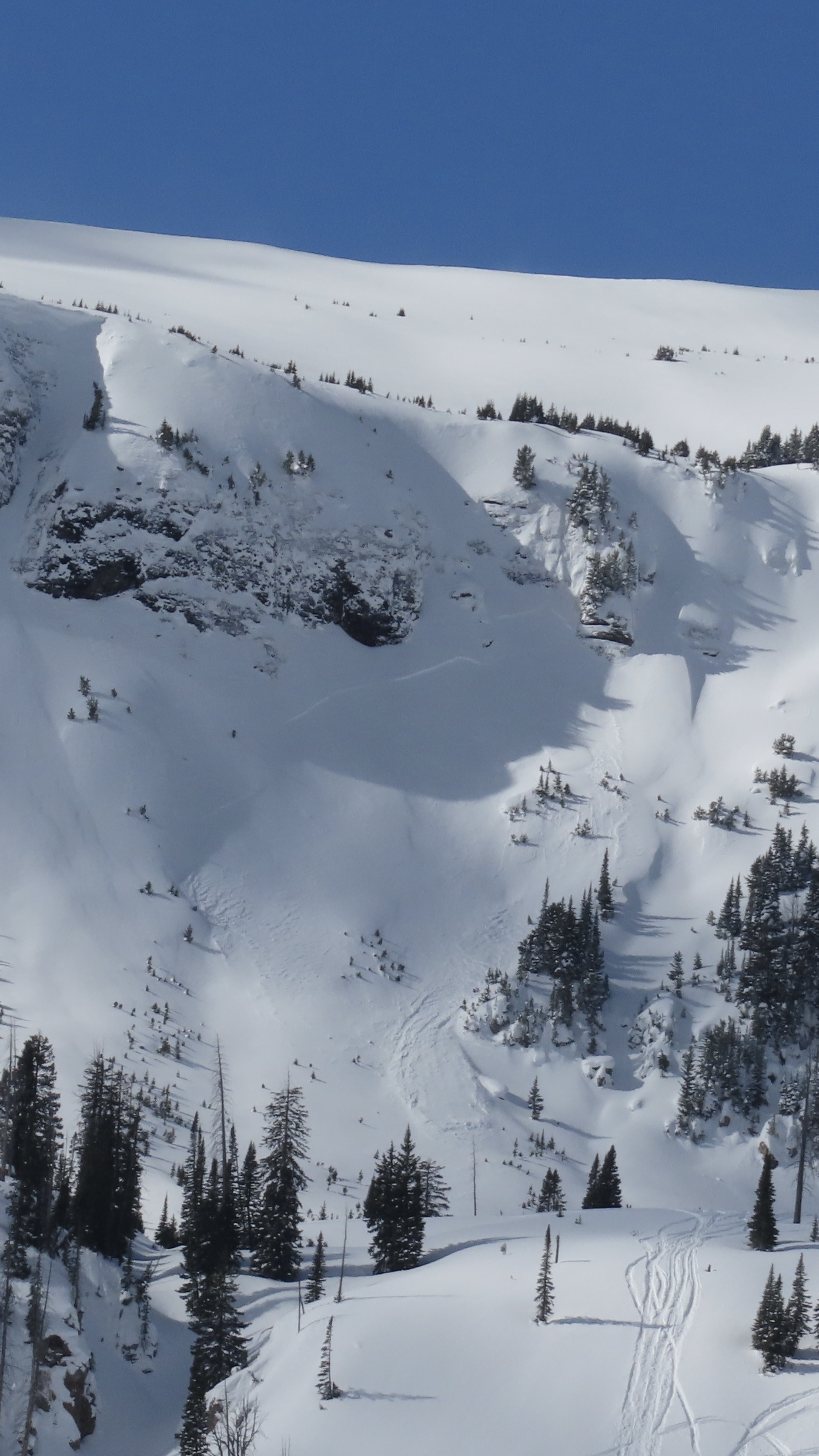
An avalanche that was triggered two days ago (Feb 22), remotely from flat terrain above a steep slope, on the northeast end of Mt. Abundance. Photo: GNFAC
A rider triggered a small avalanche near Lulu Pass. No one was caught in the slide. Photo: N. Gaddy
A rider triggered a small avalanche near Lulu Pass. No one was caught in the slide. Photo: N. Gaddy
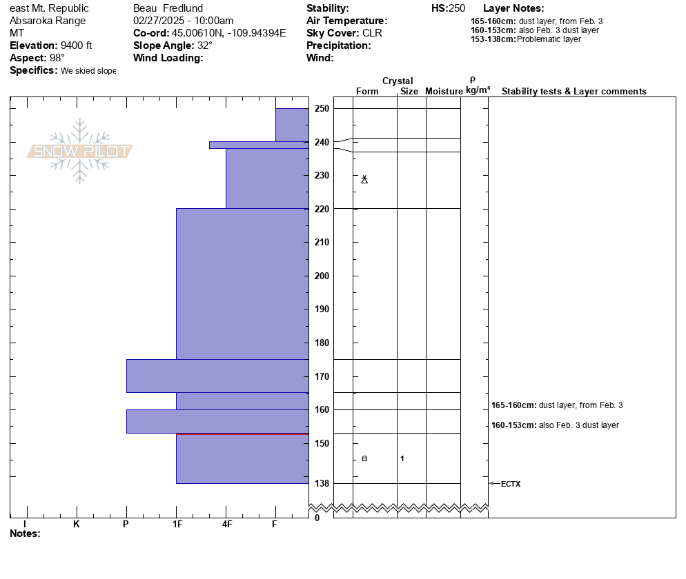
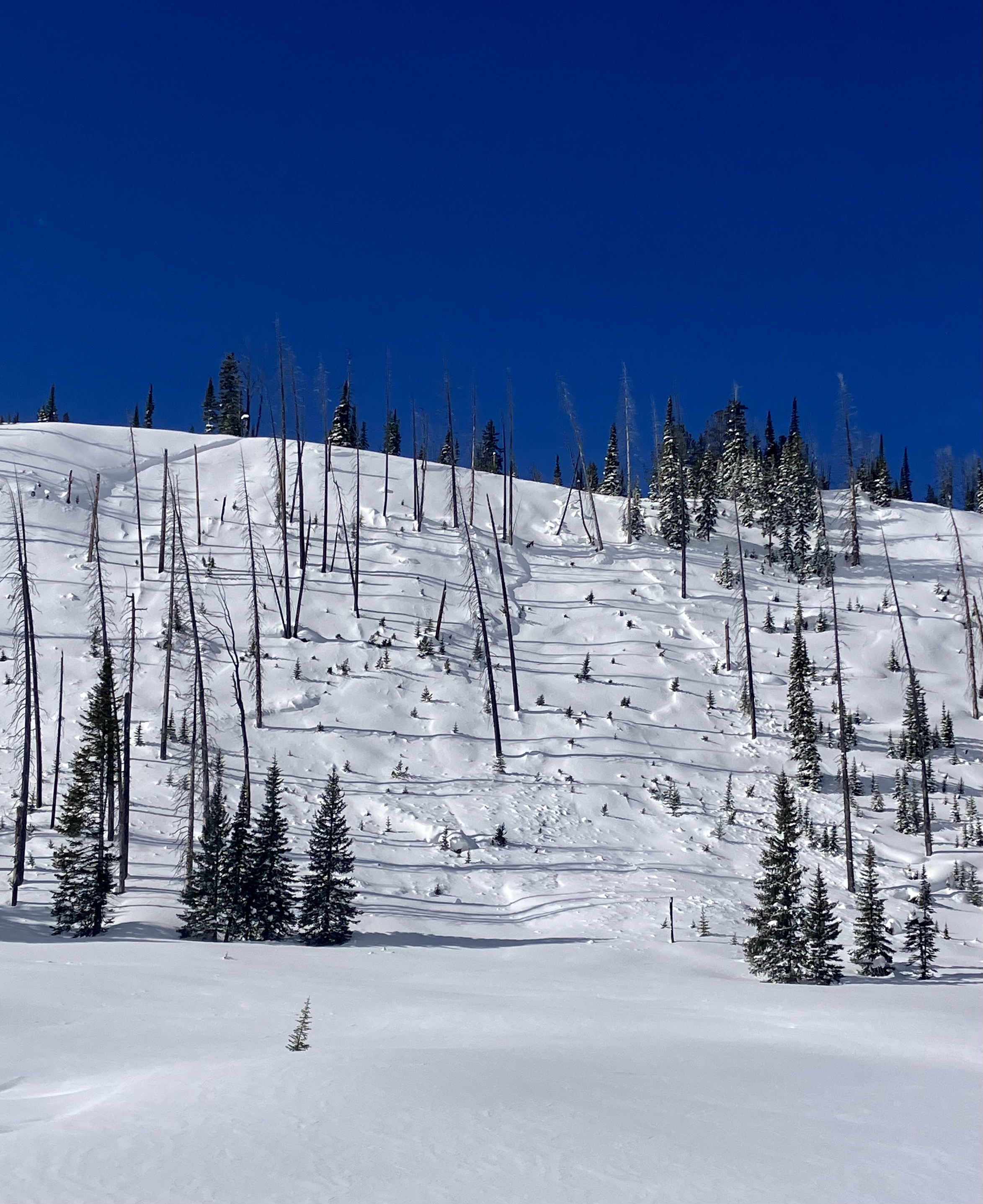
On Feb 23 We went up Republic Creek to look at the stability of snow that has fallen over the last 2-3 weeks. We were able to easily to trigger a couple wind slab avalanches on test slopes. Photo: GNFAC
On Feb 23 We went up Republic Creek to look at the stability of snow that has fallen over the last 2-3 weeks. We were able to easily to trigger a couple wind slab avalanches on test slopes. Photo: GNFAC
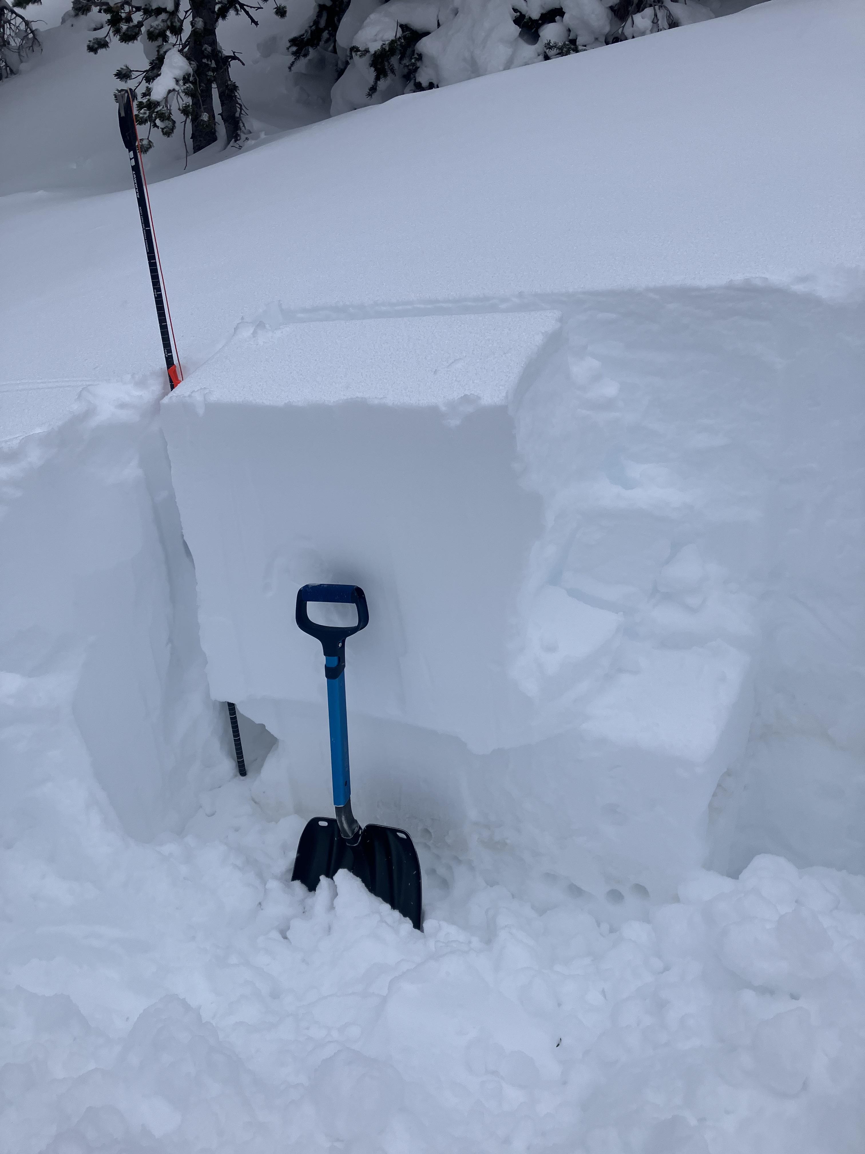
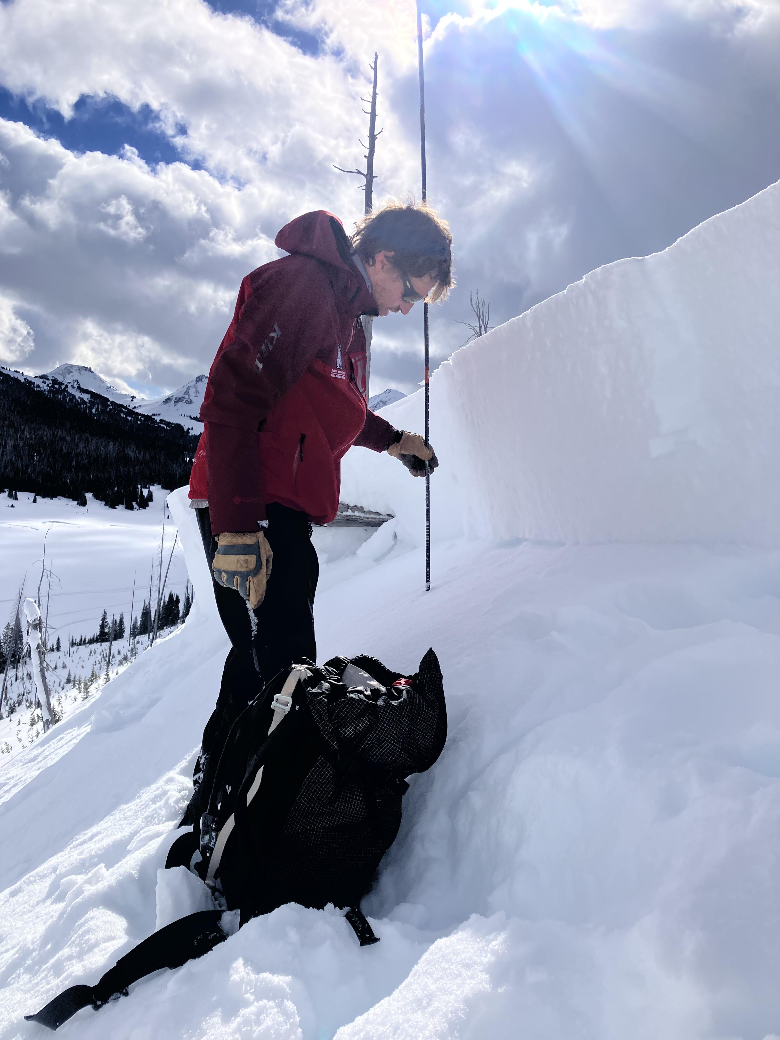
On Feb 23 We went up Republic Creek to look at the stability of snow that has fallen over the last 2-3 weeks. We found a thin layer buried 2’ deep that showed potential to propagate and slide. We dug down 4 feet, just below the dirt layer that was deposited earlier this month. We got an ECTP30 that broke about 8" above that dirt layer. This was either on a thin layer of facets or preserved lower density dendrites. Photo: GNFAC
Today we observed a couple day old wind slabs in steep SW facing terrain on Mt Zimmer. Photo: BPG
Wet loose occurred sometime today between 11-2 pm on S facing terrain nearby. Photo: BPG
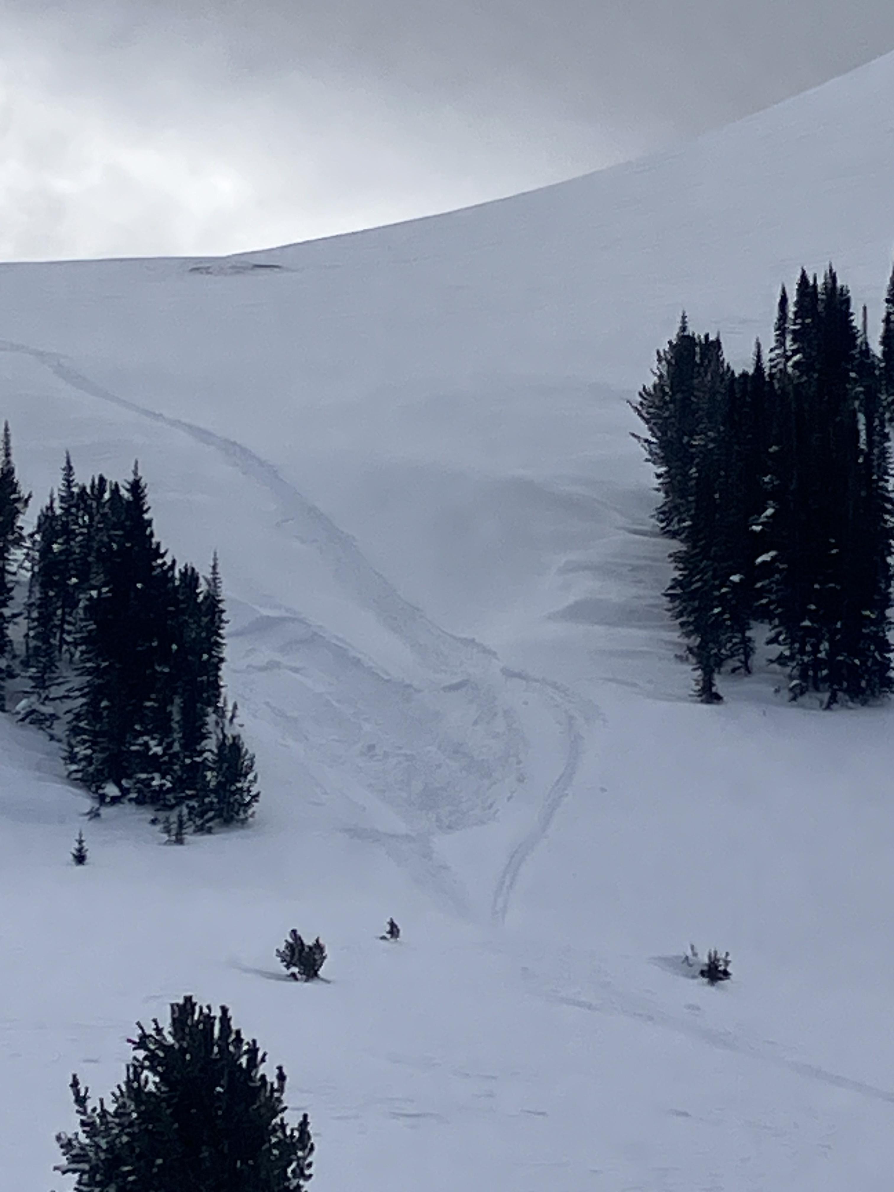
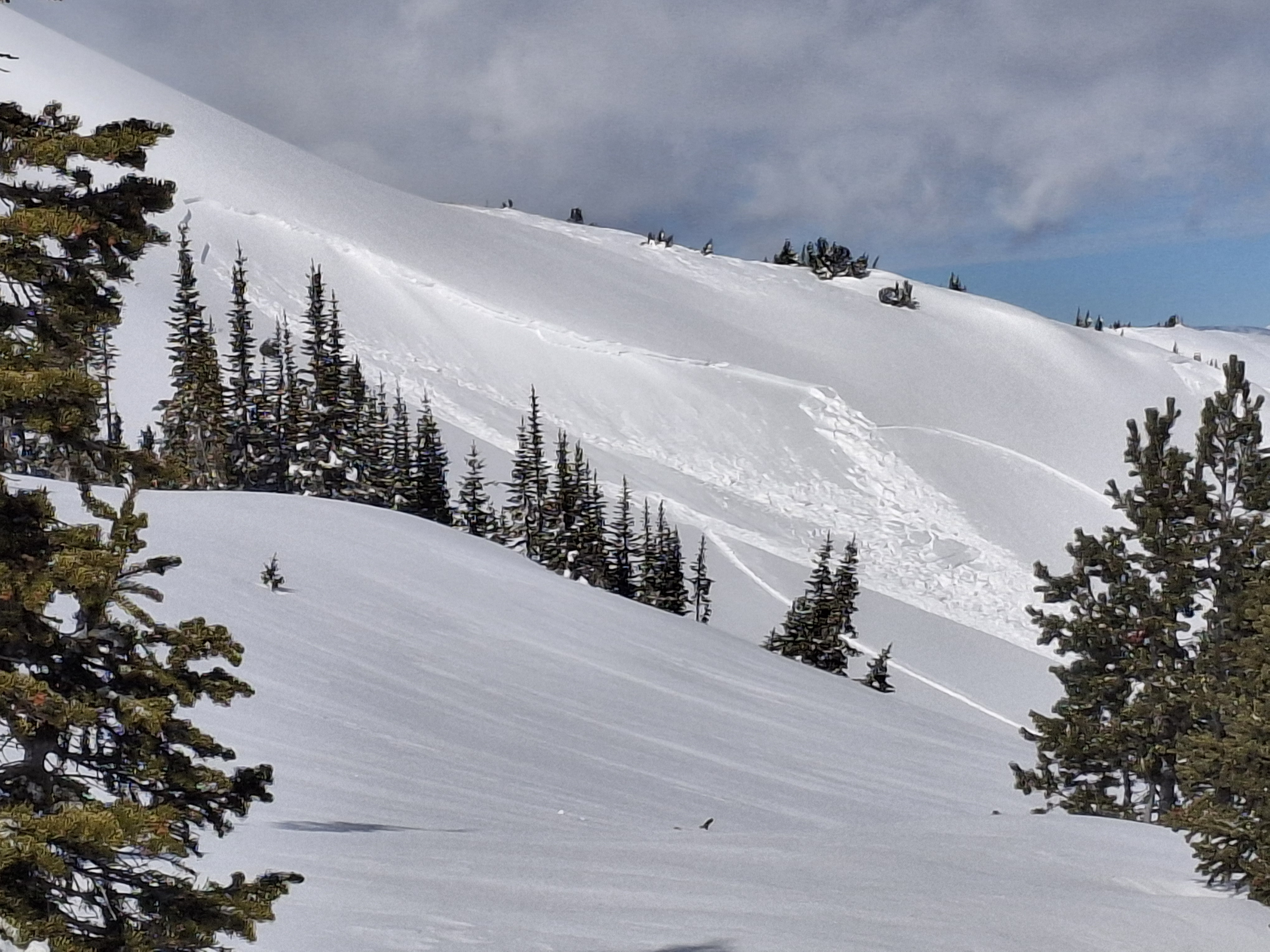
Skier in Republic Creek observed a natural (wind/storm slab) avalanche on an east aspect at ~9200ft. Photo: R. Minton
I could visibly see some layer distinction about 8-12” deep. This is the same weakish layer we found in our column test, where we got ect16 just below robs knob. This was on a north facing aspect. Photo: I Tuttle
In Hayden Creek, we saw many D1-D1.5 wind slab avalanches seen on leeward slopes- east and northeast slopes at and above treeline. Photo: N. Mattes (Beartooth Powder Guides)
In Hayden Creek, we saw many D1-D1.5 wind slab avalanches seen on leeward slopes- east and northeast slopes at and above treeline. Photo: N. Mattes (Beartooth Powder Guides)
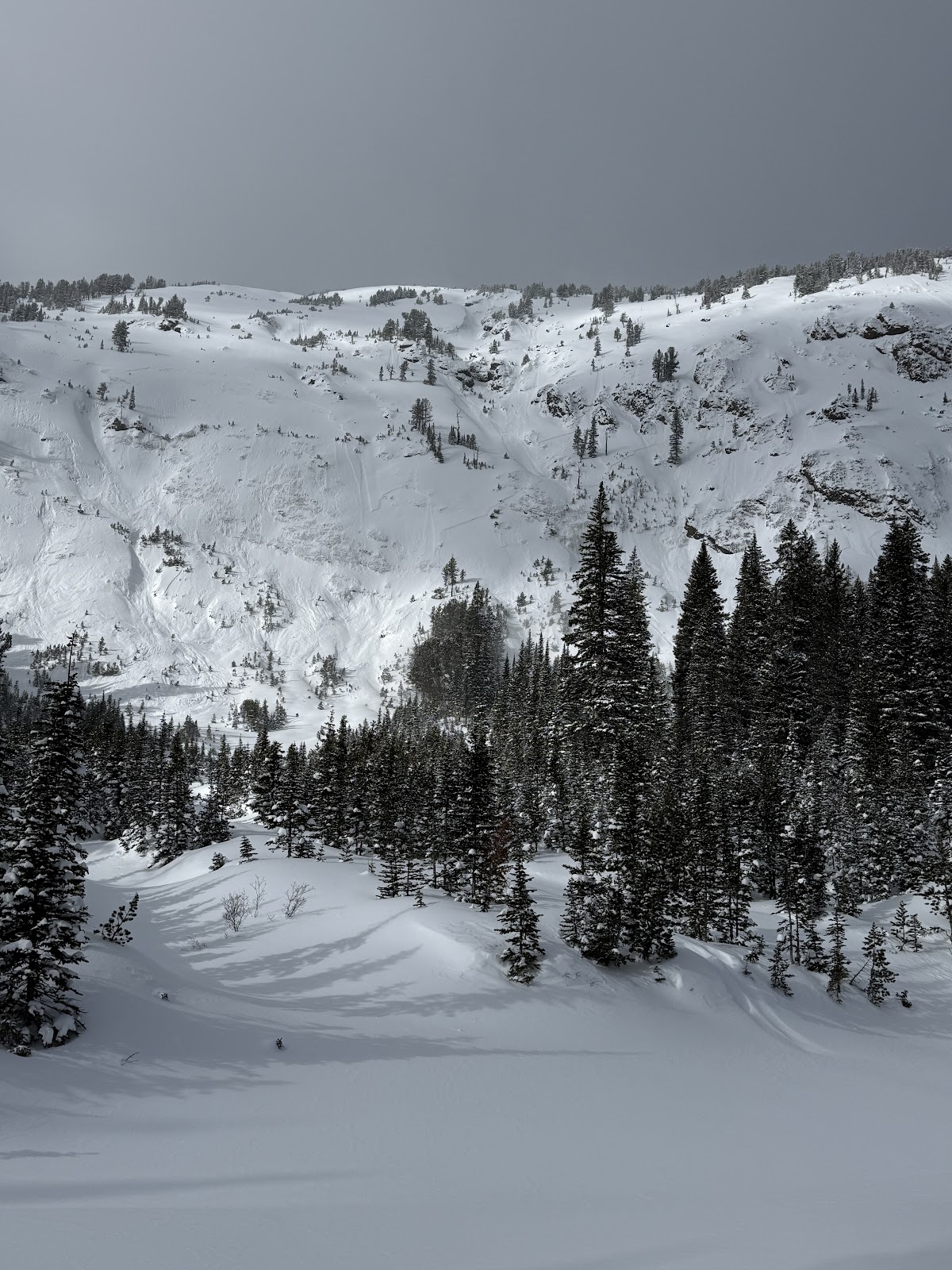
In Hayden Creek, we saw many D1-D1.5 wind slab avalanches seen on leeward slopes- east and northeast slopes at and above treeline. Photo: N. Mattes (Beartooth Powder Guides)
In Hayden Creek, we saw many D1-D1.5 wind slab avalanches seen on leeward slopes- east and northeast slopes at and above treeline. Photo: N. Mattes (Beartooth Powder Guides)
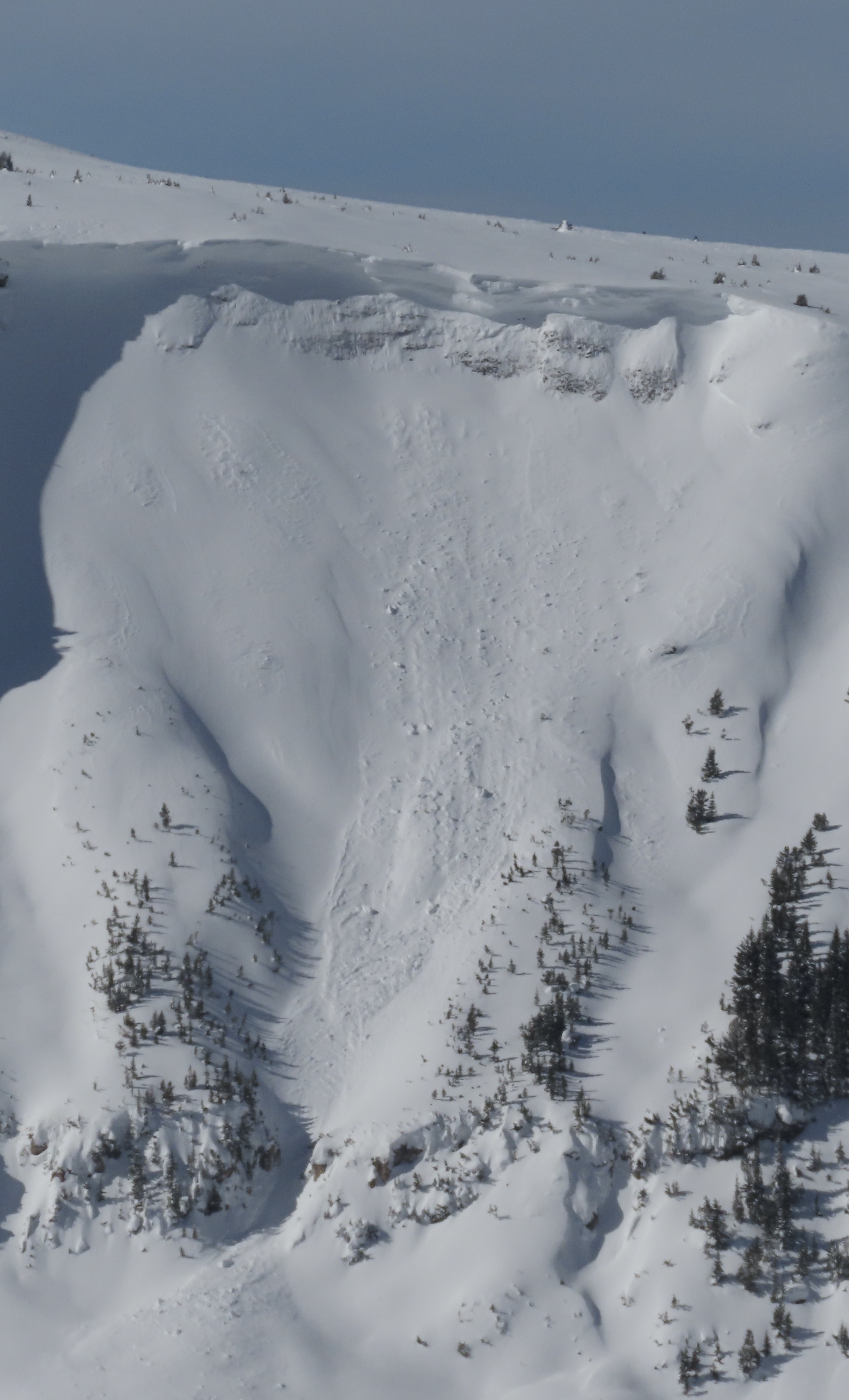
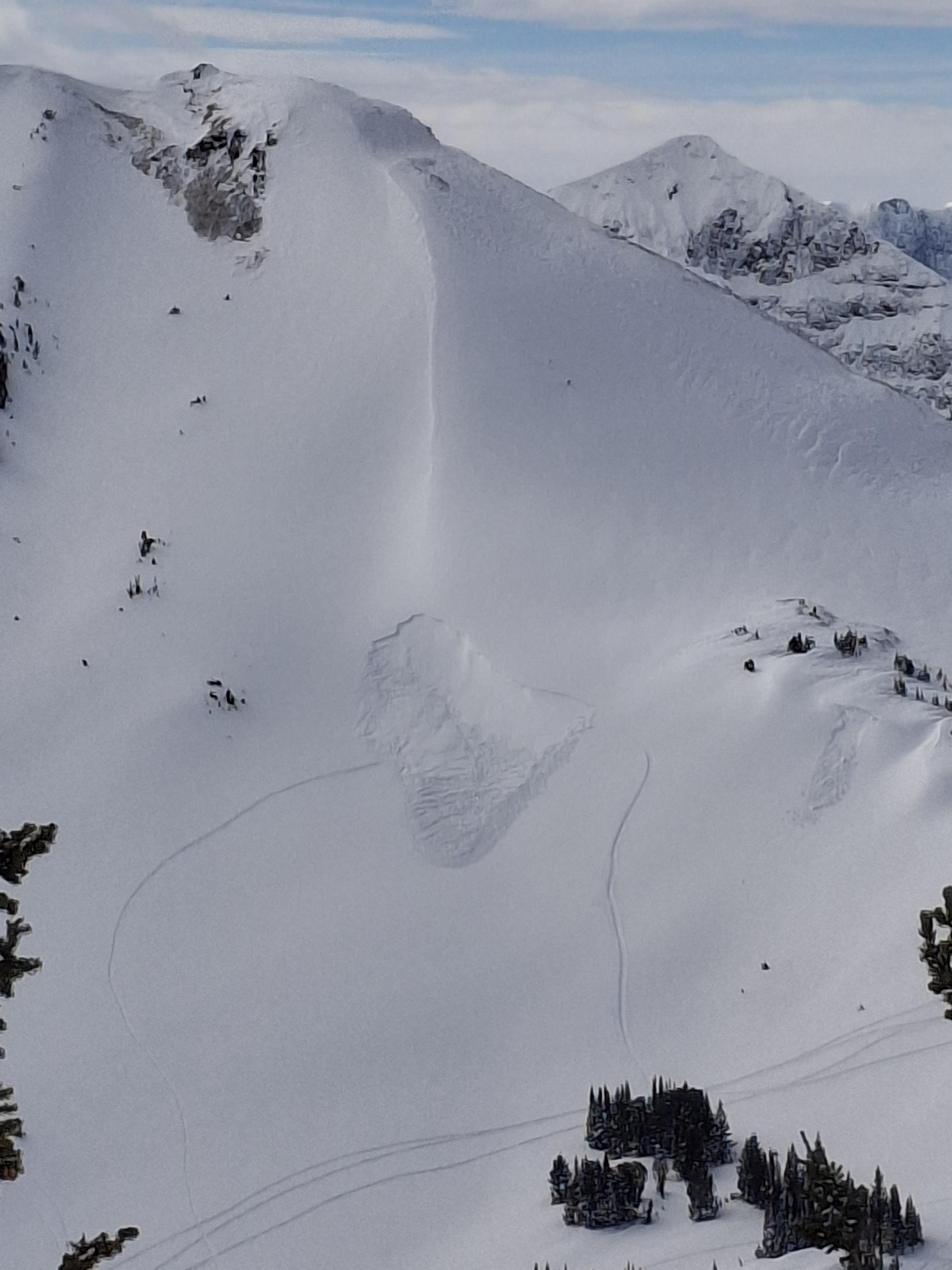
Noticed a large cornice triggered avalanche on Mineral Mtn today. Likely broke on 2/12 or early am 2/13. E aspect ran almost to the valley floor. Photo: BPG

Saw what looked to be a small wind slab or cornice fall on South Siren in Republic Creek. SE facing, 10100 ft. Photo: BPG
Saw a few wind slabs. Some appeared to be skier triggered, some were natural. Photo: BPG
Saw a few wind slabs. Some appeared to be skier triggered, some were natural. Photo: BPG
On Feb 9 we watched two snowboarders trigger separate wind slabs, while riding one at a time in avalanche terrain, on the south side of Scotch Bonnet. Photo: J. Mancey
On Feb 9 we watched two snowboarders trigger separate wind slabs, while riding one at a time in avalanche terrain, on the south side of Scotch Bonnet. Photo: GNFAC
On Feb 9 we saw a fresh natural wind slab near Wolverine, R1-D1.5. Photo: GNFAC
Saw this small soft slab above Round Lake today. SE facing, 9500 ft. Likely skier triggered, there were lots of ski tracks on that hill. Photo: J Mundt
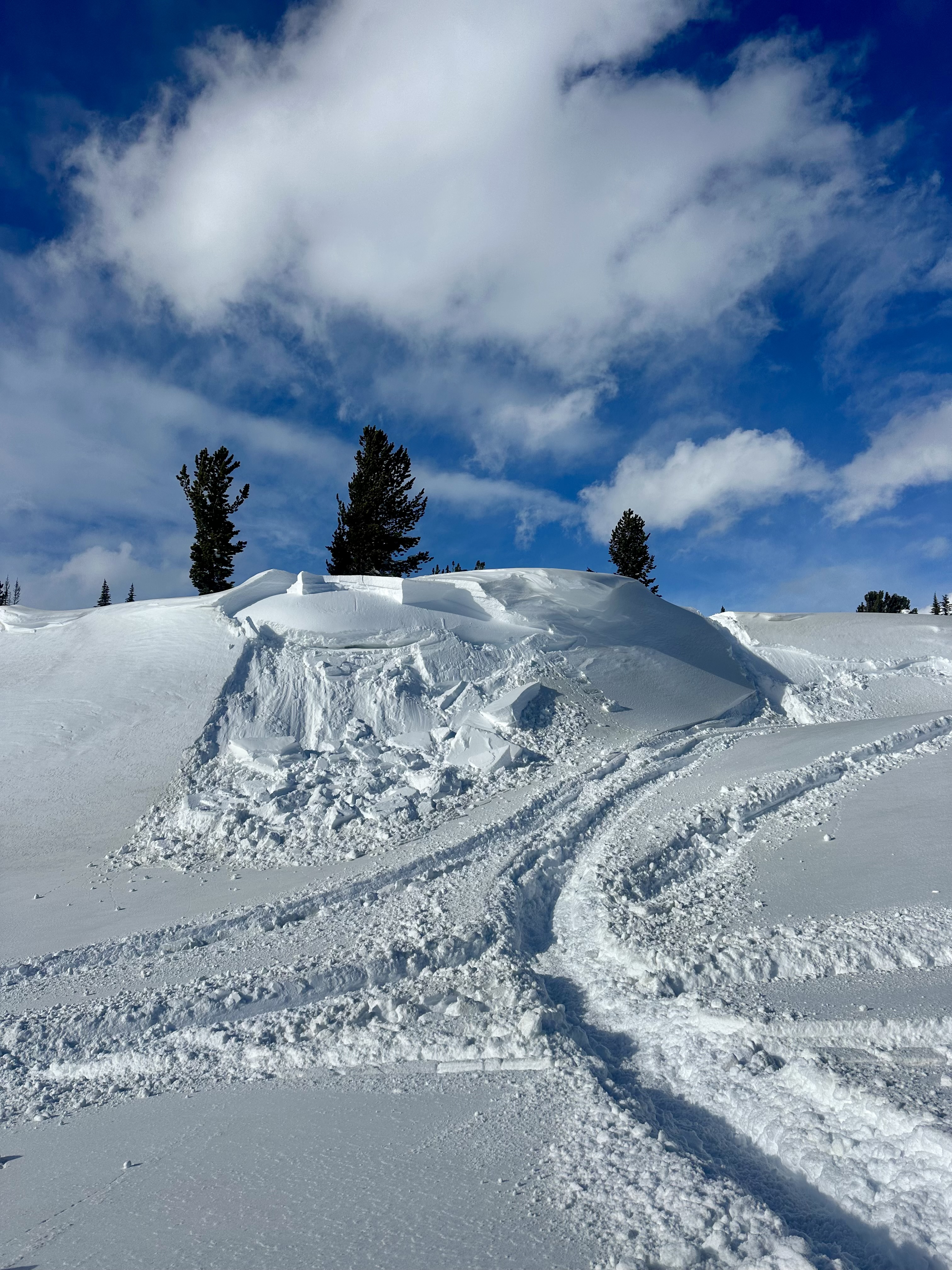
A little wind load cornice break, but it broke while I was coming down that track to the right. Photo: S Strenge

This is the N side of scotch bonnet, looks like a big break, didn’t get any closer than this however. Photo: S Strenge
N face of crown butte, looks like it slid before the dirt event (we think the end of the storm yesterday/ or last night must have been dirty snow?). Photo: S Strenge
Avalanche east aspect of Henderson. This slid sometime between 11:30 - 12:30 on 2/4/24. Photo: BPG
Tonight

Low: 23 °F
Mostly Clear
Monday
High: 33 °F
Mostly Sunny
then Slight
Chance Snow
Showers
Monday Night
Low: 22 °F
Chance Snow
Showers then
Mostly Cloudy
Tuesday

High: 35 °F
Mostly Sunny
Tuesday Night

Low: 24 °F
Partly Cloudy
Wednesday
High: 36 °F
Partly Sunny
then Chance
Snow
Wednesday Night

Low: 27 °F
Chance Snow
Thursday

High: 35 °F
Snow Likely
Thursday Night

Low: 19 °F
Snow